VietnamWayfarerEST. 2026
目的地行程美食与饮品旅行贴士
订阅 →
Browse by region▲Bắc · Northern■Trung · Central●Nam · Southern
+Travel essentialsISSUE №01 · MMXXVIAbout
Vietnam
Wayfarer.
Colophon

An independent field guide to Vietnam — food, destinations, and the kind of practical advice you only get from people who live here.

Get the dispatch

Monthly: dishes, destinations, itineraries — once a month, straight to your inbox.

Subscribe →
Topics
  • 目的地
  • 美食与饮品
  • 行程
  • 旅行贴士
Regions
  • Northern Vietnam
  • Central Vietnam
  • Southern Vietnam
Resources
  • About
  • Contact
  • Affiliate Disclosure
  • Disclaimer
  • Privacy
  • Terms
© 2026 Vietnam WayfarerMade in VietnamAll rights reserved
Independent · Reader-supported

We use minimal analytics + ads (no personal tracking). See our privacy policy.

Binh Thuan 省:海滩、占婆文化与海岸风光 | Vietnam Wayfarer
  1. Home
  2. Destinations
  3. Binh Thuan 省:海滩、占婆文化与海岸风光
🇨🇳 Destinations · south · phan-thiet

Binh Thuan 省:海滩、占婆文化与海岸风光

这是越南中南部的一个沿海省份,以其干旱的气候、多山的西北部、丰富的渔场和独特的 Cham 族社区而闻名。Phan Thiet 和 Mui Ne 是游客的主要门户。

By the Wayfarer teamApr 4, 20265 min read
Bình Thuận province
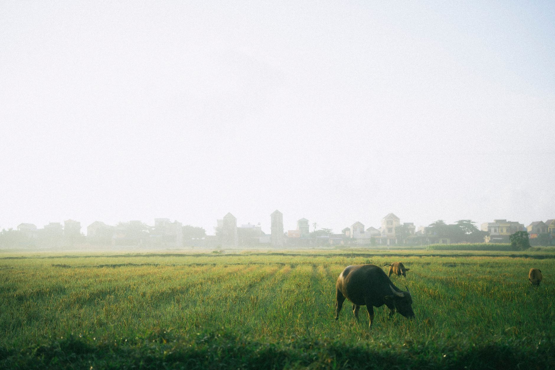
↑ Bình Thuận provinceImage via Wikipedia (Bình Thuận province, CC BY-SA)
Tags
#binh thuan#phan thiet#mui ne#phu quy island#cham culture#south central coast#beach provinces#vietnam history
You might also like
Motorbikes and vendors at Phan Ri Cua Market, flourishing with activity.
Destinations

What to Eat in Binh Thuan: A Traveler's Guide to Local Dishes and Markets

May 24, 20266 min
Delicious Bánh Căn Vietnamese rice pancakes garnished with scallions and crispy shallots.
Food & Drink

Banh Xeo: Vietnam's Sizzling Pancake, Region by Region

Mar 11, 20264 min
— FIN —

Last updated · May 19, 2026 · independently researched, never sponsored.

More like this
→

Keep reading — related guides.

All destinations →

More from Southern Vietnam

Other articles covering the same region.

Traditional Chinese ancestral shrine with ornate wooden panels and calligraphy.
Destinations

Van Thanh Mieu Vinh Long: A Traveler's Guide to the Mekong Delta's Confucian Temple

Van Thanh Mieu in Vinh Long is one of the best-preserved Confucian temples in southern Vietnam — here's how to visit, what to see, and where to eat nearby.

May 25, 20266 min read
A vibrant scene of a street food vendor at Đà Lạt Night Market, Vietnam.
Destinations

Comments

Loading…

发表评论

邮箱仅用于Gravatar头像和回复通知,不会公开显示。

每月精选

计划去越南?
更聪明地吃喝玩乐。

每月一次:新发现的美食、不为人知的目的地以及行程攻略 — 直送邮箱。无垃圾邮件,可随时退订。

加入1,247名读者 · 首期:2026年6月
01 · Itineraries
2 Weeks in Vietnam: The Perfect First-Timer's Itinerary
16 min read
  • 02 · Food & Drink
    Pho in Hanoi: The 7 Bowls That Are Actually Worth Lining Up For
    11 min read
  • 03 · Destinations
    The Ha Giang Loop: A Complete 4-Day Motorbike Adventure Guide
    14 min read
  • Phu Quoc Night Market: A Traveler's Guide

    Everything you need to know about Phu Quoc Night Market — from the best seafood stalls to navigating the crowds and avoiding tourist traps.

    May 25, 20265 min read
    A woman skillfully peels a pineapple at a bustling night market in Hanoi, Vietnam, showcasing urban life.
    Destinations

    What to Eat in Dong Nai: Local Dishes, Markets & Where Locals Go

    Dong Nai's food scene sits between industrial city grind and rural delta freshness. Here's where to find the real food—markets, family-run joints, and dishes that rarely make it to guidebooks.

    May 25, 20265 min read

    More in Destinations

    More articles from the same category.

    View all in Destinations →
    Scenic aerial view of Bac Son Valley, Vietnam, capturing houses and lush fields at sunset.
    Destinations

    Dinh Phat Chi (Lang Son): A Traveler's Guide

    Dinh Phat Chi is one of Lang Son's highest peaks and a rewarding day trek near the Chinese border. Here's everything you need to plan the trip.

    May 25, 20267 min read
    Breathtaking view of a Buddhist temple amidst stunning limestone mountains in Ninh Bình.
    Destinations

    Chua Ham Long in Bac Ninh: A Traveler's Guide

    Chua Ham Long is a centuries-old Buddhist pagoda tucked into a limestone hillside near Bac Ninh. Here's what to expect and how to visit.

    May 25, 20266 min read
    A peaceful motorcycle ride on the winding roads of Van Ho amidst lush mountains.
    Destinations

    How to Get to Ninh Thuan: Transport Options from Hanoi, Saigon & Da Nang

    Ninh Thuan sits on Vietnam's south-central coast, halfway between Da Nang and Ho Chi Minh City. Here's how to reach it by bus, train, flight, or motorbike—plus costs and realistic travel times.

    May 25, 20265 min read
    A lone explorer illuminates a vast, mysterious cave in Son La, Vietnam with a torch, showcasing nature's hidden wonders.
    Destinations

    Nang To Thi in Lang Son: A Traveler's Guide to Vietnam's Most Famous Rock Formation

    Nang To Thi is a limestone rock formation in Lang Son that's woven into Vietnamese folklore. Here's what to expect, how to get there, and what to eat nearby.

    May 25, 20266 min read
    The Center of Vietnam Quintessential Handicraft showcases modern architectural design with wave-like patterns.
    Destinations

    Vietnam Fine Arts Museum in Hanoi: A Traveler's Guide

    Everything you need to know before visiting the Vietnam Fine Arts Museum in Hanoi — what to see, how to get there, and what to eat nearby.

    May 25, 20266 min read
    Vibrant green guest house surrounded by lush greenery and a serene road setting.
    Destinations

    Where to Stay in Lam Dong: Budget to Luxury by Neighborhood

    Lam Dong's main towns offer distinct vibes for different travelers. Here's how to pick a base—from Da Lat's colonial guesthouses to Thac Dac's jungle ecolodges.

    May 25, 20264 min read
    View all in Destinations →
    Hidden gems

    Lesser-known articles tourists usually miss

    • 01
      food

      Banh da lon: Vietnam's Colorful Layered Steamed Cake

    • 02
      food

      Best Bun Ca in Nha Trang: Where Locals Send You

    • 03
      food

      Best Ham Bao in Phu Quoc: Where Locals Send You

    ← Older
    Ca phe muoi: Vietnam's salt coffee, where it came from and why it works
    Newer →
    Tra Vinh: Mekong Delta province with deep Khmer roots

    Binh Thuan 是 Vietnam (베트남 / 越南 / ベトナム) 中南部沿海地区的一个省份,从北部与 Lam Dong 接壤的高地一直延伸至南海。这里的地理和历史塑造了其独特的旅游魅力——内陆群山起伏,平坦的海岸线上点缀着座座岛屿,而这里的人口构成则印证了 Cham 族、Kinh 族和少数民族几个世纪以来的定居史。

    地理与气候

    该省的地形分为两个区域:西北部山区(与 Lam Dong 接壤)和平坦的沿海平原。最高峰海拔 1,548 米,位于靠近 Lam Dong 边界的 Tanh Linh 县。海岸线上点缀着超过 200 米的小山丘,近海有几个岛屿——位于 Phan Thiet 东南约 120 公里处的 Phu Quy 岛(一个独立的县),加上东部的 Cau 岛、Mui Ne (무이네 / 美奈 / ムイネー) 附近的 Lao 岛,以及西部的 Ba 岛。

    Binh Thuan 是 Vietnam 最干旱的省份之一。该省大部分地区年降雨量不足 800 毫米,旱季(11 月至次年 4 月)降雨量低于 200 毫米。这种干旱的气候决定了当地的地貌:截至 2007 年,森林覆盖了该省 50% 的面积(394,100 公顷),主要集中在北部和东北部山区,而农业用地占 284,200 公顷——在所有中部沿海省份中面积最大。

    主要河流包括东部的 Lui River、中部的 Cai River 和西部的 Dinh River;大多数河流向东流入大海。在内陆,Song Quan 湖位于 Phan Thiet 以北约 30 公里处。

    历史渊源:Cham 族与越南的融合

    如今 Binh Thuan 的大部分地区在历史上曾是 Cham 族公国 Panduranga 的一部分。几个世纪以来,Cham 族人一直居住在沿海村庄,直到越南的扩张逐渐将该地区融合。到 1832 年,Ninh Thuan 和 Binh Thuan 已完全并入越南版图。

    20 世纪,行政边界发生了多次变动。1976 年之前,Binh Thuan 的面积较小,西部地区组成了独立的 Binh Tuy 省。1976 年,Binh Tuy、Binh Thuan 和 Ninh Thuan 合并为 Thuan Hai 省。1991 年,该省再次划分为 Ninh Thuan 和 Binh Thuan,Binh Tuy 被重新并入 Binh Thuan。

    民族多样性

    Kinh 族(越南主体民族)占多数,但 Binh Thuan 的民族构成反映了其历史。Cham 族社区居住在东部沿海地区,保留着具有 Cham 族名称的独特村落,如 Tuy Phong 县的 Cawait (Lac Tri) 和 Ham Tan 县的 Bhumi (Lang Cham)。其他少数民族——Koho 族和 Raglai 族——居住在沿 Lam Dong 边界的山区。Hoa 族(华裔)也是一个重要的少数民族。

    一位面带微笑的风筝冲浪者在阳光明媚的海滩上拿着冲浪板,背景是风力涡轮机。

    照片由 Serg Alesenko 发布于 Pexels

    经济与资源

    截至 2007 年,Binh Thuan 的经济是中南部沿海地区增长最快的,年均增长率接近 14%。人均 GDP 达到 1100 万 VND,在该地区排名第三,仅次于 Da Nang 和 Khanh Hoa。

    农业与渔业: 水稻是主要农作物——2007 年产量为 434,600 吨(高于 2000 年的 321,500 吨),尽管水稻仅占农业用地的大约三分之一。该省扩大了橡胶、胡椒和腰果的种植面积。沿海地带和 Phu Quy 岛提供了盛产虾、鱿鱼和金枪鱼的丰富渔场,尽管渔业对全省经济的贡献不及农业。

    工业: 截至 2007 年,工业部门以每年 21.6% 的速度增长,这主要得益于私营和外资企业的推动。国有工业有所下降。由于西海岸钛矿储量与土地所有权主张存在重叠,工业发展面临挑战。

    该省西北部山区还蕴藏着砷矿资源。

    人口与城市化

    2007 年,Binh Thuan 人口为 1,170,700 人,年增长率为 1.35%(2000-2007 年)。城市地区扩张更快,每年增长 4.42%,使城市化率从 30.4%(2000 年)提高到 37.5%(2007 年)——在中南部沿海省份中仅次于 Khanh Hoa,位居第二。人口密度差异巨大:Phan Thiet 每平方公里约 1,000 人,但在 Bac Binh、Ham Tan 和 Tanh Linh 等县则不到 100 人。
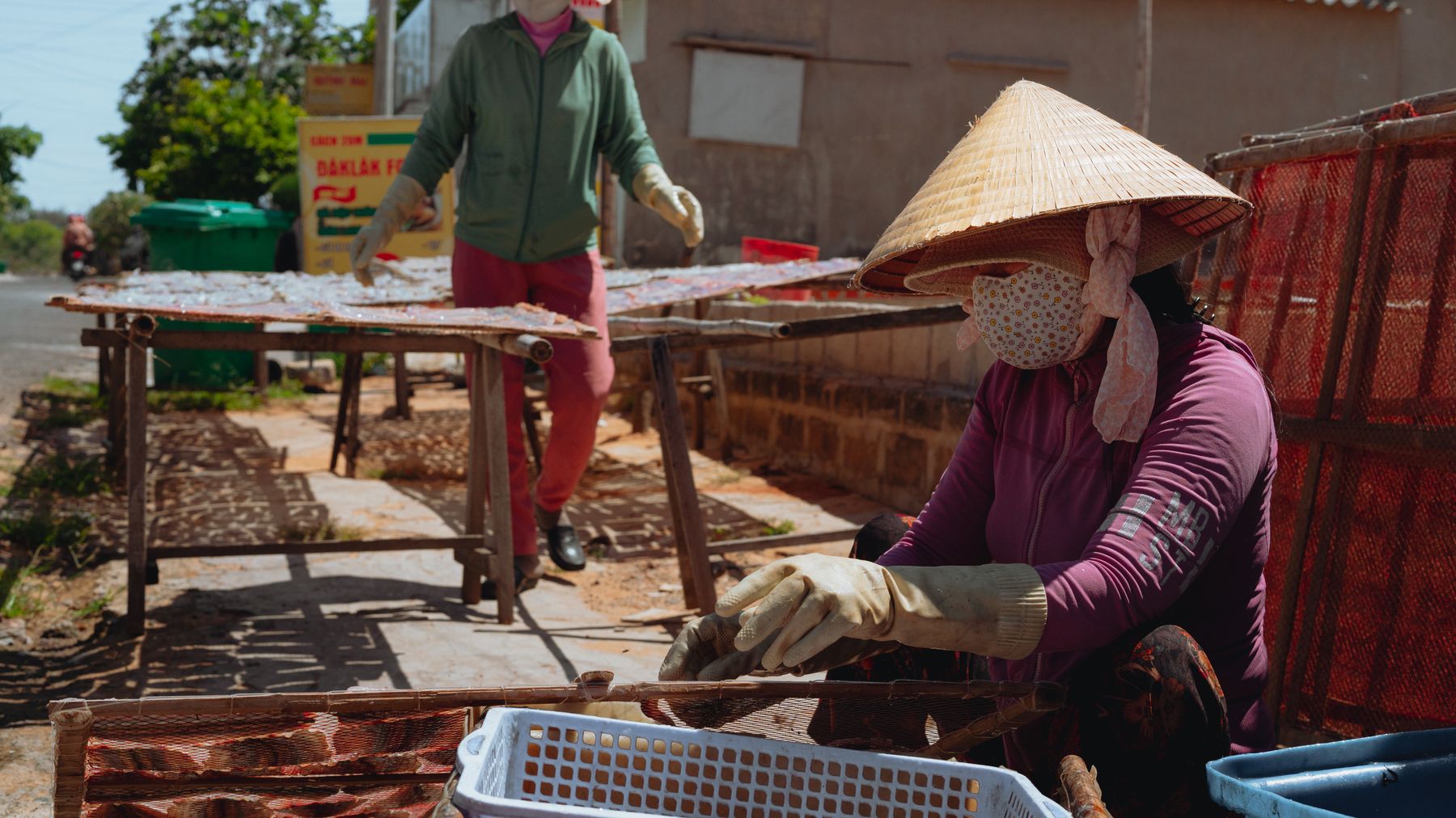
    工人们在 Binh Thuan 的阳光下晾晒海鲜,展现了传统工艺与乡村生活。

    照片由 Theodore Nguyen 发布于 Pexels

    主要城镇与区县

    省会 Phan Thiet 是游客的主要门户。该省在行政上划分为 8 个县(Bac Binh、Duc Linh、Ham Thuan Bac、Ham Thuan Nam、Ham Tan、Phu Quy、Tanh Linh、Tuy Phong)、1 个县级市(La Gi)以及众多的乡镇和街道。位于近海的 Phu Quy 岛构成了一个独立的县,与繁忙的大陆海岸相比,这里提供了更宁静的海岛体验。

    游客指南

    Binh Thuan 的魅力在于其海滩(尤其是 Mui Ne 和 Phan Thiet)、海岛度假胜地,以及可以探访高地上的 Cham 族文化遗址和少数民族村落。干旱的气候意味着一年中大部分时间都是阳光明媚、干燥的天气——非常适合海滩时光,而旱季(11 月至次年 4 月)则是旅游旺季。该省经济的快速增长扩大了基础设施和住宿条件,尽管内陆大部分地区的开发程度仍不及沿海地区。

    常见问题解答

    Binh Thuan 省位于哪里?它的地貌是什么样的?

    Binh Thuan 位于 Vietnam 中南部沿海地区,西北与 Lam Dong 省接壤,东临南海。地形分为两个区域:西北部山区(最高峰位于 Tanh Linh 县,海拔 1,548 米)和点缀着岛屿的平坦沿海平原。近海有位于 Phan Thiet 东南约 120 公里处的 Phu Quy 岛,以及 Cau 岛、Lao 岛和 Ba 岛。

    历史上 Binh Thuan 省居住着哪些民族?

    Kinh 族(越南主体民族)占多数,但 Cham 族社区在东部保留着独特的沿海村落——包括 Tuy Phong 县的 Cawait (Lac Tri) 和 Ham Tan 县的 Bhumi (Lang Cham)。Koho 族和 Raglai 族居住在沿 Lam Dong 边界的山区,而 Hoa 族(华裔)也是一个重要的少数民族。在 1832 年完全并入越南之前,该地区曾是 Cham 族公国 Panduranga 的一部分。

    Binh Thuan 的旱季是什么时候?有多干旱?

    旱季从 11 月持续到次年 4 月,此时全省大部分地区的降雨量降至 200 毫米以下。总体而言,Binh Thuan 是 Vietnam 最干旱的省份之一,大部分地区的年降雨量不足 800 毫米。这种干旱的气候极大地塑造了当地的地貌——截至 2007 年,森林覆盖了该省 50% 的面积(394,100 公顷),主要集中在较为湿润的北部和东北部山区。