Da Nang (다낭 / 岘港 / ダナン) ranks as Vietnam (베트남 / 越南 / ベトナム)'s fourth-largest municipality by population and sits on one of the country's most significant ports. The city straddles National Route 1 and the North–South Railway, making it a crucial junction for anyone moving between north and south. Since 1997, when it separated from Quang Nam province, Da Nang has operated as a directly administered municipality under central government control.
For most travelers, Da Nang is the layover between Hoi An's old town and Hue's imperial tombs. That's a mistake. The city has its own personality — younger, louder, more concrete than its neighbors — and spending a day or two here fills in a side of central Vietnam you won't get anywhere else.
What's in a Name: Tracing Da Nang's Many Identities
The city has worn different names across centuries, each tied to its geography and the cultures that inhabited it.
Scholar Inrasara suggests "Da Nang" derives from the Cham word daknan, meaning "the large water." Others propose it comes from da nak, also Cham, meaning "opening of a large river." These roots make sense: the Han River estuary was always the city's defining feature. The Cham called it Cua Han — literally "mouth of the Han River."
French colonizers heard that name and produced "Tourane," a rough transliteration that stuck on colonial maps. Before the French arrived, Vietnamese scholars used literary names like Tra Uc, Tra Ao, and Tra Son, preferring those over everyday terms. The Chinese version, Xianggang, derived from an older reference to clam harbors.
After the 1945 August Revolution, locals called it Thai Phien for a time, honoring Thai Phien, a resistance leader from the 1916 Duy Tan uprising. That name faded, and Da Nang prevailed.
You'll still see "Tourane" on vintage postcards sold in shops along Bach Dang street near the riverfront. It makes decent wall art.
Geography: Mountains, Sea, and Seasonal Monsoons
Da Nang spreads across 1,283 square kilometers wedged between the Annamite Range to the west and the South China Sea to the east. The Han River cuts through the city center. To the north, the Hai Van Pass marks the boundary with Hue, 764 kilometers north of Hanoi and 964 kilometers south of Ho Chi Minh City.
The terrain climbs steeply inland: peaks in the Annamite Range rise between 700 and 1,500 meters. Closer to shore, coastal plains flatten into white sand beaches.
The climate divides into two seasons. From September to December, typhoons arrive and rainfall peaks — between 550 and 1,000 millimeters monthly. January through August brings dry weather, though February to April sees the least rain (23 to 40 millimeters). Temperatures hover around 26°C annually, climbing to 28–30°C in June through August and dropping to 18–23°C in winter. Higher elevations like Ba Na Hills stay cooler, averaging 20°C year-round.
Humidity runs consistently high — 81% annually, peaking at 84–86% from October to January. The city averages 2,162 hours of sunlight yearly, brightest in May and June (234–277 hours) and dimmest in November and December (69–165 hours).
Practically speaking, the best window for beach days is March through June. July and August are hot but still dry. If you're arriving in October or November, pack a rain jacket and expect that some boat trips to the Cham Islands may be cancelled due to rough seas.

Image by CEphoto, Uwe Aranas via Wikimedia Commons (CC BY-SA)
From Champa Kingdom to French Arrival
Da Nang's deep history belongs first to Champa, a Hindu-Buddhist kingdom established in 192 AD that once controlled territory from present-day Hue south to Vung Tau. Around 875 AD, the Cham city of Indrapura — located near Dong Duong village in modern Quang Nam Province, roughly 50 kilometers from Da Nang — became the kingdom's capital.
Indrapura flourished for centuries until clashes with Dai Viet became impossible to avoid. In 979, amid turmoil in Dai Viet following the assassination of Emperor Dinh Tien Hoang, Champa attacked northward but was repelled by Le Hoan's forces. The conflict escalated in 982 when Champa captured three Dai Viet ambassadors. Le Hoan sacked Indrapura in retaliation and killed King Parameshvaravarman I. Facing this pressure — and threats from the Khmer Empire to the west — Champa abandoned Indrapura around 1000 AD.
The city's fortifications came later. Emperor Gia Long built the Dien Hai Citadel in 1813 as an earthen fortress on the northern bank, with the An Hai citadel on the eastern bank to guard the port. By 1819, both had been rebuilt in brick. In 1823, Emperor Minh Mang moved the original Dien Hai fortress to a mound at its present location and upgraded it from a fortress to a full citadel in 1835.
Today you can visit the Dien Hai Citadel grounds for free. The site sits in the Hai Chau district, about 1 km west of the Han River bridge. It's small — you can walk the perimeter in 20 minutes — but the remaining walls and gatehouse give a sense of scale. The Da Nang Museum inside the citadel grounds covers Cham artifacts and wartime photographs.
For deeper Cham history, the Museum of Cham Sculpture on Trung Nu Vuong street (about 2 km south along the river) holds the world's largest collection of Cham artifacts — sandstone altars, lingas, Garudas, and dancing Shiva figures pulled from My Son Sanctuary and surrounding sites. Entry is 60,000 VND. Give it at least an hour.

Image by CEphoto, Uwe Aranas via Wikimedia Commons (CC BY-SA)
Early European Contact
Portuguese explorer Antonio de Faria anchored in Da Nang in 1535 — one of the first Europeans to arrive. His reports encouraged more Portuguese ships to visit the nearby port of Hoi An. Throughout the 17th and 18th centuries, French and Spanish traders and missionaries followed.
American ships came later. On June 18, 1819, John White arrived aboard the merchant vessel Franklin from Salem, Massachusetts. He found the country still recovering from devastating internal wars, trade goods scarce, and locals wary. Other American vessels — the Marmion from Boston and the Aurora and Beverly from Salem — encountered the same difficulties. Later missions by East India Company agent John C. C. Roberts also faced challenges in establishing trade.
This pattern of contact, conflict, and commerce would shape Da Nang through the colonial period and into the modern era.
Getting to Da Nang and Moving Around
Da Nang International Airport (DAD) sits about 3 km from the city center — one of the shortest airport-to-downtown transfers in Vietnam. A taxi to My Khe Beach takes roughly 15 minutes and costs 80,000–120,000 VND depending on traffic. Grab is widely available and usually cheaper. There are direct flights from Hanoi (1 hour 20 minutes), Ho Chi Minh City (1 hour 15 minutes), Da Lat (1 hour), and Phu Quoc (1 hour 40 minutes), plus international routes from Seoul, Bangkok, Singapore, Kuala Lumpur, and several Chinese cities.
The Reunification Express train stops at Da Nang station on Hai Phong street, walking distance to the city center. The ride from Hue takes about 2.5 hours and costs 50,000–120,000 VND depending on seat class. From Hanoi, expect 14–17 hours; from Ho Chi Minh City, roughly 17–20 hours. The Hue–Da Nang leg crosses the Hai Van Pass — it's one of the more scenic rail stretches in the country, especially if you grab a seat on the east-facing side.
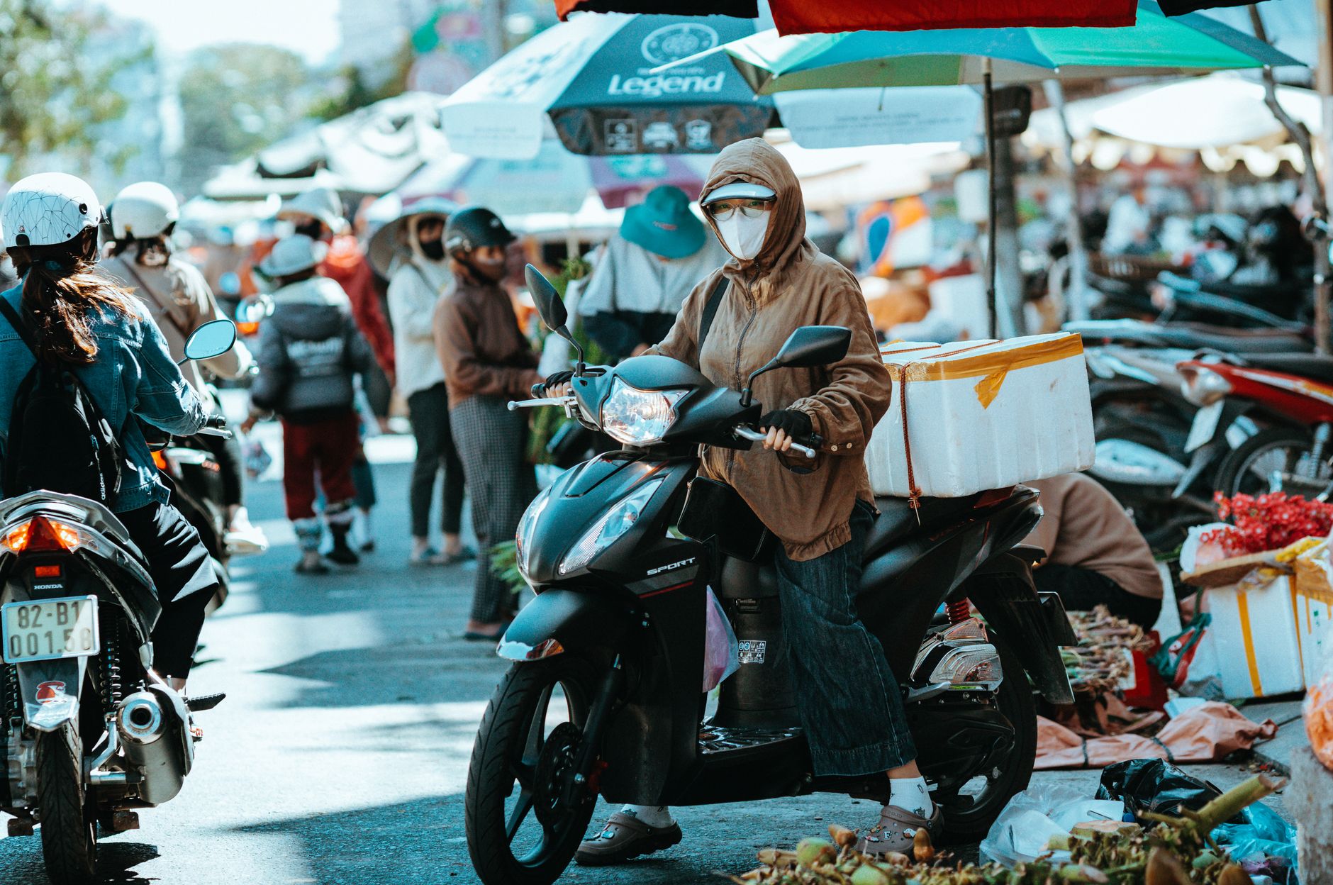
Within the city, renting a motorbike runs 100,000–150,000 VND per day from shops along An Thuong street near My Khe Beach. Da Nang is flat and grid-like compared to Hanoi or Saigon — easier riding for less experienced drivers. The main landmarks are spread across maybe 10 km north to south. City buses exist but routes are limited and schedules unreliable; most visitors stick with Grab or motorbikes.
For day trips, Hoi An is 30 km south (about 40 minutes by car), and the Hai Van Pass starts 20 km north. Ba Na Hills is 25 km west, uphill. My Son Sanctuary is roughly 70 km southwest — doable as a half-day trip.
Eating in Da Nang
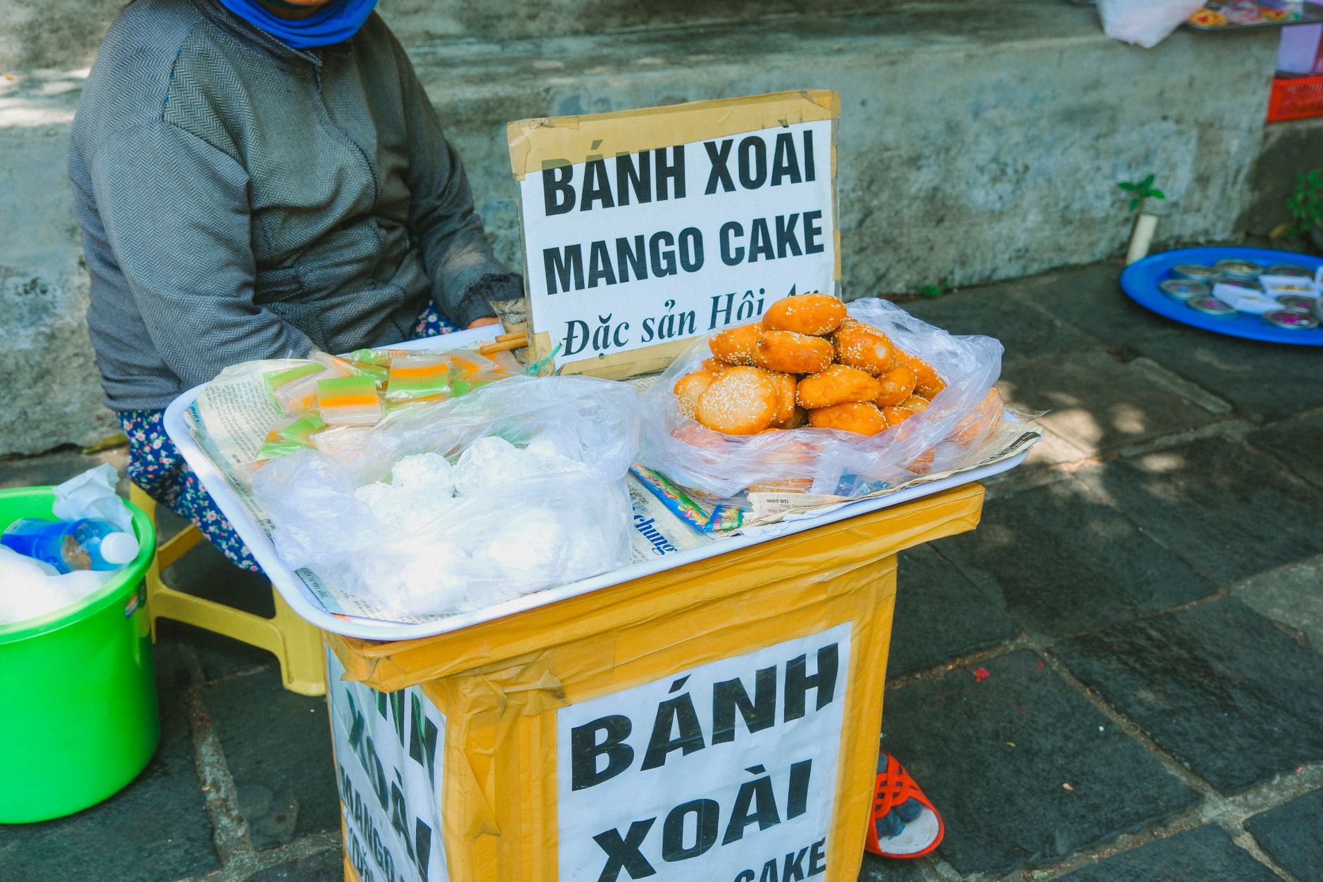
Da Nang's food identity sits between the Hue tradition of complex, spicy flavors to the north and the sweeter, coconut-heavy dishes of the south. The city has its own specialties worth seeking out.
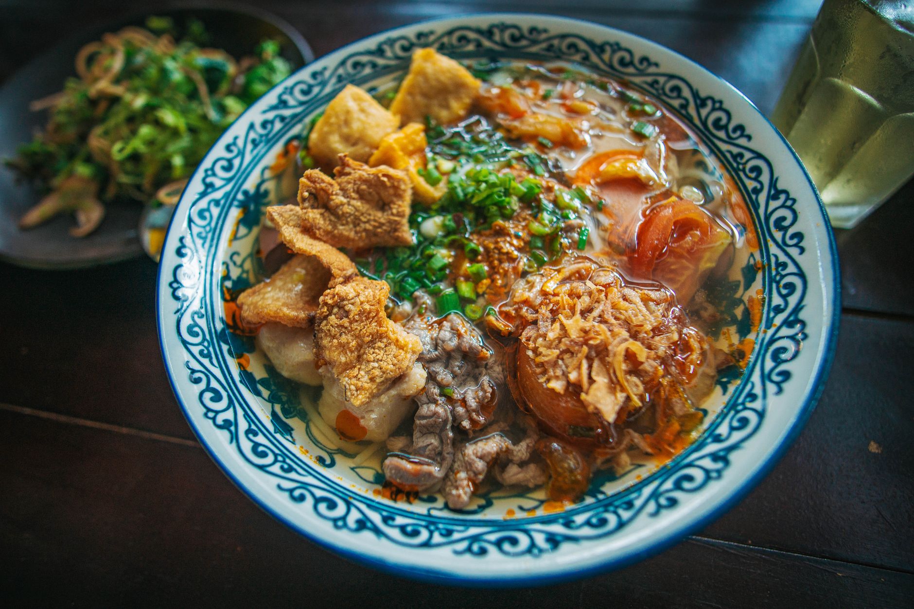
"Mi quang" is the signature noodle dish — wide, yellow turmeric-stained rice noodles with a shallow pool of broth (not a soup, more of a sauce), topped with pork, shrimp, quail eggs, peanuts, sesame crackers, and a fistful of herbs. A bowl runs 30,000–50,000 VND at street-side places. Mi Quang Ba Vi on Le Hong Phong street in Thanh Khe district is a reliable local pick.
"Bun cha ca" is another Da Nang staple — fish cake noodle soup made with mackerel or snakehead fish, served in a light tomato-tinged broth. Morning stalls along Hoang Dieu street serve it from around 6:00 to 9:00 AM for 35,000–45,000 VND.
"Banh xeo" in central Vietnam comes smaller and crispier than the Saigon version — more like a stuffed crepe than a pancake. Ba Duong on Hoang Dieu street has been doing them since the 1980s. Expect to pay 5,000–8,000 VND per piece. You wrap them in rice paper with greens and dip in "nuoc cham" (fish sauce dressing). Most locals eat five or six in a sitting.
For "banh mi," Banh Mi Ba Lan near the Con Market has a loyal following. A sandwich costs 15,000–25,000 VND. The bread here tends to be slightly chewier than the crackly Saigon style.
Seafood is everywhere along the My Khe and Nam O beach strips. Restaurants on Vo Nguyen Giap street grill whole squid, razor clams, and mantis shrimp — prices vary by catch but budget 150,000–300,000 VND per person for a full spread with beer. Point at what looks good in the tank and confirm the price before they cook it.
For coffee, Da Nang has adopted the Saigon-style "ca phe sua da" (iced milk coffee) more than the Hanoi egg coffee tradition, but you can find both. 43 Factory Coffee Roaster on Tran Phu street is one of the better specialty spots if you want single-origin pour-over (45,000–65,000 VND). For the classic streetside experience, any "quan ca phe" with low plastic stools will do — iced coffee runs 15,000–25,000 VND.
Common Mistakes Visitors Make
Skipping Da Nang entirely. Many travelers bus straight from the airport to Hoi An. Da Nang deserves at least one full day — the Cham museum alone justifies it, and the beach here is less crowded than An Bang in Hoi An.
Visiting Ba Na Hills on a weekend or holiday. The Golden Bridge and French Village get packed. Weekday mornings are significantly calmer. Cable car tickets cost around 900,000 VND for adults — not cheap, so you want to enjoy it without queueing 30 minutes per ride.
Underestimating typhoon season. October and November can bring real storms — cancelled flights, flooded streets, closed beaches. If your dates are locked in that window, have flexible plans and travel insurance.
Eating seafood without confirming prices. Some beachfront restaurants charge by the kilogram and the final bill surprises people. Ask "bao nhieu mot ky" (how much per kilo) before ordering.
Expecting Hoi An pace. Da Nang is a working city of over a million people, not a preserved old town. Traffic moves fast, construction is constant, and whole neighborhoods are mid-development. That's part of the appeal — it feels like real Vietnam, not a tourism set.
Da Nang at a Glance
- Population: over 1.1 million (2023 estimate)
- Airport code: DAD — 3 km from city center
- Best weather: March through June (dry, warm, 25–33°C)
- Rainy/typhoon season: September through December
- Distance to Hoi An: 30 km south (~40 min by car)
- Distance to Hue: ~100 km north (~2.5 hours by train)
- Currency: Vietnamese dong (VND). ATMs everywhere. Cards accepted at hotels and larger restaurants; cash needed at markets and street stalls
- Local specialties: "mi quang", "bun cha ca", "banh xeo", seafood
- Average meal cost (street food): 30,000–60,000 VND ($1.20–$2.50)
- Motorbike rental: 100,000–150,000 VND/day
- Grab availability: reliable citywide
Frequently Asked Questions
How far is Da Nang from Hanoi and Ho Chi Minh City?
Da Nang sits 764 kilometers south of Hanoi and 964 kilometers north of Ho Chi Minh City. The city lies on National Route 1 and the North-South Railway, making it a natural midpoint for travelers moving between the two major cities. Its position also puts it close to Hue to the north and Hoi An to the south, both reachable as day trips.
What is the best time of year to visit Da Nang for beach weather?
March through June offers the best conditions for beach days, with February to April recording the least rainfall at just 23 to 40 millimeters monthly. July and August remain dry but temperatures climb to 28-30 degrees Celsius. Avoid October and November if beach activities are a priority: monthly rainfall peaks between 550 and 1,000 millimeters, and rough seas can cancel boat trips to the Cham Islands.
When did Da Nang become a separate city from Quang Nam province?
Da Nang separated from Quang Nam province in 1997 and has since operated as a directly administered municipality under central government control, the same status held by Hanoi and Ho Chi Minh City. It now ranks as Vietnam's fourth-largest municipality by population and remains one of the country's most significant port cities, sitting on the Han River estuary that gave the city its name.
Bottom Line
Da Nang works best when you stop treating it as a transit point and start treating it as a destination. The Cham layers, the beach, the food scene — they reward a slower look. Pair it with Hoi An and Hue for a central Vietnam stretch that covers ancient kingdoms, imperial tombs like the Tomb of Tu Duc, French colonial traces, and some of the best noodles in the country.
Last updated · May 29, 2026 · independently researched, never sponsored.