VietnamWayfarerEST. 2026
गंतव्ययात्रा कार्यक्रमभोजन और पेययात्रा टिप्स
न्यूज़लेटर →
Browse by region▲Bắc · Northern■Trung · Central●Nam · Southern
+Travel essentialsISSUE №01 · MMXXVIAbout
Vietnam
Wayfarer.
Colophon

An independent field guide to Vietnam — food, destinations, and the kind of practical advice you only get from people who live here.

Get the dispatch

Monthly: dishes, destinations, itineraries — once a month, straight to your inbox.

Subscribe →
Topics
  • गंतव्य
  • भोजन और पेय
  • यात्रा कार्यक्रम
  • यात्रा टिप्स
Regions
  • Northern Vietnam
  • Central Vietnam
  • Southern Vietnam
Resources
  • About
  • Contact
  • Affiliate Disclosure
  • Disclaimer
  • Privacy
  • Terms
© 2026 Vietnam WayfarerMade in VietnamAll rights reserved
Independent · Reader-supported

We use minimal analytics + ads (no personal tracking). See our privacy policy.

Fansipan: वियतनाम की सबसे ऊंची चोटी और वहां कैसे पहुंचें | Vietnam Wayfarer
  1. Home
  2. Destinations
  3. Fansipan: वियतनाम की सबसे ऊंची चोटी और वहां कैसे पहुंचें
🇮🇳 Destinations · north · sapa

Fansipan: वियतनाम की सबसे ऊंची चोटी और वहां कैसे पहुंचें

वियतनाम का सबसे ऊंचा पर्वत Lao Cai प्रांत से 3,147 मीटर ऊपर स्थित है। चाहे आप तीन दिनों में इसकी चढ़ाई करें या तीन घंटे में केबल कार लें, Fansipan उत्तरी वियतनाम के सबसे शानदार अनुभवों में से एक है。

By the Wayfarer teamMar 26, 20264 min read
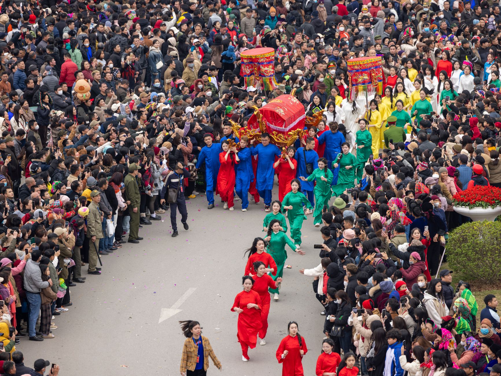
A lively procession during the Ky Cung Ta Phu Temple Festival in Lạng Sơn, Vietnam, showcasing colorful costumes and cultural traditions.
↑ A lively procession during the Ky Cung Ta Phu Temple Festival in Lạng Sơn, Vietnam, showcasing colorful costumes and cultural traditions.Photo by Vietnam Hidden Light on Pexels
Tags
#fansipan#sapa#mountain#hiking#cable car#lao cai#northern vietnam
You might also like
Aerial view of Fansipan Mountain in Lao Cai, Vietnam with a large Buddha statue and scenic cable car ride.
Destinations

Sun World Fansipan Legend: A Traveler's Guide to Vietnam's Rooftop

May 24, 20265 min
Three men ride a motorcycle through a foggy road near an industrial plant
Travel Tips

Vietnam Air Quality by City: When to Wear a Mask and What to Know

May 23, 20265 min
— FIN —

Last updated · May 13, 2026 · independently researched, never sponsored.

More like this
→

Keep reading — related guides.

All destinations →

More from Sapa

Other articles covering this city.

Rooftops of Sapa with dramatic mountains in the background on a clear day.
Destinations

Thac Bac Sapa: A Traveler's Guide to Silver Waterfall

Thac Bac is a 100-meter waterfall just 12 km from Sapa town. Here's what to expect, how to get there, and whether it's worth your time.

May 23, 20266 min read
A peaceful motorcycle ride on the winding roads of Van Ho amidst lush mountains.
Destinations

Comments

Loading…

टिप्पणी छोड़ें

ईमेल Gravatar अवतार और उत्तर सूचना के लिए। कभी सार्वजनिक नहीं।

मासिक डिस्पैच

वियतनाम जा रहे हैं?
स्मार्ट तरीके से खाएं और यात्रा करें।

महीने में एक बार: नए व्यंजन, अनदेखे गंतव्य, और यात्रा कार्यक्रम — सीधे आपके इनबॉक्स में। स्पैम नहीं, कभी भी अनसब्सक्राइब करें।

1,247 पाठकों से जुड़ें · पहला अंक: जून 2026
01 · Itineraries
2 Weeks in Vietnam: The Perfect First-Timer's Itinerary
16 min read
  • 02 · Food & Drink
    Pho in Hanoi: The 7 Bowls That Are Actually Worth Lining Up For
    11 min read
  • 03 · Destinations
    The Ha Giang Loop: A Complete 4-Day Motorbike Adventure Guide
    14 min read
  • Cong Troi O Quy Ho: A Traveler's Guide to Lai Chau's High Pass

    Everything you need to know about visiting Cong Troi O Quy Ho, the high mountain pass between Sapa and Lai Chau — transport, timing, food, and what to actually do up there.

    May 23, 20267 min read
    Scenic view of Vietnamese flag on rooftop with mountainous background in Sapa, Vietnam.
    Food & Drink

    Best Thang Co in Sapa: Where Locals Send You

    Sapa's version of "thang co" is heartier and wilder than the lowland versions—pork organ soup with local herbs and mountain vegetables. Here's where to find it.

    May 23, 20264 min read

    More from Northern Vietnam

    Other articles covering the same region.

    Scenic aerial view of Bac Son Valley, Vietnam, capturing houses and lush fields at sunset.
    Destinations

    Dinh Phat Chi (Lang Son): A Traveler's Guide

    Dinh Phat Chi is one of Lang Son's highest peaks and a rewarding day trek near the Chinese border. Here's everything you need to plan the trip.

    May 25, 20267 min read
    Breathtaking view of a Buddhist temple amidst stunning limestone mountains in Ninh Bình.
    Destinations

    Chua Ham Long in Bac Ninh: A Traveler's Guide

    Chua Ham Long is a centuries-old Buddhist pagoda tucked into a limestone hillside near Bac Ninh. Here's what to expect and how to visit.

    May 25, 20266 min read
    A lone explorer illuminates a vast, mysterious cave in Son La, Vietnam with a torch, showcasing nature's hidden wonders.
    Destinations

    Nang To Thi in Lang Son: A Traveler's Guide to Vietnam's Most Famous Rock Formation

    Nang To Thi is a limestone rock formation in Lang Son that's woven into Vietnamese folklore. Here's what to expect, how to get there, and what to eat nearby.

    May 25, 20266 min read

    More in Destinations

    More articles from the same category.

    View all in Destinations →
    A peaceful motorcycle ride on the winding roads of Van Ho amidst lush mountains.
    Destinations

    How to Get to Ninh Thuan: Transport Options from Hanoi, Saigon & Da Nang

    Ninh Thuan sits on Vietnam's south-central coast, halfway between Da Nang and Ho Chi Minh City. Here's how to reach it by bus, train, flight, or motorbike—plus costs and realistic travel times.

    May 25, 20265 min read
    Traditional Chinese ancestral shrine with ornate wooden panels and calligraphy.
    Destinations

    Van Thanh Mieu Vinh Long: A Traveler's Guide to the Mekong Delta's Confucian Temple

    Van Thanh Mieu in Vinh Long is one of the best-preserved Confucian temples in southern Vietnam — here's how to visit, what to see, and where to eat nearby.

    May 25, 20266 min read
    A vibrant scene of a street food vendor at Đà Lạt Night Market, Vietnam.
    Destinations

    Phu Quoc Night Market: A Traveler's Guide

    Everything you need to know about Phu Quoc Night Market — from the best seafood stalls to navigating the crowds and avoiding tourist traps.

    May 25, 20265 min read
    The Center of Vietnam Quintessential Handicraft showcases modern architectural design with wave-like patterns.
    Destinations

    Vietnam Fine Arts Museum in Hanoi: A Traveler's Guide

    Everything you need to know before visiting the Vietnam Fine Arts Museum in Hanoi — what to see, how to get there, and what to eat nearby.

    May 25, 20266 min read
    Vibrant green guest house surrounded by lush greenery and a serene road setting.
    Destinations

    Where to Stay in Lam Dong: Budget to Luxury by Neighborhood

    Lam Dong's main towns offer distinct vibes for different travelers. Here's how to pick a base—from Da Lat's colonial guesthouses to Thac Dac's jungle ecolodges.

    May 25, 20264 min read
    A woman skillfully peels a pineapple at a bustling night market in Hanoi, Vietnam, showcasing urban life.
    Destinations

    What to Eat in Dong Nai: Local Dishes, Markets & Where Locals Go

    Dong Nai's food scene sits between industrial city grind and rural delta freshness. Here's where to find the real food—markets, family-run joints, and dishes that rarely make it to guidebooks.

    May 25, 20265 min read
    View all in Destinations →
    Hidden gems

    Lesser-known articles tourists usually miss

    • 01
      itineraries

      10 Days on the Northern Frontier Loop: Hanoi to Ha Giang and Back

    • 02
      itineraries

      5 Days Northern Vietnam by Private Car: Hanoi, Ha Long, Sapa, Ninh Binh

    • 03
      tips

      Hanoi to Sapa: Night Train vs Sleeper Bus vs Limousine Van

    ← Older
    Pho Vietnam Guide: Broth, Regions & Varieties (2026)
    Newer →
    3 Days in Ninh Binh: Trang An, Tam Coc & Bai Dinh

    Fansipan वियतनाम (베트남 / 越南 / ベトナム) का सबसे ऊंचा पर्वत है, जो उत्तर-पश्चिम में Lao Cai प्रांत से 3,147.3 मीटर (10,326 फीट) ऊपर स्थित है। यह Sapa से नौ किलोमीटर दक्षिण-पश्चिम में, Hoang Lien Son पर्वत श्रृंखला के भीतर स्थित है—प्राचीन ग्रेनाइट और चूना पत्थर की एक शानदार श्रृंखला जो उस परिदृश्य पर हावी है जहां वियतनाम और चीन मिलते हैं।

    इस पर्वत को पहली बार 1909 में सटीक रूप से 3,143 मीटर मापा गया था। यह आंकड़ा तब तक बना रहा जब तक कि बाद के एक सर्वेक्षण ने इसे आज की आधिकारिक ऊंचाई पर समायोजित नहीं कर दिया। जो भी हो, Fansipan की प्रसिद्धि का कारण सरल है: यह पूरे इंडोचाइनीज प्रायद्वीप की सबसे ऊंची चोटी है।

    Fansipan ही क्यों?

    कोई नहीं जानता कि इस पर्वत का नाम कैसे पड़ा। सबसे प्रशंसनीय स्पष्टीकरण इसे "Hua Xi Pan" से जोड़ता है—एक स्थानीय बोली का वाक्यांश जिसका अर्थ है "लड़खड़ाती हुई विशाल चट्टान," एक ऐसा वर्णन जो इस चोटी की ऊबड़-खाबड़ रूपरेखा पर बिल्कुल सटीक बैठता है। एक अन्य सिद्धांत इसे Hmong लोगों से जोड़ता है, जो सदियों से इन ढलानों पर रह रहे हैं; उनकी भाषा में, इस नाम का अनुवाद "अज़ेलिया पर्वत" (azalea mountain) होता है, जो ऊपरी ऊंचाई पर खिलने वाले रोडोडेंड्रोन (rhododendrons) की प्रचुरता को देखते हुए एक उपयुक्त वर्णन है।

    एक तीसरा, कम प्रचलित विचार यह सुझाव देता है कि यह नाम Nguyen राजवंश के एक भूगोल अधिकारी Phan Van Son से आया है, जिन्होंने 1905 में फ्रांसीसियों को इस सीमावर्ती क्षेत्र का नक्शा बनाने में मदद की थी। हो सकता है कि स्थानीय स्तर पर उनके नाम का गलत उच्चारण किया गया हो और अंततः यह "Fansipan" के रूप में प्रसिद्ध हो गया।

    भूविज्ञान और इतिहास

    Fansipan बहुत प्राचीन है। इसके द्रव्यमान को बनाने वाली चट्टानें 250-260 मिलियन वर्ष पहले पर्मियन और ट्राइसिक काल (Permian and Triassic periods) के दौरान बनी थीं। तब से, हिमालयी पर्वत-निर्माण प्रक्रिया ने पूरी Hoang Lien Son पर्वत श्रृंखला के साथ-साथ इसे भी और ऊंचा धकेल दिया है। रेड रिवर फॉल्ट (Red River Fault), जो ठीक पूर्व की ओर बहती है, एक प्रमुख भूकंपीय सीमा को चिह्नित करती है जिसने इस क्षेत्र की शानदार स्थलाकृति को भी आकार दिया है।

    1985 में, सोवियत इंजीनियरों ने Fansipan की चढ़ाई की और शिखर पर एक धातु का पिरामिड छोड़ दिया—जो वियतनाम की स्वतंत्रता के बाद इस पर्वत की पहली चढ़ाई का प्रतीक था। इस अभियान का समय द्वितीय विश्व युद्ध में सोवियत जीत की 40वीं वर्षगांठ मनाने के लिए निर्धारित किया गया था।

    Fansipan Summit

    Wikimedia Commons (CC BY-SA) के माध्यम से Isderion (talk) द्वारा चित्र

    शिखर तक ट्रैकिंग (Hiking)

    Fansipan पर चढ़ने का पारंपरिक तरीका पैदल जाना है। एक पीढ़ी पहले, Sapa से आने-जाने में पांच से छह दिन लगते थे। आधुनिक ट्रेल रखरखाव ने अधिकांश ट्रैकर्स के लिए इसे घटाकर दो या तीन दिन कर दिया है। यह चढ़ाई खड़ी और लगातार है—यह कोई सामान्य सैर नहीं है।

    बुनियादी आवास और भोजन स्टेशन लगभग 1,500 मीटर (4,920 फीट) और फिर 2,800 मीटर (9,190 फीट) के आसपास स्थित हैं। Sapa में टूर ऑपरेटर एक, दो या तीन दिन के पैकेज के रूप में गाइडेड ट्रेक चलाते हैं; अधिकांश लोग दो या तीन दिन के विकल्प की सलाह देते हैं। बहुत फिट पर्वतारोहियों के लिए एक दिन में चढ़ना और उतरना तकनीकी रूप से संभव है, लेकिन पर्यटकों को यह विकल्प शायद ही कभी दिया जाता है। बारिश में रास्ता कीचड़ भरा हो जाता है, धुंध में फिसलन भरा होता है, और चोटी के पास पतली हवा के अनुकूल होने (acclimatization) की मांग करता है।

    Fansipan Cable Car in the fog

    Wikimedia Commons (CC BY-SA) के माध्यम से Christophe95 द्वारा चित्र

    केबल कार और फनिक्युलर (Funicular) मार्ग

    यदि ट्रैकिंग आपको पसंद नहीं है, तो एक आधुनिक तीन-चरणीय केबल-और-रेल प्रणाली (Sun World Fansipan Legend द्वारा संचालित) आपको न्यूनतम पैदल दूरी के साथ लगभग तीन घंटे में शिखर तक पहुंचा सकती है।

    Muong Hoa Funicular

    यह यात्रा Sapa के Sun Plaza शॉपिंग कॉम्प्लेक्स के अंदर से शुरू होती है। Muong Hoa Funicular—जो मार्च 2018 में खुला—लगभग 2 किलोमीटर तक फैला है और यह वियतनाम की सबसे लंबी फनिक्युलर लाइन है। इसमें लगभग छह मिनट लगते हैं और यह दो सुरंगों और चार पुलों (viaducts) से होकर गुजरती है। स्विस-निर्मित कारों में 200 यात्रियों तक के बैठने की क्षमता है और इन्हें 20वीं सदी के यूरोपीय सौंदर्यशास्त्र के अनुसार डिज़ाइन किया गया है। यह छोटा सा हिस्सा मुख्य रूप से कनेक्शन के लिए है; असली काम इसके बाद शुरू होता है।

    Fansipan Cable Car

    मुख्य चढ़ाई Fansipan Cable Car है, जिसका उद्घाटन फरवरी 2016 में हुआ था। यह Hoang Lien Cable Car Station (फनिक्युलर के ऊपरी टर्मिनस के बगल में) से प्रस्थान करती है और लगभग बीस मिनट की लगभग ऊर्ध्वाधर (vertical) गति से पहाड़ पर चढ़ती है। केबल कार 6.3 किलोमीटर लंबी है—जो दुनिया की सबसे लंबी नॉनस्टॉप, तीन-रस्सी वाली प्रणाली है—और यह 1,410 मीटर (4,626 फीट) की ऊर्ध्वाधर ऊंचाई तय करती है, जो एक और विश्व रिकॉर्ड है। साफ दिन में, केबिन से नज़ारे अविस्मरणीय होते हैं: नीचे रेड रिवर घाटी (Red River valley) फैली हुई है, और अच्छी दृश्यता वाले दिनों में, आप सीमा पार चीन तक देख सकते हैं।

    Fansipan Funicular

    अंतिम चरण Do Quyen Funicular Station से Truc May Funicular Station तक एक छोटी फनिक्युलर सवारी है, जो वास्तविक शिखर मार्कर से कुछ ही मीटर नीचे स्थित है। अधिकांश आगंतुक वापस नीचे जाने से पहले तस्वीरें लेने और आराम करने के लिए चोटी पर एक घंटा बिताते हैं।

    चोटी पर क्या उम्मीद करें

    शिखर अपने आप में बहुत साधारण है—एक फ्लैगपोल और सोवियत पिरामिड के साथ एक कंक्रीट का मंच। साफ दिनों में (जो बारिश के मौसम में दुर्लभ होते हैं), आप तीन प्रांतों और पड़ोसी लाओस और चीन तक देख सकते हैं। धुंध बहुत जल्दी छा जाती है; दृश्यता कुछ ही मिनटों में कुछ मीटर तक गिर सकती है। चोटी पर तापमान नियमित रूप से नीचे Sapa शहर की तुलना में 10–15°C (18–27°F) ठंडा होता है, इसलिए गर्मियों में भी जैकेट साथ लाएं।

    केबल कार ने Fansipan को पहले की तुलना में कहीं अधिक सुलभ बना दिया है। लेकिन यह पर्वत अभी भी प्रभावशाली बना हुआ है: चाहे आप पैदल चढ़ें या शिखर तक सवारी करें, वियतनाम के सबसे ऊंचे बिंदु पर 3,147 मीटर की ऊंचाई पर खड़े होना दक्षिण पूर्व एशिया की छत पर खड़े होने जैसा महसूस होता है।


