Dinh Phat Chi sits at roughly 1,000 meters above sea level in Mau Son range, Lang Son province — close enough to Hanoi for a weekend trip, remote enough that you won't share the trail with tour buses.
What it is
Dinh Phat Chi is a granite peak in the Mau Son mountain area, about 30 km east of Lang Son city. The mountain is part of a cluster of peaks that includes Mau Son's more famous summit, but Phat Chi draws a different crowd — mostly Vietnamese hikers and a handful of travelers who prefer a quieter route. The area is home to Dao and Nung ethnic communities who've farmed the slopes for generations. There's no cable car, no ticket booth, no souvenir strip. You walk up, and you walk down.
The name roughly translates to "Buddha's Finger Peak," a reference to the narrow rock formations near the summit that look, with some imagination, like upturned fingers. French colonial surveyors mapped the area in the early 1900s, but for most of the 20th century it stayed off the radar of anyone who wasn't local.
Why travelers go
Three reasons. First, the trek itself — it's a solid half-day hike through bamboo forest and cloud forest, with actual elevation gain that makes you feel like you earned the view. Second, the air temperature: Mau Son range regularly drops below 10°C in winter and occasionally sees frost, which is about as close to cold weather as northern Vietnam (베트남 / 越南 / ベトナム) gets. Third, the lack of infrastructure means the landscape is largely unmanaged — no concrete steps poured into the hillside, no painted arrows every 50 meters. You navigate by trail and common sense.
The summit views extend across Lang Son province and, on clear days, into Guangxi on the Chinese side. It's a quieter alternative to Sapa or Ha Giang for travelers who want mountain scenery without the motorbike-loop crowds.
Best time to visit
October through December is the sweet spot. Skies are clearest, humidity drops, and temperatures on the peak hover between 5–15°C — comfortable for hiking if you layer up. January and February bring the coldest weather and occasional freezing fog, which some people specifically come for, but trails get slippery and visibility can drop to almost nothing.
Avoid June through August. The monsoon dumps heavy rain on this part of the northeast, trails turn to mud chutes, and leeches come out in force. March to May is passable but hazy — the burning season across northern Vietnam fills valleys with smoke.
How to get there from Hanoi
Hanoi (하노이 / 河内 / ハノイ) to Lang Son city is about 155 km via the Hanoi–Lang Son expressway (QL1B/CT.04). Options:
- Bus: Frequent departures from My Dinh or Gia Lam bus stations. The ride takes around 3 hours. Tickets run 120,000–180,000 VND depending on the operator. Hoang Long and Duc Phuc are reliable.
- Motorbike: A popular option for riders. The expressway is smooth and takes about 2.5 hours. Fuel cost roughly 80,000–100,000 VND one way.
- Private car/taxi: Around 1,500,000–2,000,000 VND for a one-way transfer if you book through your hotel.
From Lang Son city to the Mau Son / Phat Chi trailhead area, you'll need a motorbike or hired car. It's about 30 km on provincial road, mostly paved but narrow and winding in the last 10 km. Budget 45 minutes to an hour. A local "xe om" (motorbike taxi) from Lang Son city to the mountain base costs around 150,000–200,000 VND one way — negotiate before you ride.
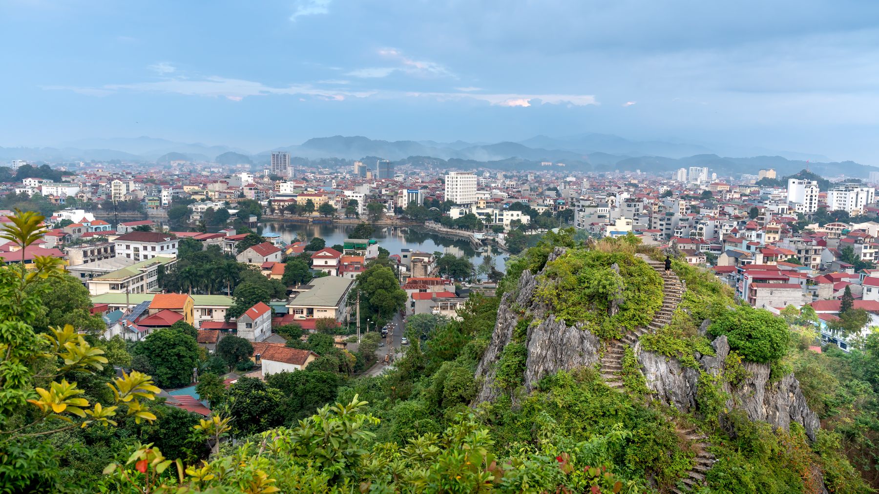
Photo by Quang Nguyen Vinh on Pexels
What to do
Hike to the summit
The main event. The trail from the nearest road access to the peak takes 2–3 hours depending on fitness and conditions. Elevation gain is roughly 400–500 meters from the trailhead. The path passes through dense bamboo groves, then transitions to scrubby cloud forest closer to the top. There's one false summit that fools everyone the first time. The actual peak has a small cleared area with enough room for maybe 15 people.
Camp overnight
If you carry gear, camping near the summit or on a saddle below it is the best way to experience the mountain. Temperatures drop sharply after sunset — bring a proper sleeping bag rated to at least 5°C if you're going between October and February. There are flat spots among the rocks, but no facilities. Pack out everything.
Visit Dao and Nung villages
The lower slopes have small settlements where families grow cardamom, anise, and mountain vegetables. Nobody's running homestay programs here like in Sapa or Mai Chau, but if you speak some Vietnamese (or bring a friend who does), people are generally welcoming. Saturday morning markets in the Mau Son area are worth timing your trip around — you'll find local honey, dried herbs, and "thit lon quay" (roasted pork) that's specific to this region.
Explore Mau Son peak
Since you're already in the range, Mau Son's main summit (1,541 m) is accessible by road and has a small resort area at the top. It's more developed — there's a French-era weather station ruin, a few guesthouses, and on winter weekends it fills with Hanoians chasing frost. Worth a side trip for comparison, even if it's less wild than Phat Chi.
Chase the frost (winter only)
In December and January, frost and occasionally ice form on the peaks. Vietnamese social media goes wild for it every year. If that's your goal, monitor weather reports for Lang Son and head up when overnight lows dip below 3°C. Get to the summit before dawn for the best chance.
Where to eat nearby
Lang Son city is the eating hub. Two things to prioritize:
- "Pho chua" (sour pho): Lang Son's signature noodle dish — rice noodles served at room temperature with sliced pork, peanuts, herbs, and a tangy broth on the side. Completely different from Hanoi's "pho." Try it at the shops along Ky Lua market street. A bowl runs 30,000–40,000 VND.
- "Vit quay" (roasted duck): Lang Son duck is roasted with "mac khen" pepper and honey, then chopped and served with sticky rice. Multiple places on Tran Dang Ninh street serve it. A half duck with rice costs around 150,000–200,000 VND and feeds two.
On the mountain itself, don't expect restaurants. Bring your own food for the hike — "banh mi" and fruit from Lang Son market work fine.
Where to stay
- Lang Son city: Budget hotels and guesthouses along Le Loi and Tran Dang Ninh streets start at 200,000–350,000 VND/night for a clean room with hot water and Wi-Fi. Mid-range options like Muong Thanh Lang Son run 500,000–800,000 VND.
- Mau Son area: A few basic guesthouses and one or two small resorts near Mau Son peak, 300,000–600,000 VND/night. Book ahead on winter weekends — they fill up when frost is forecast.
- Camping: Free, obviously. But you're on your own for water and shelter.
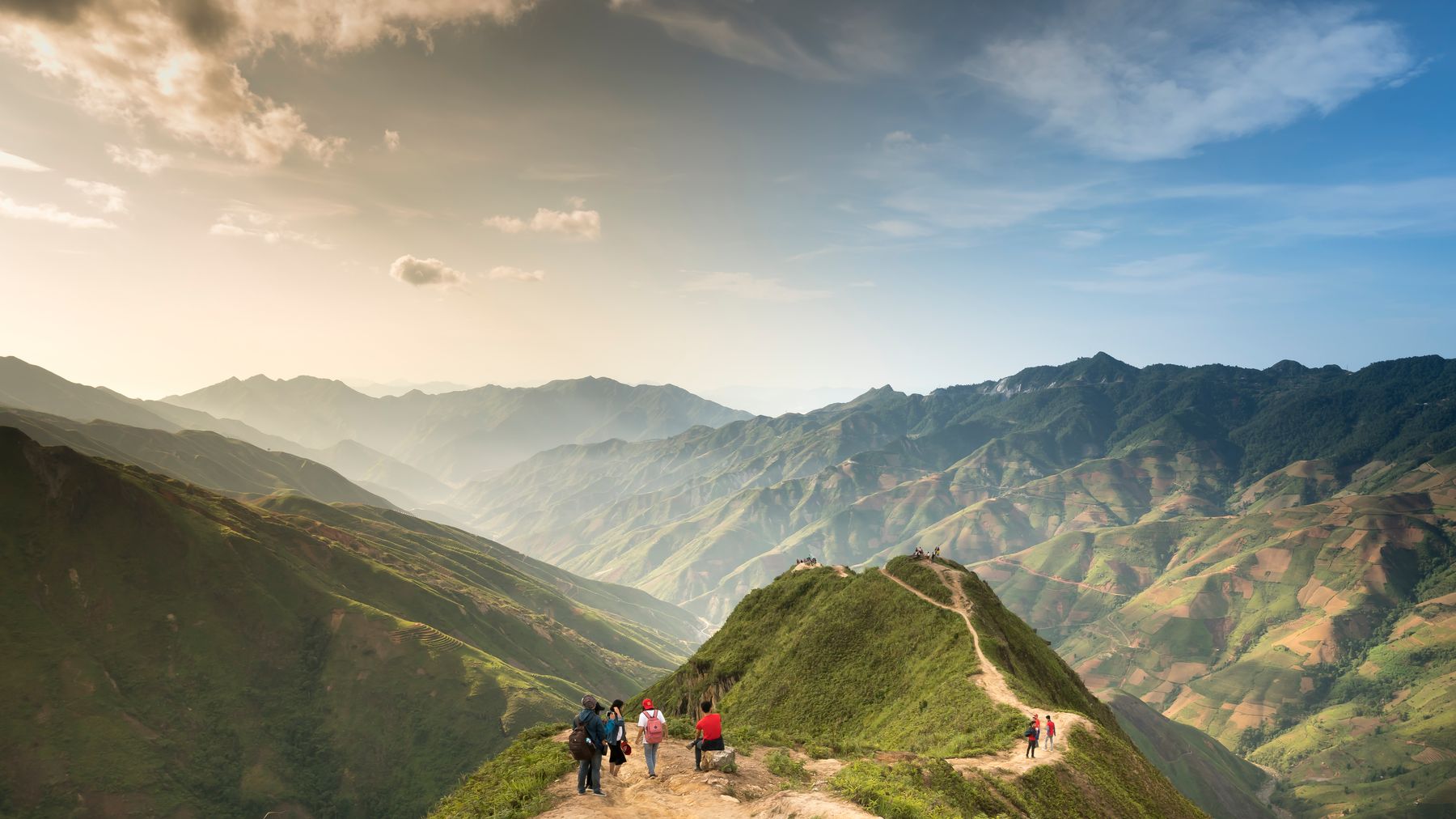
Photo by Quang Nguyen Vinh on Pexels
Practical tips locals would tell you
- Bring more water than you think. There's no reliable stream source on the upper trail.
- Wear proper hiking shoes, not sneakers. The granite gets slick when wet.
- Start early. Cloud cover typically rolls in by mid-afternoon, killing the views.
- If you're riding a motorbike up the mountain road, watch for loose gravel on turns — the road maintenance is inconsistent.
- Cell signal (Viettel works best in this area) is patchy above 700 meters and nonexistent near the summit.
Common mistakes to avoid
- Going without enough layers in winter. It's the tropics at sea level, but at 1,000 m in January, you'll be shivering in a t-shirt. Bring a proper jacket and gloves.
- Underestimating the hike. It's not Fansipan, but 3 hours uphill at altitude with a pack is real exercise. Don't start at 2 PM.
- Skipping Lang Son city entirely. Some travelers treat it as just a transit point. The old town, Ky Lua market, and Tam Thanh cave pagoda are worth a half day.
- Relying on Google Maps for trail navigation. The trails aren't well-mapped digitally. Ask locals at the trailhead or in nearby villages for current conditions.
Practical notes
Dinh Phat Chi works best as a 2–3 day trip from Hanoi: one day to reach Lang Son and explore the city, one day for the hike, and a buffer day if weather doesn't cooperate. It pairs well with a longer northeast loop through Lang Son province and onward toward Ha Giang if you have the time.
Last updated · May 29, 2026 · independently researched, never sponsored.