The Geography
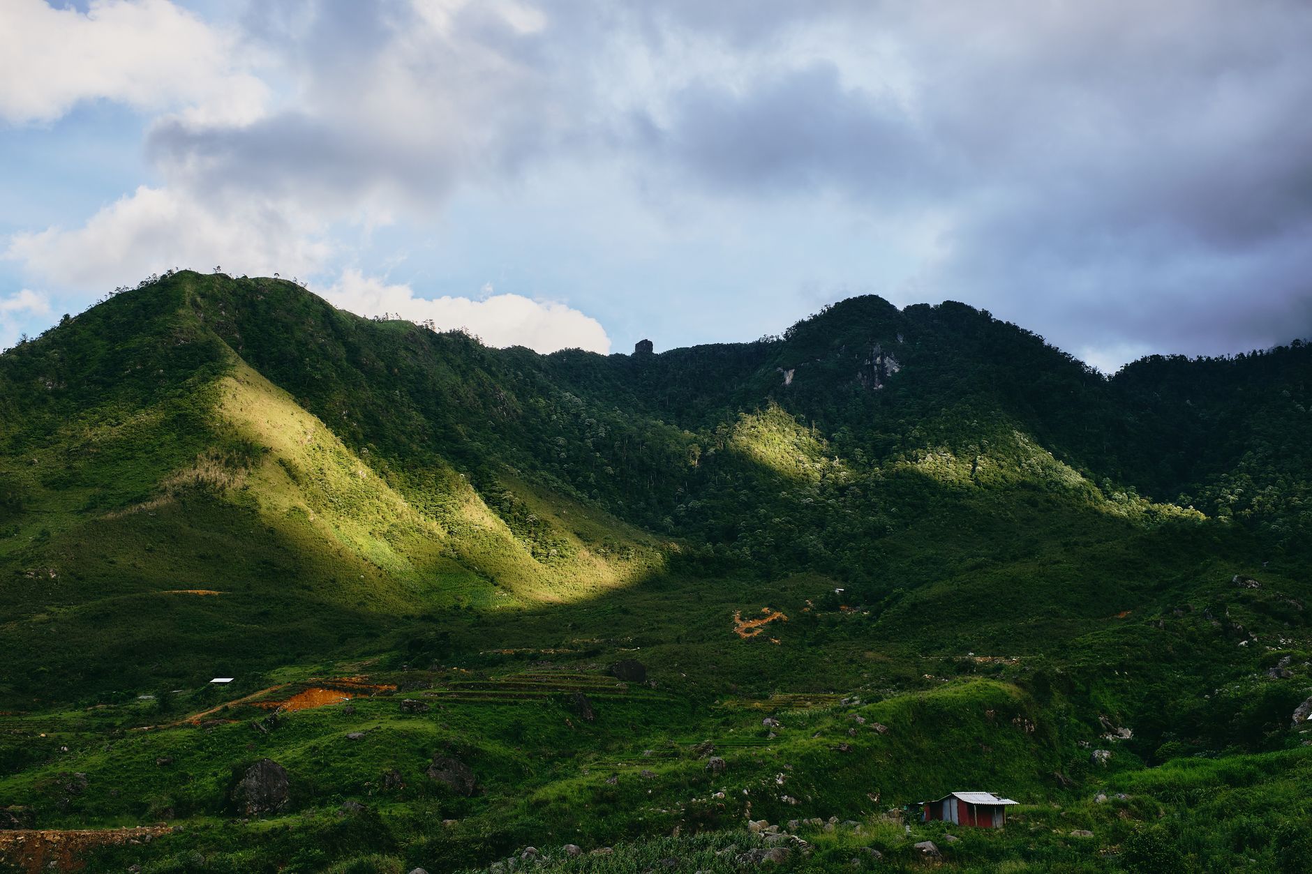
Ma Pi Leng Pass sits at the 1,500-meter crest of National Highway 4C, a roughly 20-kilometer section connecting Dong Van and Meo Vac in far northern Ha Giang province. The road clings to steep slopes above the Nho Que River gorge, where limestone cliffs rise near-vertical on both banks. From the viewpoint at the pass, the river is a thin thread far below; the Tu San canyon cuts deeper still through the same stone.
The surrounding Dong Van Karst Plateau is limestone throughout—a landscape shaped over millions of years by water dissolving rock, leaving behind sinkholes, cave systems, and these vertiginous valleys. In 2010, UNESCO designated the plateau as a Global Geopark, recognizing it as geologically exceptional and worth protecting. Fossil discoveries here date back hundreds of millions of years, embedding the whole region in deep time.
If you have ridden the Ha Giang Loop, you already know the karst terrain shifts character every few kilometers. But the stretch approaching Ma Pi Leng is different in degree—the canyon walls here are taller, the road cuts narrower, and the drop to the Nho Que below is the kind that makes your hands grip the handlebars a little tighter.
The Road Nobody Wanted to Build
Before 1959, the plateau communities of Dong Van and Meo Vac were reachable only by footpath and packhorse. The idea of cutting a motorable road across Ma Pi Leng seemed lunatic—the most difficult 21-kilometer section, directly above the gorge, would require cutting sheer rock face by hand.
Construction ran from 1959 to 1965. Over 1,300 youth volunteers and 1,000 civilian workers, drawn from 16 ethnic minority groups—Hmong, Tay, Dao, Nung, Pu Peo, Lo Lo—took on the work. The Ma Pi Leng cliffside section alone, with no explosives budget worth mentioning, took nearly two years to complete. Men worked with chisels and hammers, removing stone by hand from a mountainside with a thousand-meter drop.
The road was named "Con Duong Hanh Phuc"—the "Happiness Road"—and the name stuck. Today, brass markers stand on the pass honoring the volunteers. The road itself was damaged by Chinese artillery in the early 1990s and later repaired; it now anchors the Ha Giang Loop, one of Southeast Asia's most popular motorcycle routes.
To put the construction in perspective: modern highway projects in northern Vietnam (베트남 / 越南 / ベトナム) use boring machines, reinforced concrete, and fleets of dump trucks. The Happiness Road crew had rope, hand drills, and whatever dynamite they could source. Some volunteers were suspended over the cliff edge in baskets to chip away at the rock face. The memorial near the pass summit lists names of workers who died during the six-year effort—reading it changes how the road feels under your wheels.

Image by Hoach Le Dinh via Wikimedia Commons (CC BY-SA)
What You Actually See
The panoramic view from the pass crest spans the Nho Que corridor below, with the Tu San canyon pulling deeper into the plateau. The road itself is paved and well-maintained, though narrow in sections; a footpath and older motorbike track run alongside, offering alternatives if the main highway feels too crowded. The 2,000-meter elevation difference between the river and the pass creates dramatic light and shadow on the stone.
On clear mornings, visibility stretches across the Dong Van plateau. On cloudy days—frequent here—the canyons fill with mist and the whole scene becomes abstract, limestone cliffs emerging and disappearing.
There are now two main viewpoint areas. The older one is a roadside pull-off near the summit marker—free to access, no infrastructure beyond a low wall. The newer viewing platform, built into the hillside about 500 meters further along, has a parking area, drink stalls, and a multi-level walkway. Entrance to the platform area costs around 20,000 VND. Both spots give you the canyon panorama, but the older pull-off tends to be less crowded early in the morning.

Image by Vuong Tri Binh via Wikimedia Commons (CC BY-SA)
Riding the Pass: Practical Route Notes
Most riders encounter Ma Pi Leng as part of the third or fourth day of the Ha Giang Loop, depending on direction. The standard approach from Dong Van town covers about 24 km to the pass summit, then another 20-odd km descending into Meo Vac. The entire Dong Van–Meo Vac stretch takes roughly two to three hours on a motorbike if you stop at viewpoints, which you will.
The road surface is asphalt and generally in decent shape, though patches of gravel or loose rock appear after heavy rain, especially on the Meo Vac descent. Sections are single-lane with blind corners—honk before every turn. Trucks and buses use this road too, particularly in the morning. If you are not confident on a motorbike, hiring an "Easy Rider" (a local driver who takes you as a passenger) out of Ha Giang city costs around 600,000–900,000 VND per day including the bike and fuel.
Fuel: Fill up in Dong Van town before heading out. There is a petrol station on the main road through Dong Van (open roughly 6:00–18:00), and a couple of roadside fuel sellers between Dong Van and the pass, but availability is not guaranteed. The next reliable station is in Meo Vac. Running dry on the pass itself is a real possibility if you start with half a tank.
When to ride: Early morning—departing Dong Van by 7:00—gives you the best light and the least traffic. The golden hour before sunset is beautiful but leaves you descending to Meo Vac in fading light on a narrow mountain road, which is not ideal. October through December offers the clearest skies; January and February can be cold enough (5–10°C at the summit) to numb your fingers through thin gloves.
Where to Eat and Sleep Nearby
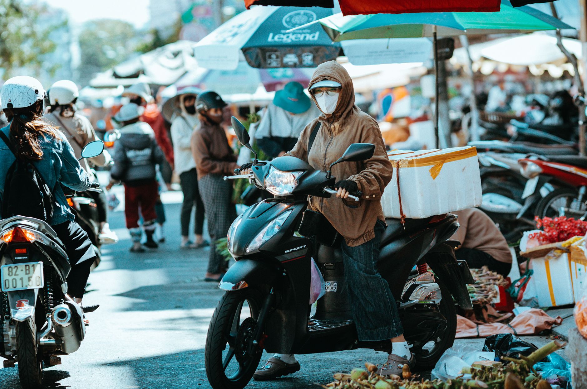
Dong Van town (24 km north of the pass) and Meo Vac town (20 km south) are the two practical bases. Neither is large, but both have enough guesthouses and "nha nghi" (basic local inns) to absorb the tourist flow outside of peak weekends.
In Dong Van, a bed in a hostel dorm runs 100,000–150,000 VND per night; a private room in a guesthouse with hot water is 250,000–400,000 VND. The old quarter has a few restaurants serving "pho" and "com tam" (broken rice plates) for 30,000–50,000 VND. The Sunday morning market, when it runs, is the best place to eat—Hmong families sell "thang co" (a sour horse-meat stew specific to the region) and grilled corn.
In Meo Vac, accommodations are similar in price. The town sits in a valley and feels more spread out. A couple of homestays on the road leading out toward Bao Lac offer better views than the in-town options. Meo Vac's market, held on Saturdays, draws Hmong, Lo Lo, and Pu Peo communities from surrounding villages—it is less photographed than Dong Van's and worth timing your loop for.
For food on the road itself, a few drink-and-noodle stalls have appeared at the main viewpoint areas on the pass. Expect instant noodles, boiled eggs, and "ca phe" (Vietnamese coffee, usually instant here) for 15,000–30,000 VND. Do not expect a proper meal between the two towns.
If you are spending more than a few days in the region and want to contrast the karst landscape with something different, Sapa is about 300 km to the west—terraced rice paddies instead of limestone towers—and Ninh Binh to the south offers karst formations at river level rather than at altitude.
What Surprises Foreigners
The altitude chill. Ha Giang (하장 / 河江 / ハーザン) province is in the tropics, so travelers pack for heat. At 1,500 meters, the pass summit can be genuinely cold, especially from November through March. Mornings regularly dip below 10°C. A windproof jacket is not optional on a motorbike at those temperatures.
The road is busy. Social media makes Ma Pi Leng look like an empty ribbon of asphalt. In reality, the road carries local traffic year-round—cement trucks heading to Meo Vac, minibuses ferrying market-goers, motorbikes loaded with building materials. On weekends from September through December (peak season), the viewpoints can get genuinely crowded. If you want solitude, ride on a Tuesday.
It is not a loop by itself. Ma Pi Leng is one section of the larger Ha Giang Loop, not a standalone day trip. Getting to Dong Van from Ha Giang city alone takes a full day of riding (about 150 km on mountain roads). Budget at least three days for the loop, four if you want to stop and actually look at things.
Phone signal drops. Coverage is patchy between Dong Van and Meo Vac. Download offline maps (Maps.me or Google Maps offline) before you leave Ha Giang city. Your Vietnamese SIM card will work in the towns but may cut out on the pass itself.
Construction surprises. Roadwork appears without warning. In 2023 and 2024, sections near the pass were widened, creating detours on gravel tracks. Ask your guesthouse host in Dong Van about current road conditions before heading out—they will know.
Administrative and Protected Status
The pass was historically in Ha Giang province until July 2025, when administrative changes shifted it into Tuyen Quang. The change is mainly bureaucratic; the geology and tourism infrastructure remain the same.
In 2009, Vietnam's Ministry of Culture formally designated the pass as a national-level scenic monument, protecting 796 hectares of the immediate landscape including parts of Pai Lung, Pa Vi, and Xin Cai communes in Meo Vac. As part of the Dong Van Karst Plateau Geopark, the site operates under a management plan balancing conservation, education, and support for local communities. The geopark requires revalidation every four years.
Recent discussions have centered on new visitor infrastructure—a multi-story viewing building near the pass—and how to integrate it without overwhelming the heritage site. The ministry has issued guidance requiring new structures to harmonize with the surrounding landscape, a tension between access and preservation that most popular sites face.
The Origin of the Name
"Ma Pi Leng" appears in multiple Vietnamese spellings, and the etymology remains debated. One interpretation translates it as "the horse's nose bridge," referencing the narrow, challenging terrain. Linguistic research has also suggested the name originally referred to a village in the area rather than the pass itself. Either way, it has stuck for generations and carries the weight of the Happiness Road story with it.
Quick Reference
- Location: National Highway 4C, between Dong Van and Meo Vac, Ha Giang province (now administratively Tuyen Quang as of July 2025)
- Summit elevation: approximately 1,500 m
- Distance Dong Van to Meo Vac (via pass): roughly 44 km
- Distance Ha Giang city to Dong Van: approximately 150 km (full day ride)
- Viewpoint entrance fee: free at roadside pull-off; approximately 20,000 VND at the newer platform
- Best months: September–December (dry, clear); March–May is pleasant but hazier
- Coldest months: December–February (5–15°C at summit)
- Fuel: Fill up in Dong Van; next reliable station in Meo Vac
- Phone signal: Patchy between towns; download offline maps in advance
- Accommodation nearby: Dong Van and Meo Vac, 100,000–400,000 VND per night
- Easy Rider day rate: 600,000–900,000 VND (driver, bike, fuel included)
Final Note
Ma Pi Leng is not a viewpoint you visit and check off. It is a piece of road that volunteers carved out of a cliff with hand tools over six years, and the landscape it crosses has been forming for hundreds of millions of years. Ride it slowly, stop more than you think you need to, and read the memorial plaque at the top. The canyon will still be there when you look up.
Last updated · May 26, 2026 · independently researched, never sponsored.