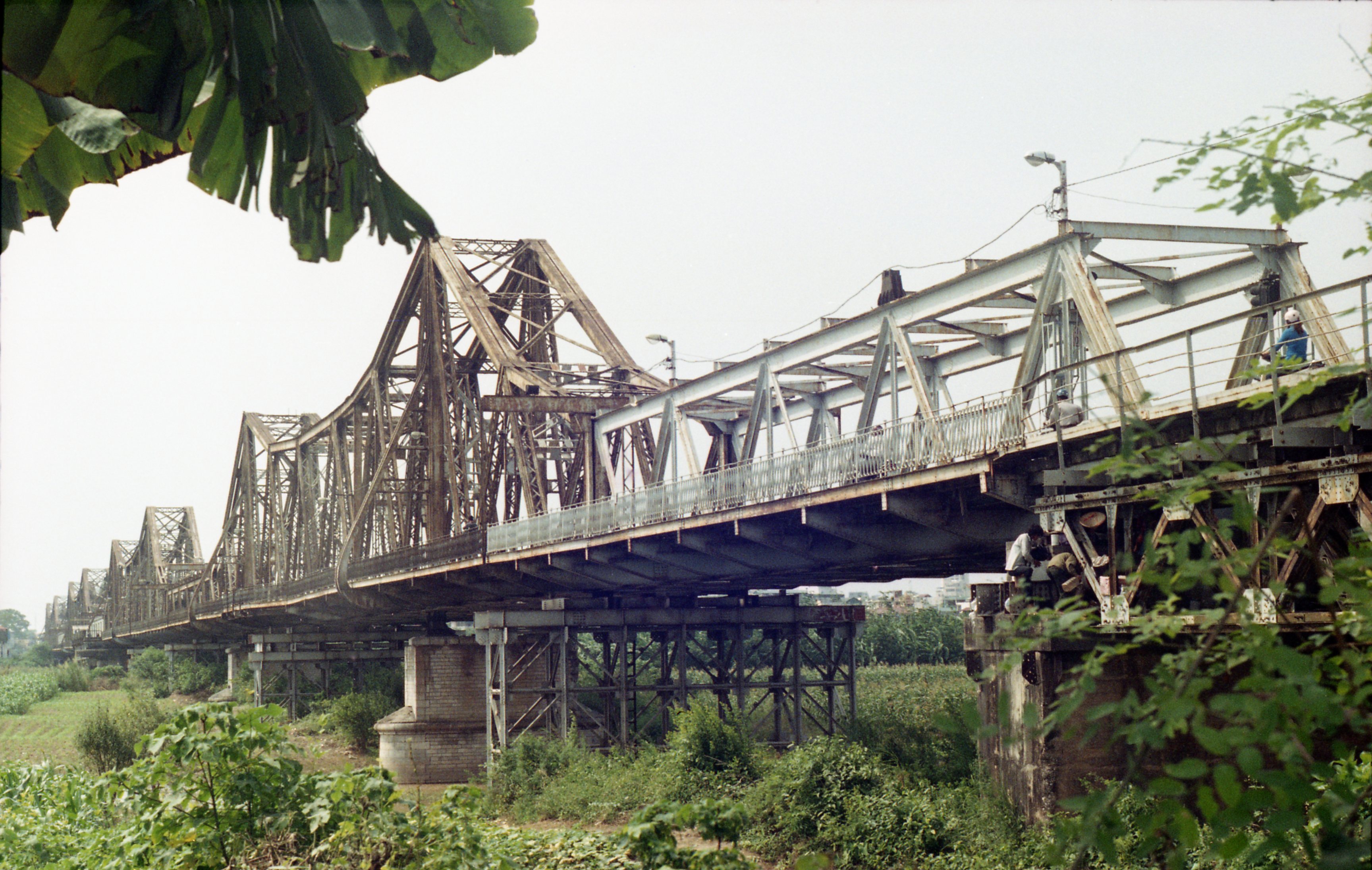
The Long Bien Bridge still dominates the Red River crossing in central Hanoi. At 2.4 kilometers long, it was one of Asia's longest bridges when it opened in 1903. Even now, bearing scars from wars and decades of wear, it's unmissable from the Hanoi Bridge area or from a boat tour on the river.
Built for the French, Designed to Last
The French colonial government commissioned the bridge in 1899. Two Parisian architects, Dayde and Pille, designed it as a cantilever structure—then a cutting-edge engineering approach. Construction took three years and employed over 3,000 Vietnamese laborers. The bridge's ironwork was intricate and heavy, built to handle both rail and vehicle traffic across one of northern Vietnam (베트남 / 越南 / ベトナム)'s most important river crossings.
When it opened, the bridge had 19 steel spans and a single-meter-gauge railway track flanked by two roadways. The total steel used exceeded 5,600 tons—shipped from France and assembled on site. Workers drove thousands of piles into the riverbed to anchor the foundations against seasonal flooding, which on the Red River can raise water levels by several meters between May and October.
The bridge connected Hanoi to the port of Haiphong, 100 kilometers downriver. For the French, it was a linchpin of colonial infrastructure—moving troops, goods, and French officials with ease. For Vietnamese under colonial rule, it was a daily reminder of foreign occupation, but also a feat of engineering that shaped modern Vietnam. Locals originally called it "Cau Doumer" after Paul Doumer, the Governor-General of Indochina who championed the project. The name Long Bien—referencing the ancient name for the area on the river's north bank—came later, after the French departed.
Bombing and Repair
By the 1960s, the Long Bien Bridge was a military prize. The United States Air Force flew bombing raids against it—first major strike on August 11, 1967, when 20 F-105 fighter-bombers collapsed its center span. The damage was real, but the bridge stayed functional; repair crews worked constantly to restore it.
Intensity spiked in May 1972 during Operation Linebacker. Laser-guided bombs hit on May 13, then August 9, then September 11. Each time, sections fell. Each time, they were repaired. By war's end in 1975, the bridge was still standing—damaged, patched, but navigable.
In total, the bridge sustained damage from at least eleven separate bombing campaigns. Several of the original French-built spans were destroyed completely and replaced with flat steel-plate sections—functional but visually distinct from the arched ironwork of 1903. You can actually see where one era ends and another begins as you walk across: the elegant lattice trusses give way to plain welded plates, then back to lattice again. It reads like a timeline bolted together overhead.

Image by Tuabiht Rellahcs via Wikimedia Commons (CC BY-SA)
What You See Today
About half the original structure remains. The rest has been rebuilt, often with concrete or steel that doesn't match the original ironwork. A French-funded restoration project is underway to restore what it can.
The bridge now carries trains (the main traffic), bicycles, mopeds, and pedestrians only. Cars and trucks use newer bridges downstream—the Thang Long Bridge, Vinh Tuy Bridge, and others built since the 1990s to handle Hanoi's vehicle boom.
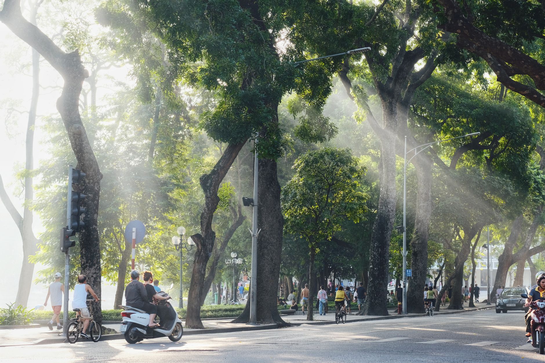
Walk or cycle across in early morning, when the light is soft and the pedestrian traffic is light. You'll see the layered repairs, the rust, the original ironwork in sections where it survived. On the riverbanks below, especially on the western (Hoang Kiem district) side, you'll see small boats where families live. It's a striking contrast—a grand colonial bridge above, informal riverside life below.
One thing to be ready for: trains still cross the bridge several times a day on the Hanoi–Haiphong and Hanoi–Lang Son lines. When a train approaches, a horn sounds and moped riders squeeze to the edges of the narrow roadway. There are no barriers separating the rail track from the pedestrian paths—just a low curb and some faded paint. Stay alert. The trains move slowly on the bridge (roughly 15 km/h), so you have time to step aside, but the gap between the train and the railing is tighter than you'd expect.

Image by Tran Trung Kien via Wikimedia Commons (CC BY-SA)
The Markets and Life Below the Bridge
What most visitors don't realize is that Long Bien Bridge anchors an entire neighborhood economy at its base. On the north end, Long Bien Market ("cho Long Bien") operates as Hanoi (하노이 / 河内 / ハノイ)'s largest wholesale fruit and vegetable market. Activity peaks between midnight and 5 a.m.—trucks arrive from farms across the Red River Delta, and vendors sort produce under fluorescent lights before dawn. By 6 a.m. the wholesale rush is over and retail buyers take their turn. If you're an early riser (or a very late sleeper), walking through the market at 3 or 4 a.m. is one of the most vivid experiences Hanoi offers. Expect muddy floors, stacked crates of dragonfruit and lychee, and zero English signage.
On the south side, the bridge deposits you into the edge of the Old Quarter, roughly 800 meters from Dong Xuan Market. From there you're a short walk to some of the city's best street food. Head down Hang Chieu or Hang Buom for "pho" served from early morning—around 15,000–40,000 VND a bowl depending on the stall. "Bun cha" joints along Hang Manh and Le Van Huu fire up charcoal grills around 11 a.m. for the lunch rush. If you've walked the full 2.4 km across the bridge, you'll have earned it.
The banana islands ("bai giua")—alluvial sandbars in the middle of the Red River, directly under the bridge—are another draw. Families farm corn and vegetables on these seasonal patches of land, and a handful of small cafes have set up along the riverbank. Access is from a staircase on the bridge's south side, about 400 meters from the Old Quarter end. You descend to a dirt path that leads to the riverbank. It's a strange pocket of rural quiet inside a city of eight million people. On weekends, Hanoians come here to drink "ca phe" at makeshift tables under the bridge pylons.
The Debate Over Demolition and Preservation
Long Bien Bridge is not a museum piece—it's still working infrastructure, and that creates tension. City planners have debated for years whether to retire it entirely, replace it with a modern crossing, or restore the original French design. In the early 2000s, a proposal to demolish the bridge and build a six-lane road bridge drew public backlash. The plan was shelved. Later proposals suggested keeping a few original spans as a monument and building a new bridge alongside. As of now, the bridge remains in active use while piecemeal repairs continue.
The structural reality is sobering. Many of the replacement spans were designed as temporary fixes in wartime conditions—they were not engineered for 50+ more years of service. Rust is visible everywhere, and weight limits are strictly enforced (no vehicles over 18 tons). The single rail line is the busiest load the bridge carries today, and Vietnamese Railways has advocated for a parallel rail bridge to relieve the strain.
For visitors, the preservation debate matters less than the fact that the bridge is still crossable, still free, and still one of the few places in Hanoi where colonial-era, wartime, and modern infrastructure literally overlap in a single structure. That won't last forever. If it's on your list, don't wait.
What Surprises Foreigners
The narrowness. Photos make the bridge look wide and grand. In person, the pedestrian and moped lanes are about 1.5 meters across on each side—barely enough for two mopeds to pass. When a train comes through, everyone presses against the railing.
No safety infrastructure. No guardrails between you and a 10-meter drop to the river in some sections. No netting. No warning signs in English. The bridge is unlit at night except by passing headlights. Walk it in daylight.
The smell. Depending on the season and water level, the Red River flats below the bridge can smell of river mud and garbage. Rainy season (June–September) raises the water and clears most of it; dry season (November–March) exposes the banks.
Moped traffic is real. This is not a pedestrian promenade. Mopeds use the bridge constantly, and they will honk and squeeze past you. Stay on one side and walk predictably—don't wander across the lane.
Vendors on the bridge. You'll occasionally see people selling sugarcane juice, "banh mi", or fruit from baskets at the bridge ends. Prices are fair—a "banh mi" runs about 15,000–25,000 VND, same as in the Old Quarter.
Quick Reference
- Location: Connects Hoan Kiem District (south) to Long Bien District (north), central Hanoi
- Length: 2.4 km (about 30–40 minutes on foot, 10 minutes by bicycle)
- Cost: Free. No tickets, no gates.
- Best time to visit: Early morning (6–7 a.m.) for soft light and thin crowds, or late afternoon (4–5 p.m.) for golden hour
- Getting there: From the Old Quarter, walk north on Hang Dau street to the bridge's south entrance. From Long Bien station, the north entrance is directly adjacent.
- Nearest landmarks: Dong Xuan Market (800 m south), Long Bien Market (at north base), Hanoi Old Quarter (immediately south), Temple of Literature (3 km southwest)
- Trains: Several crossings daily on the Hanoi–Haiphong line; check schedule at Long Bien station or ask at your hotel
- Combine with: A morning walk across the bridge pairs well with "pho" in the Old Quarter, a stop at Dong Xuan Market, or a visit to Bat Trang ceramic village (13 km southeast, reachable by bus 47 from Long Bien station)
- Useful phrase: "Cau Long Bien o dau?" (Where is Long Bien Bridge?)—though in the Old Quarter, just walking north will get you there
Where to Experience It
The bridge is free to cross. No entrance fee. Access from Hanoi Bridge station (north side) or from the Old Quarter (south side). The best light is early morning (6–7 a.m.) or late afternoon (4–5 p.m.). If you want to avoid crowds, go on a weekday.
Nearby: the Old Quarter is immediately south; Hanoi Bridge station is north; Red River boat tours depart from the south bank. The bridge is easiest as part of a larger Old Quarter or riverside walk, rather than a destination in itself.
For a full day, you could cross the bridge on foot in the morning, eat "bun cha" for lunch on Hang Manh, visit the Imperial Citadel of Thang Long in the afternoon (about 2 km west of the bridge's south end), and finish with an "egg coffee" at one of the Old Quarter cafes on Hang Gai or Nha Tho street. Or head the other direction: cross to Long Bien District, grab "hu tieu" at one of the noodle stalls near the market, and take bus 47 out to Bat Trang for an afternoon of pottery shopping.
Final Note
Long Bien Bridge is not beautiful in any conventional sense. It's rusted, patched, loud with mopeds, and narrower than you imagined. But it's one of the few structures in Hanoi where you can physically touch three eras of the city's history—colonial ambition, wartime destruction, and postwar improvisation—in a single walk. Go early, stay alert, and bring water.
Last updated · May 29, 2026 · independently researched, never sponsored.