While most riders rush along the coastal highway between Nha Trang (냐짱 / 芽庄 / ニャチャン) and Hoi An, the quiet provinces of Binh Dinh and Phu Yen offer some of the most rewarding, traffic-free riding in Central Vietnam. This four-day, 420-kilometer loop starts and ends in the coastal city of Quy Nhon, taking you along empty cliffside roads, past ancient Cham ruins, and up into the cool, forested valleys of the highland interior.
Unlike the famous Ha Giang loop, you will not find tourist crowds or organized group tours here. You will need a decent semi-automatic or manual bike, a map app that works offline, and a willingness to eat at roadside shacks where English is rarely spoken.
Preparation, Bike Rental, and Fuel
Expect to pay between 120,000 and 150,000 VND per day for a standard 110cc semi-automatic bike (like a Honda Wave or Yamaha Sirius) from rentals near the Quy Nhon railway station or along Nguyen Hue street. For the highland climbs on Day 2 and 3, a semi-automatic is highly recommended over an automatic scooter because of better engine braking on descents.
Fuel is easy to find along the coast, but once you turn inland toward Son Hoa and Tay Son, petrol stations become sparse. Always top up your tank when it hits half-empty. A full tank on a standard bike costs about 70,000 to 90,000 VND.
Day 1 — Quy Nhon to Tuy Hoa via the Cliffs of Phu Yen (100 km)
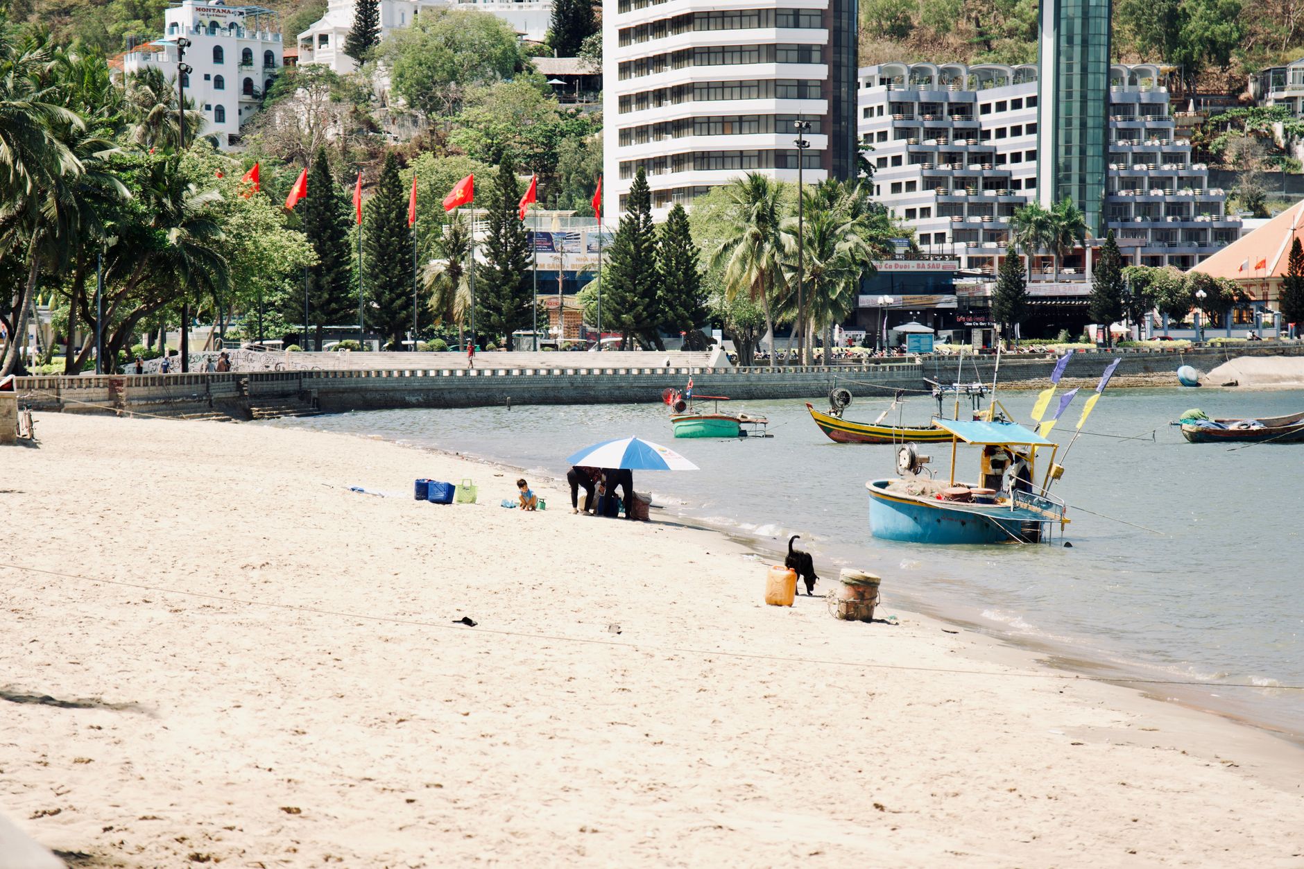
Leave Quy Nhon early to beat the mid-morning heat. Head south out of the city along the QL1D, a spectacular coastal road that hugs the cliffs overlooking quiet fishing coves. Stop for a quick "ca phe sua da" (iced coffee with condensed milk) at one of the roadside shacks overlooking Bai Xep, a tiny fishing village tucked into a sandy cove.
After crossing the provincial border into Phu Yen, leave the main highway and follow the local coastal roads toward Xuan Dai Bay. The route takes you past coconut groves and wooden lobster-farming rafts floating in the calm turquoise water.
Your main detour today is Ghenh Da Dia (The Cliff of Stone Plates), a geological oddity made of thousands of pentagonal basalt columns stacked neatly like giant beehives at the water's edge. Entry is 40,000 VND. Avoid the midday sun here, as the black rocks absorb intense heat.
From Ghenh Da Dia, ride south along the quiet local roads crossing the wooden Binh Thanh bridge—one of the longest wooden bridges in Vietnam (베트남 / 越南 / ベトナム)—before arriving in the provincial capital of Tuy Hoa.
- Where to sleep: Choose a local hotel near Hung Vuong street in Tuy Hoa.
- What to eat: Try "banh xeo" (savory rice crepes stuffed with pork and shrimp) at the local stalls near the central market.

Photo by Ngân Dương on Pexels
Day 2 — Tuy Hoa to Son Hoa via Cape Dien (120 km)
Start the day by riding south along the Phu Sen coastal road to Mui Dien (Cape Dien). This is the easternmost point of mainland Vietnam, marked by a French-built lighthouse dating back to 1890. The walk up to the lighthouse takes about 20 minutes and offers views of rugged cliffs dropping vertically into the East Sea.
After visiting the cape, turn west onto the QL29. The road leaves the coast behind, climbing steadily into the foothills of the Truong Son mountain range. The salty sea breeze quickly gives way to the scent of pine and eucalyptus. The road here is wide, well-paved, and carries very little traffic.
You will climb onto the Phu Yen plateau, passing vast fields of sugarcane and cassava. Your destination is Son Hoa, a quiet highland district capital that sees almost no foreign tourists.
- Where to sleep: Look for a basic "nha nghi" (local guesthouse) along the main road in Son Hoa town. Expect to pay around 150,000 to 200,000 VND for a clean, simple room.
- What to eat: Look for roadside stalls serving "com tam" (broken rice with grilled pork) or hot bowls of beef noodle soup.
Day 3 — Son Hoa to Tay Son (110 km)
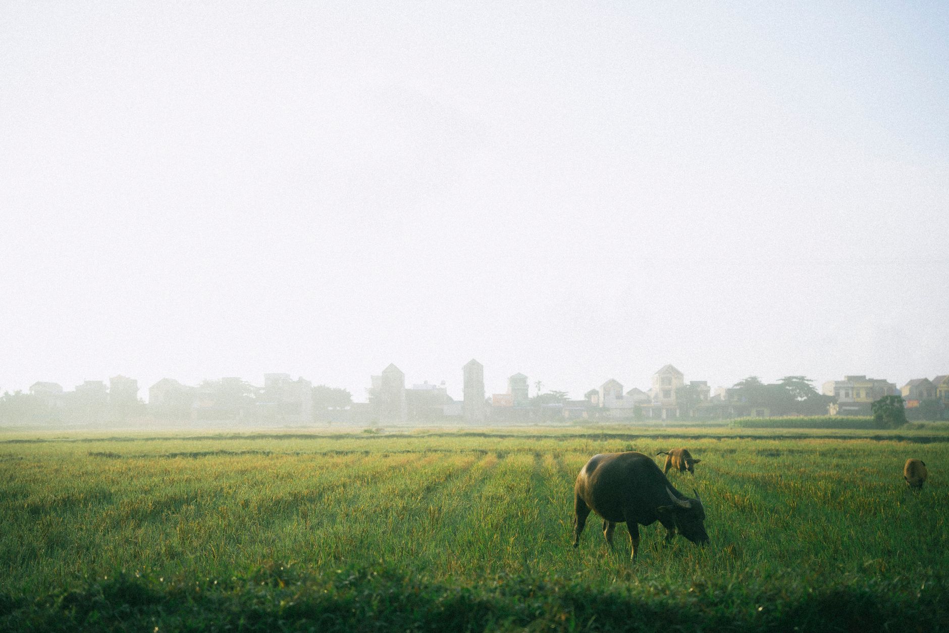
This is the most remote leg of the loop. From Son Hoa, head north along the QL19C, a rugged interior highway that runs parallel to the coast but deep in the hinterlands. The road winds through dense forests, small ethnic minority villages, and river valleys where water buffalo graze by the roadside.
The pavement on QL19C can be patchy in places, with occasional gravel sections and potholes caused by logging trucks. Keep your speed moderate (around 40-50 km/h) and watch for stray livestock on the road.
As you cross back into Binh Dinh province, the landscape opens up into the wide, fertile valley of Tay Son. This region is famous as the birthplace of the Tay Son rebellion in the late 18th century and is the cradle of traditional Vietnamese martial arts.
- Where to sleep: Stay in a local guesthouse in Phu Phong, the main town of the Tay Son district.
- What to eat: Try "nem chua" (fermented pork rolls grilled over charcoal) wrapped in rice paper with fresh herbs.
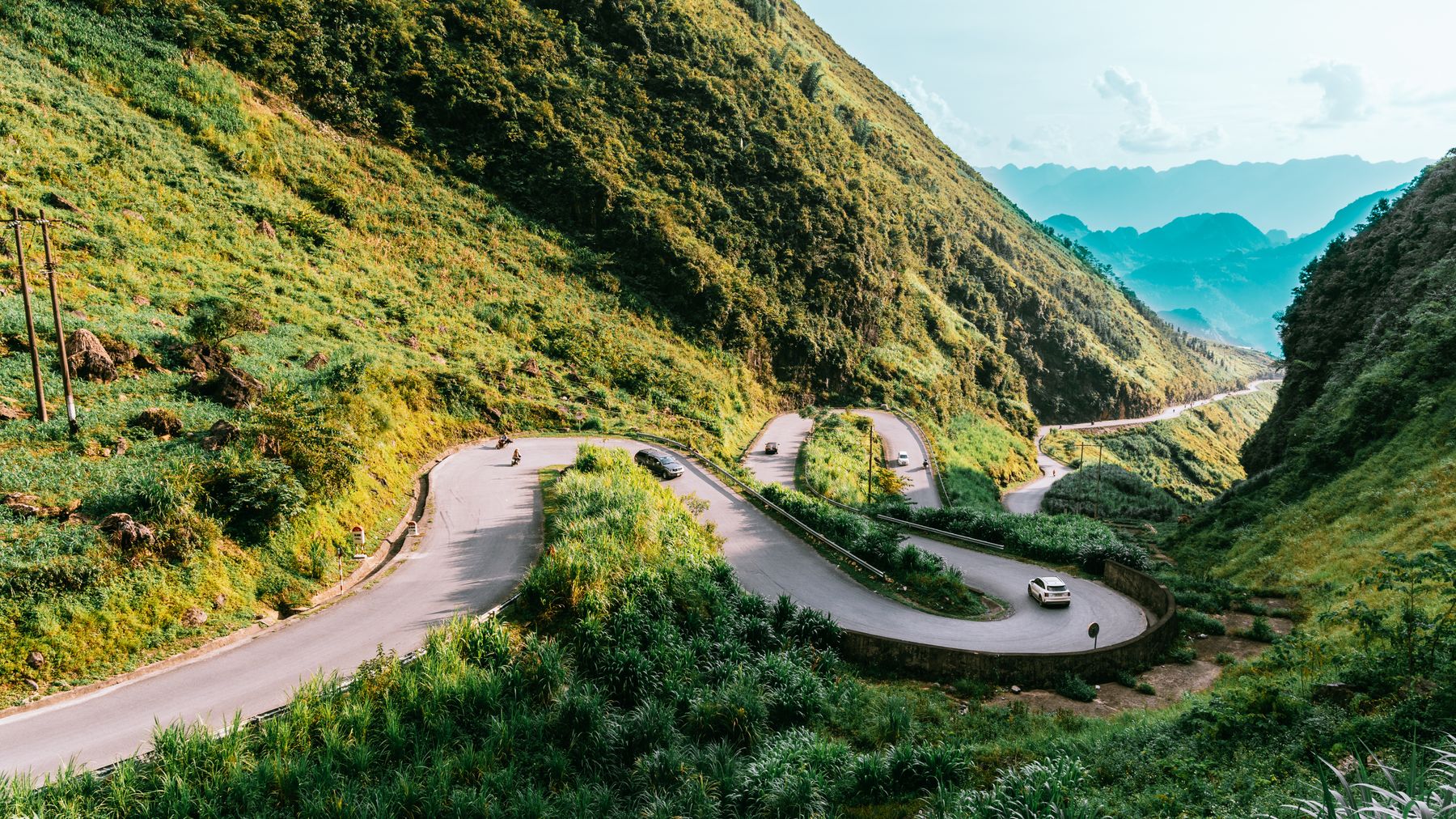
Photo by Nguyễn Sơn Tùng on Pexels
Day 4 — Tay Son to Quy Nhon via the Cham Towers (90 km)
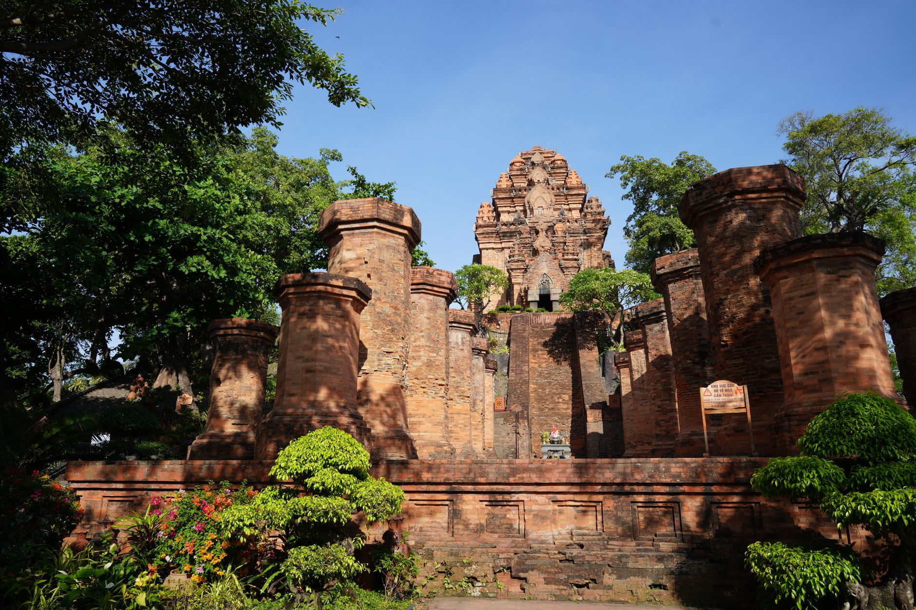
Before heading back to the coast, spend the morning exploring the ancient history of the region. Binh Dinh was once the center of the Kingdom of Champa, and the hills around Tay Son are dotted with red-brick Cham towers dating back to the 11th and 12th centuries.
First, visit the Duong Long Towers, a group of three brick towers that are the tallest Cham structures in Southeast Asia. From there, ride east toward the Banh It Towers, which sit on a hilltop offering panoramic views of the surrounding rice paddies and the distant ocean.
From Banh It, take the DT640 north toward the Nhon Ly peninsula. Ride across the Thi Nai Bridge—a 2.5-kilometer span over the salt marshes—to reach the dramatic cliffs of Eo Gio. Walk the paved coastal path along the windy cliffs before heading back into Quy Nhon to return your bike.
Finish your loop with a cold glass of fresh "bia hoi" (draft beer) at one of the busy seafood joints along Xuan Dieu street on the Quy Nhon waterfront.
Practical Notes
- Best time to ride: January to August. The dry season offers clear skies and safe road conditions. Avoid October to December when heavy rains and typhoons hit the central coast.
- Navigation: Download Google Maps for offline use. Mobile signal can be weak in the valleys between Son Hoa and Tay Son.
- Safety: Always wear a full-face helmet and protective gear. The coastal winds can be strong enough to buffet light scooters, so keep a firm grip on the handlebars.
Last updated · May 30, 2026 · independently researched, never sponsored.