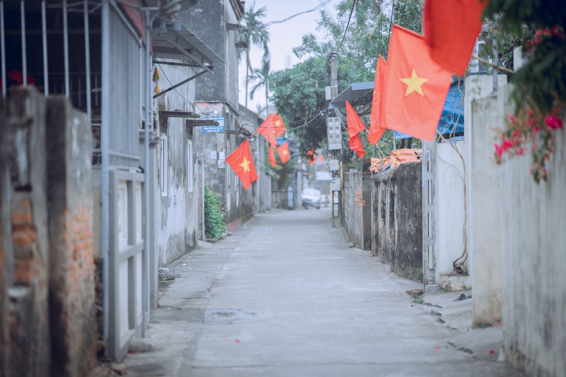
Dong Thap province sits in the heart of Vietnam (베트남 / 越南 / ベトナム)'s Mekong Delta (메콩 델타 / 湄公河三角洲 / メコンデルタ), stretching across 5,939 km² of some of the country's most productive agricultural land. It's formed from two watersheds divided by the Tien River: the northern plain (Dong Thap Muoi) and the southern ribbon between the Tien and Hau rivers. If you're interested in rice, flowers, or the delta's rhythms, this is the place.
How Dong Thap Became Dong Thap
The province is relatively young. Serious Vietnamese settlement didn't arrive until the late 17th century, when migrants from the Red River Delta moved south. By the early 18th century, hamlets were taking root near the Cai Sao Thuong rivulet (now Cao Lanh). Sa Dec, whose name is Khmer for "iron market," grew from a few hamlets into a major trading hub—second only to Cholon (Saigon) by the 19th century. Today Sa Dec is famous for something far more delicate: flowers.
The modern province took its current form in 1976 when two older provinces (Kien Phong and Sa Dec) merged. Sa Dec was the capital until recently; now Cao Lanh serves as the provincial seat.
Geography and Climate
Dong Thap is pancake-flat. It sits between 10°07'N and 10°58'N latitude, bordered by Tay Ninh and Cambodia to the north, Vinh Long to the south, An Giang to the west. The Soai Rap river marks much of the eastern edge toward Ho Chi Minh City. There are four official border crossings into Cambodia: Thong Binh, Dinh Ba, Thuong Phuoc, and My Can.
Two rivers—the Tien and Hau—are the province's lifelines. They bring fresh, silt-rich water and create a hydrology that shifts dramatically with the monsoon. From May to November, the rainy season dumps 90–95% of the year's 1,682–2,005 mm of rainfall. December to April is drier. The flood season (July–November) pushes water from the upper Mekong through the delta; the dry season (December–June) sees the rivers draw down. Average temperature hovers around 27°C, with highs near 34°C and lows around 22°C.
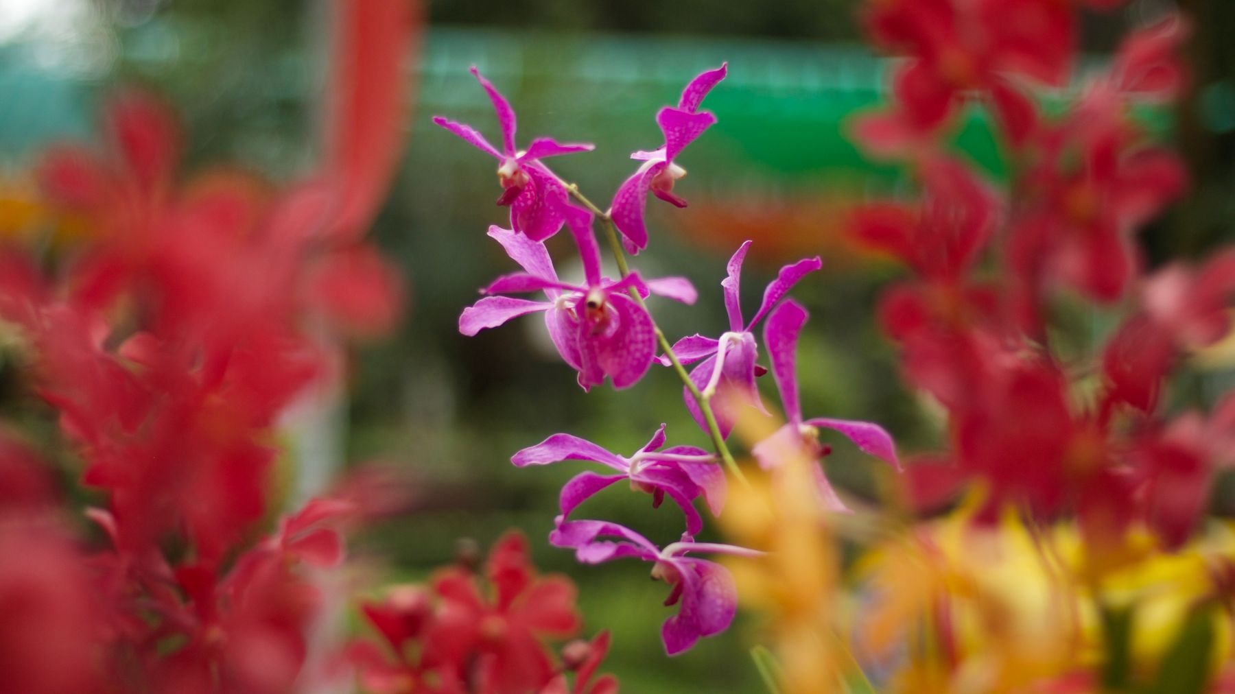
Photo by Duy's House of Photo on Pexels
Rice and Agriculture
Dong Thap is Vietnam's third-largest rice producer. The province grows rice on 462,042 hectares, turning out over 2.8 million tons of paddy annually. Beyond rice, another 38,000+ hectares grow industrial crops—corn, cassava, sugar cane. The soil is alluvial, deep, and never saline because fresh water from the rivers is constant.
Agricultural zones have been carved up and intensified along both river systems; cooperatives and state enterprises run much of the export supply chain. If you drive through Dong Thap in the dry season, you see neat rectangles of emerald shoots; in the rainy season, flooded paddies reflecting sky.
Sa Dec Flower Village
The real draw for many visitors is the Sa Dec flower village, which sprawls across nearly 300 hectares. This is not a theme park—it's a working production landscape. Nurseries grow over 12 million plants annually: orchids, lilies, roses, ornamentals, tropical exotics. Families live on-site, tending seedlings in shaded beds and selling cuttings to middlemen who supply Ho Chi Minh City's markets and export buyers.
Walking through Sa Dec on a quiet morning, you pass low greenhouses, open-air beds, families watering by hand. It's humid, earthy, and very real. The best time to visit is early morning or just after rain, when the air smells like soil and growing things. Many small farms welcome foot traffic; some sell directly to visitors.
The village peaks in activity from late December through Tet / 越南春节 / テト) (Vietnamese Lunar New Year), when demand for ornamental flowers explodes across southern Vietnam. During those weeks, the lanes between nurseries turn into impromptu markets—trucks and motorbikes loaded with chrysanthemums, marigolds, and kumquat trees jostle for space on narrow paths. If you visit in mid-January, expect crowds and color on a scale the rest of the year can't match. Outside the Tet rush, you'll often have entire nursery rows to yourself.
Photo by Phượng Lê on Pexels
What to Eat in Dong Thap
The Mekong Delta eats differently from Hanoi or Saigon, and Dong Thap has its own local accents. The province's waterways mean freshwater fish and river shrimp dominate the protein side of the plate.
"Hu tieu" Sa Dec is the signature bowl. Sa Dec-style "hu tieu" uses thin, translucent rice noodles produced locally—Sa Dec has been a noodle-making town for generations. The broth is pork-bone based, lighter and sweeter than what you'd find in a Saigon "hu tieu" shop. A bowl at a street stall in Sa Dec town runs 30,000–45,000 VND. Look for stalls along Hung Vuong street near the old market; the best ones open at 6:00 AM and sell out by 9:00 AM.
Beyond noodles, Dong Thap does excellent "lau mam"—a fermented fish hotpot loaded with catfish, river shrimp, eggplant, water spinach, and fresh herbs. It's pungent, rich, and very much a communal meal. Expect to pay 150,000–250,000 VND for a hotpot serving two to three people at local restaurants along the Cao Lanh riverfront.
For breakfast, "banh mi" carts are everywhere, though the fillings lean toward pork and local pate rather than the elaborate builds you see in Hoi An or Saigon. A "banh mi" here costs 15,000–25,000 VND. Delta-style "goi cuon" (fresh spring rolls) with river shrimp and pork are a common snack—lighter and more herb-heavy than the northern version.
If you're visiting during flood season (August–November), look for "bong dien dien"—bright yellow sesbania flowers that locals pick from flooded fields and toss into sour soups or eat raw with "lau mam." They taste mildly sweet and slightly crunchy. It's a seasonal ingredient you won't find in cities, and it's one of those things that makes eating in the delta feel genuinely different.
Drink-wise, the delta runs on iced coffee. "Ca phe sua da" from a streetside stall costs 15,000–20,000 VND. You won't find the egg coffee culture of Hanoi here—this is robusta country, brewed dark and poured over condensed milk and ice.
Tram Chim National Park
About 40 km northwest of Cao Lanh, Tram Chim National Park protects 7,313 hectares of the Dong Thap Muoi wetlands—the largest remaining patch of seasonally flooded "Plain of Reeds" grassland in the delta. The park is best known as a refuge for the eastern sarus crane ("sếu đầu đỏ"), a tall, red-headed bird that migrates here between December and May. At peak season (January–March), birdwatchers count 50–100 cranes in the park, though numbers fluctuate year to year.
The park is more than cranes. Over 230 bird species have been recorded here, along with 130 plant species adapted to the flood-drain cycle. Boat tours through the park's channels run about 150,000–200,000 VND per person for a two-hour circuit. The park opens at 7:00 AM; arrive early, because birds are most active in the first two hours of daylight. Binoculars are essential—the park doesn't rent them, so bring your own.
To get there from Cao Lanh, hire a motorbike taxi (about 80,000–100,000 VND one way) or rent a motorbike in town (150,000–200,000 VND/day). The road is flat and paved the entire way. If you're combining Tram Chim with a trip from Saigon, budget a full day: it's roughly 190 km from central HCMC.
Xeo Quyt and Nguyen Sinh Sac Historical Sites
Dong Thap has a handful of historical sites connected to the resistance period. Xeo Quyt, about 30 km east of Cao Lanh, is a former base preserved in a cajuput forest. The site includes reconstructed bunkers, tunnels, and meeting rooms tucked under tree cover, connected by elevated walkways over swampy ground. It gives a sense of how delta geography shaped wartime logistics—everything had to move by water. Entrance is around 20,000 VND. Small boats ferry visitors through the flooded forest channels (about 50,000 VND per person). The site is quiet on weekdays and worth an hour or two.
In Cao Lanh city itself, the Nguyen Sinh Sac memorial honors the father of Ho Chi Minh, who spent his later years in the area. It's a modest but well-maintained park with a small museum. Entry is free. The site is on Pham Huu Lau street, a short walk from the Cao Lanh market area.
If you're interested in this kind of site, the Cu Chi Tunnels near Saigon offer a much larger-scale version of the same concept—but Xeo Quyt has far fewer tourists and a more natural setting.
Getting Around
Dong Thap is connected by national highways 1, 30, 50, 80, and 54, linking it to Ho Chi Minh City (about 152 km northeast) and other delta provinces. Can Tho International Airport is roughly 80 km south; Tan Son Nhat (HCMC) is about 152 km away. Local transport is mainly motorbike taxis, buses, and rented bicycles—the flat terrain is perfect for cycling.
The province has 102 commune-level administrative units: 20 urban wards and 82 rural communes. Key towns include Cao Lanh, Sa Dec, Hong Ngu, and Cao Lanh (the provincial capital).
From Saigon's Mien Tay bus station, direct buses to Cao Lanh run every 30–60 minutes throughout the day. The ride takes about 3.5 hours and costs 100,000–130,000 VND. Buses to Sa Dec are similarly frequent. If you're looping through the delta—say, Can Tho to Dong Thap to Vinh Long—local buses and shared vans connect the provincial capitals for 50,000–80,000 VND per leg.
Cycling is genuinely good here. The roads are flat, traffic outside town centers is light, and the scenery is open paddies, canals, and fruit orchards. A full-day loop from Sa Dec through the flower village and along the river levees covers about 30–40 km and never requires more effort than a gentle pedal.
Quick Reference: Dong Thap at a Glance
- Provincial capital: Cao Lanh
- Area: 5,939 km²
- Distance from HCMC: ~152 km (3.5 hours by bus)
- Distance from Can Tho: ~80 km (1.5 hours by bus)
- Best time for flowers: Late December through Tet (January/February)
- Best time for birdwatching: December–March (sarus cranes at Tram Chim)
- Flood season: July–November (dramatic but wet; roads remain passable)
- Dry season: December–April (easier cycling, cooler mornings)
- Budget meal: 30,000–50,000 VND
- Motorbike rental: 150,000–200,000 VND/day
- Currency: VND only in most places; ATMs in Cao Lanh and Sa Dec
- Language tip: English is limited outside hotels. Learn "cho toi mot to hu tieu" (give me one bowl of hu tieu) and "bao nhieu tien?" (how much?)
Common Mistakes and What Surprises Foreigners
Skipping Sa Dec for Cao Lanh. Most tourists who visit Dong Thap head straight to Cao Lanh because it's the capital. But Sa Dec—with its flower village, old shophouses, and noodle culture—has more character for a short visit. If you only have one day, Sa Dec is the better bet.
Visiting the flower village at midday. The heat between 11:00 AM and 3:00 PM is brutal, and the nursery workers retreat indoors. Arrive before 8:00 AM or after 4:00 PM. The light is better for photos too.
Expecting tourist infrastructure. Dong Thap is not Da Lat or Phu Quoc. English signage is rare. Hotels exist in Cao Lanh and Sa Dec but are basic—expect to pay 250,000–500,000 VND per night for a clean room with air conditioning. Booking apps work, but many smaller guesthouses only take walk-ins.
Underestimating the flood season. If you visit between August and October, parts of the Dong Thap Muoi plain are underwater. Roads stay passable, but side routes flood. This is actually a great time to visit if you want to see the delta at its most alive—floating markets intensify, fish are abundant, and the "bong dien dien" flowers bloom across the floodplains. Just bring waterproof bags and flexible plans.
Thinking it's a day trip from Saigon. You can technically drive to Sa Dec and back in a day, but it's rushed. One night in Sa Dec and one in Cao Lanh gives you time for the flower village, a boat ride, Tram Chim, and a proper bowl of "hu tieu" at dawn. Pair it with a couple of nights in Can Tho for a solid delta loop.
Why Go
Dong Thap is not a beach or mountain destination. It's a landscape of productivity—rice, water, flowers, and the people who work them. If you want to understand how the Mekong Delta feeds Vietnam and the world, or if you're a gardener curious about ornamental production at scale, or simply prefer quieter, working countryside to tourist spectacle, Dong Thap rewards slow travel and early mornings. The wet season (May–November) is when the delta is fullest and most dramatic; the dry season (December–April) is cooler and easier for cycling.
Final Note
Dong Thap won't make anyone's highlight reel of Vietnam, and that's precisely the point. It's the kind of place where you sit at a canal-side "hu tieu" stall at 6:30 AM, watch a woman paddle past with a boat full of orchids, and realize you're seeing the delta as it actually works—not as it's packaged. Give it two days, bring a bicycle, and eat everything.
Last updated · May 29, 2026 · independently researched, never sponsored.