A Narrow Coastal Province
Quang Binh sits on Vietnam (베트남 / 越南 / ベトナム)'s North Central Coast, bordered by Ha Tinh to the north, Quang Tri to the south, Laos to the west, and the Dong Sea to the east. The province is notably narrow—just 40 kilometers from coast to border at its tightest—and as of June 2025, it was administratively merged with Quang Tri province. But travelers still identify Quang Binh by its name, and the region retains its distinct character: mountains and forest cover about 85% of the land.
Historically, Quang Binh shifted between Champa and Vietnamese rule before being absorbed into the Vietnamese kingdom in 1069. During the Trinh-Nguyen War (centuries later), the Gianh River marked the dividing line between north and south Vietnam. The region remained strategically important through French colonial times and beyond.
For most international visitors, Quang Binh means one thing: caves. That reputation is earned, but the province has more texture than a single national park. There are empty beaches north and south of Dong Hoi, fishing villages along the Nhat Le River, and a food culture that borrows from both Hue to the south and Ha Tinh to the north without quite matching either.
Phong Nha-Ke Bang: The Main Draw
Quang Binh's defining feature is Phong Nha-Ke Bang National Park, a UNESCO World Heritage site in the province's western mountains. The park sits along the Annamite Range, which forms the border with Laos and includes peaks between 1,000 and 1,500 meters. The highest point in the area, Phi Co Pi, reaches 2,017 meters.
Inside the park, the landscape is pure karst—limestone formations riddled with cave systems. The primary tropical forest here is home to 751 species of vascular plants, 36 of them endangered. Common trees include hopea, garcinia, and various dipterocarp species; the forest is mostly evergreen, with scattered deciduous trees that shed leaves seasonally. Seedlings grow slowly in cracks and holes where soil accumulates on the limestone, so the ecosystem recovers slowly from disturbance.
The park earned its first UNESCO inscription in 2003 for geology, then a second recognition in 2015 for biodiversity. It covers roughly 857 square kilometers of protected karst, making it one of the largest limestone regions in Southeast Asia. If you only have two days, focus on the boat ride into Phong Nha Cave and a half-day trek to Paradise Cave—those two alone justify the trip.

Photo by Quang Nguyen Vinh on Pexels
Caves Beyond Son Doong
Son Doong gets the headlines—it is one of Vietnam's largest caves, and expeditions book out months ahead at roughly 58,000,000 VND per person for a four-day trek operated exclusively by Oxalis Adventure. But Quang Binh's cave network runs far deeper than a single showpiece.
- Phong Nha (퐁냐 / 峰牙 / フォンニャ) Cave: The most accessible option. A motorboat takes you 1.5 km up the Son River and into the cave mouth. Tickets cost around 150,000 VND per person, plus a shared boat fee of about 360,000 VND for up to 14 passengers. The interior river passage, lit by colored floodlights, stretches roughly 1,500 meters into the mountain. Open daily, usually 7:30–16:00.
- Paradise Cave (Thien Duong): A dry cave with a 31 km surveyed length—though tourists walk a 1 km boardwalk inside. Entry is about 250,000 VND. An extended 7 km trek deeper into the cave is available through tour operators for around 2,500,000 VND, including a guide and gear. The scale of the main chamber—up to 100 meters wide—makes it one of the more impressive walks you can do without any caving experience.
- Dark Cave (Hang Toi): More adventure park than pure caving. You zipline 400 meters across the Chay River, then swim and mud-bath inside the cave. Tickets run about 450,000 VND for the full combo (zipline, kayak, mud cave, swimming). It is loud and crowded in summer, but genuinely fun if you accept it for what it is.
- Tu Lan Cave System: A multi-cave trek through jungle, river crossings, and underground passages. One-day tours start around 2,800,000 VND; two-day expeditions with camping run higher. This is the best middle ground between Son Doong's price tag and the drive-up caves.
- Hang En: The third-largest cave in the world by volume, reachable via a two-day/one-night trek that includes camping inside the cave mouth. Expect to pay around 6,000,000–7,000,000 VND. The campsite inside the entrance, with light filtering in from the massive opening, is one of the most memorable overnight spots in Vietnam.
All multi-day cave treks require licensed operators. Oxalis and Jungle Boss are the two main outfits based in Phong Nha village. Book at least a few weeks ahead for anything beyond the drive-up caves, especially between April and August.
Five Rivers and a Long Coast
Quang Binh drains via five major rivers flowing east from the Truong Son Range to the sea: the Gianh, Ron, Nhat Le, Ly Hoa, and Dinh rivers, plus tributaries like the Son River (which passes through Phong Nha-Ke Bang). The province has a river density of 1.1 km per square kilometer and about 160 natural and man-made lakes holding 234 million cubic meters of fresh water.
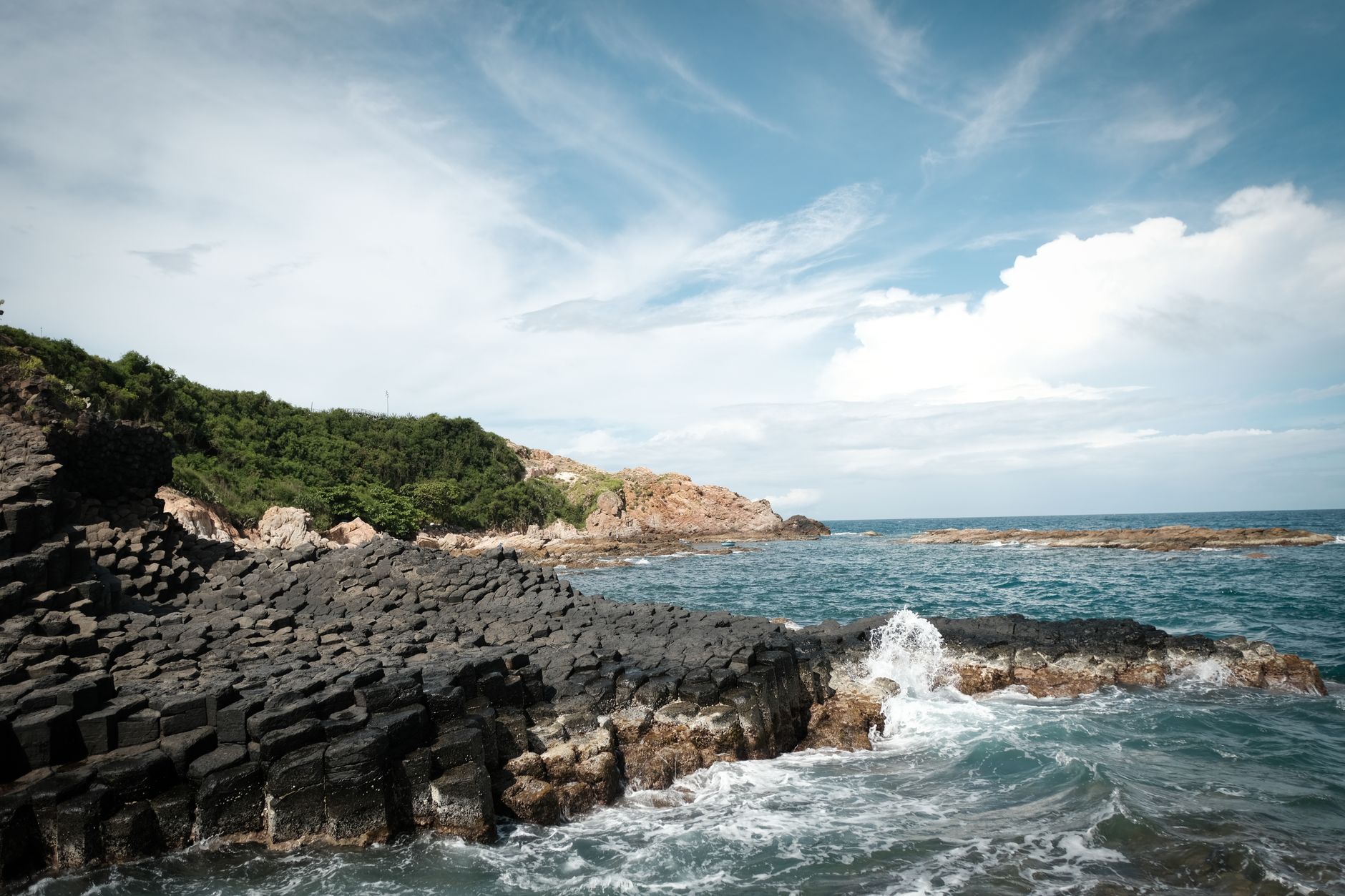
The coastline stretches 116 kilometers and is marked by sand dunes that buffer tides. Offshore islets—Hon La, Hon Gio, Hon Nom, Hon Co, Hon Chua—are small but contribute to the province's fishery zone. Hon La bay, 4 square kilometers wide and up to 15 meters deep, has been proposed for deep-water port development.
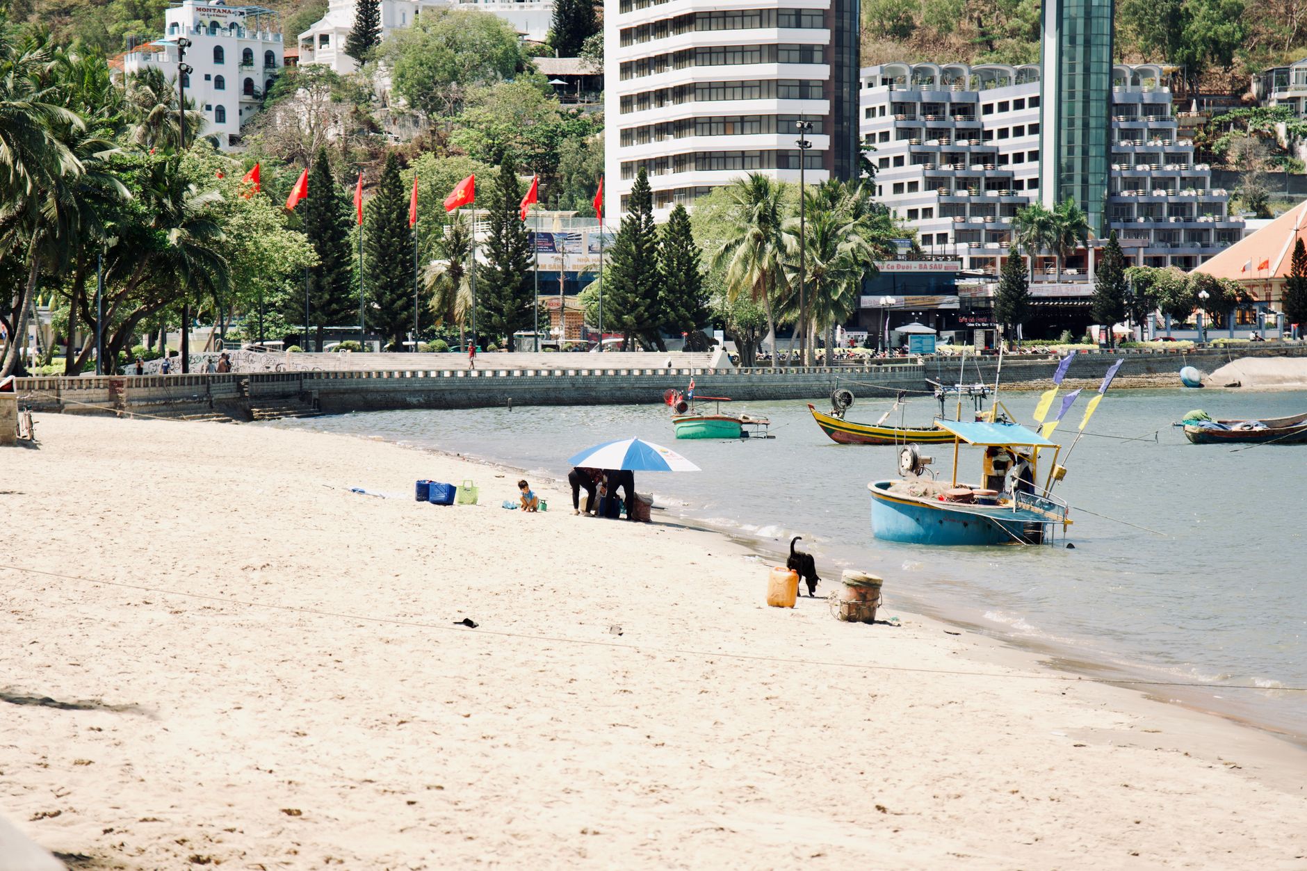
The beaches near Dong Hoi—Nhat Le Beach and Bao Ninh peninsula—are wide, flat, and mostly empty on weekdays. They lack the resort infrastructure of Da Nang or Phu Quoc, which is either a drawback or the whole point depending on what you want. A seafood lunch at one of the beachfront shacks on Bao Ninh runs 150,000–300,000 VND per person for grilled squid, clams, and rice.

Photo by Quang Nguyen Vinh on Pexels
Climate and Travel Timing
Quang Binh has four seasons:
- Spring (Feb–Apr): 18–25°C, warm with light rain.
- Summer (May–Jul): 35–36°C peak, hot and mostly dry with occasional storms.
- Fall (Aug–Nov): 22–28°C, rainy and cool; heaviest rains Sept–Nov.
- Winter (Dec–Jan): 12–16°C, humid with light rain.
Annual rainfall is 2,000–2,300 mm. The dry season is April to August—the best window for visiting caves and hiking.
A practical note: cave treks shut down or get cancelled during heavy rain, particularly from October through mid-December. The Son River floods, access roads wash out, and operators suspend departures. If you are planning a Son Doong or Hang En trek, do not book for October or November—you will likely lose your slot to weather.
Food and Drink in Quang Binh
Quang Binh is not a food destination the way Hoi An or Saigon are, but the local cooking is honest and cheap. A few things to look for:
- "Banh loc": Tapioca dumplings stuffed with shrimp and pork, wrapped in banana leaf. Similar to the Hue version but slightly thicker-skinned. Sold in markets and roadside stalls for 5,000–8,000 VND per piece.
- "Chao canh": A thin rice porridge served with freshwater fish from the Gianh or Son rivers. Locals eat it for breakfast. A bowl costs 15,000–25,000 VND at market stalls in Dong Hoi.
- Grilled seafood: The coast means squid, prawns, and clams grilled over charcoal at beachside spots. Bao Ninh peninsula has a strip of seafood restaurants where you pick from tanks. Budget 200,000–400,000 VND for two people eating well.
- "Ca phe": Coffee culture here is simpler than in Hanoi or Saigon. Most cafes serve standard drip "ca phe sua da" (iced coffee with condensed milk) for 15,000–25,000 VND. Don't expect the egg coffee scene from Hanoi—Quang Binh keeps it straightforward.
In Phong Nha village, a cluster of backpacker-friendly restaurants along the main road serves decent Vietnamese and Western food. Phong Nha Farmstay and Easy Tiger are the most established. A plate of "com tam" (broken rice with grilled pork) or a bowl of "pho" runs 40,000–60,000 VND at these spots—slightly above local prices but reasonable for the quality.
For "bia hoi" (fresh draft beer), look for the small roadside stalls in Dong Hoi's town center near the Nhat Le River bridge. A glass costs 5,000–10,000 VND. It is light, barely bitter, and best consumed before sunset with a plate of boiled peanuts.
Visiting Quang Binh Today
The main town is Dong Hoi, a modest coastal base for exploring the national park and its famous cave system (including Son Doong, one of Vietnam's largest caves). The Nhat Le River delta offers quieter riverside scenery. Most visitors come for Phong Nha-Ke Bang's trekking, caving, and wildlife—gibbons, langurs, and forest birds are common in the park.
Access: Dong Hoi airport connects to Hanoi and Ho Chi Minh City. Highway 1 runs along the coast. The merge with Quang Tri province in 2025 simplified some administrative processes, but tourism infrastructure and town names remain unchanged.
Dong Hoi to Phong Nha village is about 45 km by road, roughly a one-hour drive. You can rent a motorbike in Dong Hoi for 120,000–150,000 VND per day or arrange a car transfer through your hotel for about 400,000 VND one way. The road is paved and straightforward—no mountain passes, just flat farmland gradually giving way to karst hills.
The Reunification Express train also stops at Dong Hoi station. A soft sleeper from Hanoi takes roughly 9–10 hours on the night train (around 500,000–700,000 VND depending on berth class), arriving early morning—a practical option if you want to skip the flight and see the coastline.
Common Mistakes Foreigners Make
- Booking Son Doong last-minute. Expeditions have limited permits and sell out months in advance. If Son Doong is your reason for visiting, book three to six months ahead.
- Visiting in October–November. This is peak flooding season. Caves close, roads flood, and you will spend your trip watching rain from a cafe in Dong Hoi.
- Skipping Dong Hoi entirely. Many travelers treat it as a bus stop. But Nhat Le Beach at sunset, a seafood dinner on Bao Ninh, and a morning walk along the river are worth at least one night in town.
- Underestimating cave trek difficulty. Paradise Cave's boardwalk is easy. But Tu Lan, Hang En, and Son Doong involve river crossings, jungle hiking, and real physical effort. Wear proper shoes, not sandals.
- Not bringing cash. Phong Nha village and rural Quang Binh run on cash. ATMs exist in Dong Hoi, but card acceptance outside hotels is spotty. Withdraw VND before heading to the caves.
- Expecting Hoi An-style food variety. Quang Binh's food is good but limited in range. If you want "banh mi", "bun cha", or "mi quang", you will find better versions in Da Nang or Hue. Come here for caves, not cuisine.
Quick Reference
- Province capital: Dong Hoi
- Airport: Dong Hoi (VDH), flights to Hanoi and Ho Chi Minh City
- Train: Dong Hoi station on the Reunification Express line
- Distance Dong Hoi to Phong Nha: ~45 km (1 hour by road)
- Distance Dong Hoi to Hue: ~170 km south (~3 hours by car)
- Distance Dong Hoi to Hanoi: ~500 km north (~8–10 hours by train)
- Best months: April–August (dry season, caves open)
- Avoid: October–November (flooding, cave closures)
- Currency: Vietnamese Dong (VND); carry cash outside Dong Hoi
- Cave entry fees: Phong Nha Cave ~150,000 VND; Paradise Cave ~250,000 VND; Dark Cave combo ~450,000 VND
- Son Doong expedition: ~58,000,000 VND (book months ahead)
- Motorbike rental: 120,000–150,000 VND/day in Dong Hoi
- Budget meal: 30,000–60,000 VND; seafood dinner for two: 200,000–400,000 VND
Frequently Asked Questions
How much does it cost to visit Phong Nha Cave by boat?
Entry to Phong Nha Cave costs around 150,000 VND per person for the ticket, plus a shared boat fee of approximately 360,000 VND split among up to 14 passengers. The motorboat travels 1.5 km up the Son River into the cave, where a lit river passage extends roughly 1,500 meters into the mountain. The cave is open daily, generally from 7:30 to 16:00.
What is the difference between Phong Nha Cave and Paradise Cave?
Phong Nha Cave is a river cave accessed by motorboat, with a 1,500-meter lit interior passage costing around 150,000 VND plus a shared boat fee. Paradise Cave is a dry cave with a surveyed length of 31 km; standard entry costs about 250,000 VND for a 1 km boardwalk walk. An extended 7 km trek deeper inside is available through tour operators for around 2,500,000 VND, including a guide and gear.
When did Phong Nha-Ke Bang National Park receive its UNESCO World Heritage status?
Phong Nha-Ke Bang received its first UNESCO World Heritage inscription in 2003, recognized for its geology. A second recognition followed in 2015 for biodiversity. The park covers roughly 857 square kilometers of karst limestone in the Annamite Range, where peaks reach between 1,000 and 1,500 meters, making it one of the largest protected limestone regions in Southeast Asia.
Bottom Line
Quang Binh is a single-purpose destination, and that purpose is underground. The caves here—from the tourist-friendly boat ride through Phong Nha to the multi-day expedition into Son Doong—are genuinely world-class, and no amount of travel writing cliche can overstate that. Come in the dry season, bring cash, book your cave treks early, and leave a day for Dong Hoi's quiet coast. The province does not try to be everything, and that restraint is part of what makes it work.
Last updated · May 29, 2026 · independently researched, never sponsored.