What Nam Nung Is and Why It Matters
Nam Nung Nature Reserve covers roughly 21,000 hectares of evergreen and semi-deciduous forest in what was formerly Dak Nong province, now part of the expanded Lam Dong province after Vietnam's 2025 administrative merger. The reserve sits on a basalt plateau at elevations between 500 and 1,500 meters, anchored by Nam Nung peak at around 1,526 meters — one of the higher points in the Central Highlands (중부 고원 / 中部高原 / 中部高原).
Established in 1986, the reserve was originally set up to protect a corridor of primary forest that links several highland ecosystems. It shelters populations of black-shanked douc langurs, pygmy slow lorises, and several hornbill species that have been squeezed out of most lowland forests in the region. For travelers, the draw is simpler: this is thick, quiet, largely unvisited forest with waterfalls, M'Nong minority villages, and trails that feel like they belong to a different decade of Vietnamese tourism.
Why Travelers Go
Nam Nung doesn't have the infrastructure or name recognition of places like Da Lat or Sapa. That's the point. You come here for forest walks where you won't see another tourist for hours, for waterfalls where the only sound is water and insects, and for M'Nong villages where people still weave on backstrap looms and ferment rice wine in clay jars. If you want polished boardwalks and ticket counters, look elsewhere. If you want to walk through forest canopy so dense it drops the temperature by five degrees, this is your place.
Birders and wildlife photographers have started trickling in over the past few years, drawn by the hornbill populations and the chance to spot douc langurs in the canopy at dawn.
Best Time to Visit
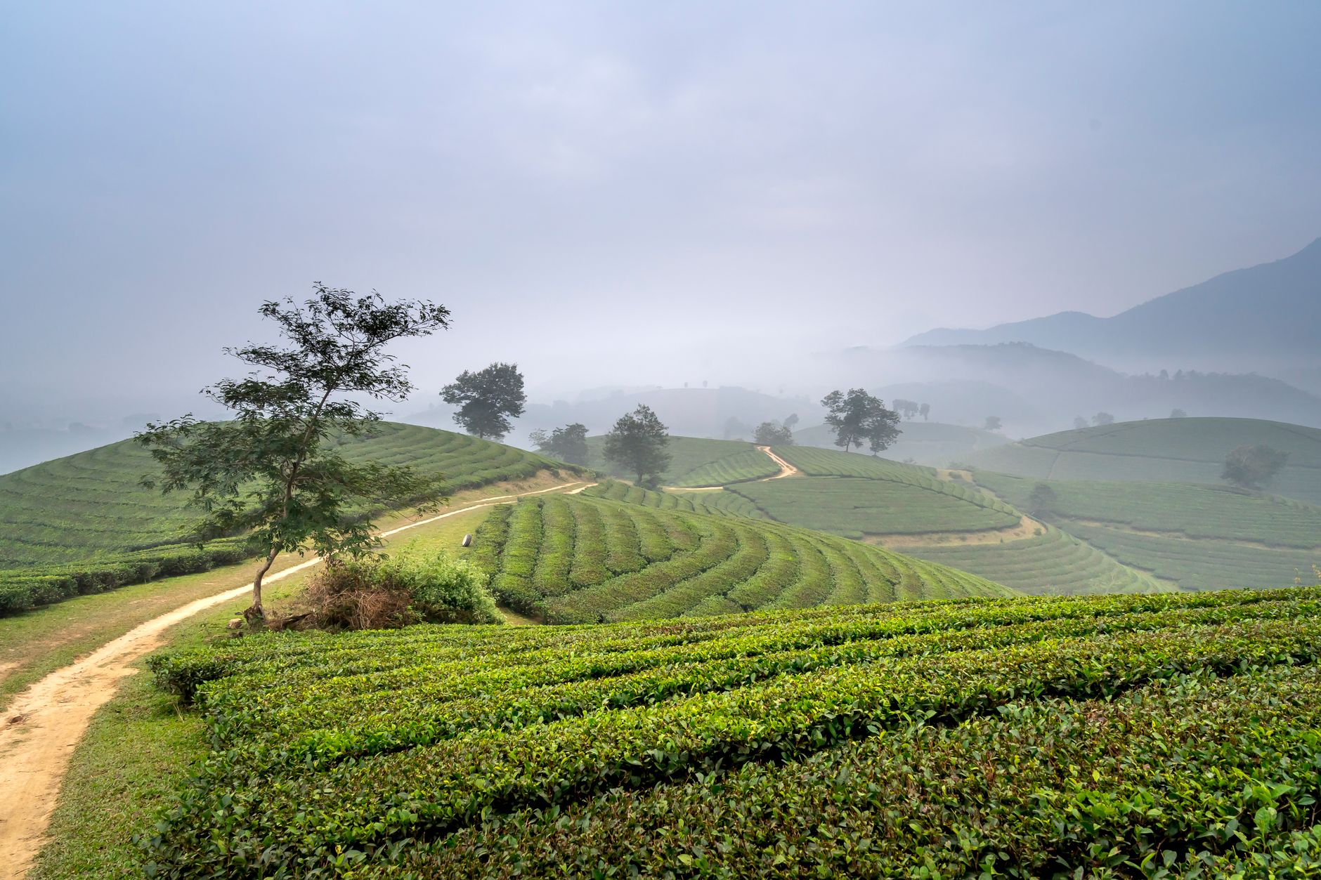
The dry season runs from November through March. Trails are passable, leeches are fewer, and mornings are cool enough — sometimes down to 15°C at higher elevations — that you'll want a light jacket. December and January are the sweet spot: clear skies, comfortable hiking temperatures, and the forest floor isn't a mud pit.
Avoid June through September if you can. The Central Highlands monsoon turns trails into streams, and some waterfalls become inaccessible. The upside of wet season is that the forest is at its greenest and the waterfalls are at full force, but getting around is genuinely difficult without a good motorbike and some tolerance for mud.

Photo by Quang Nguyen Vinh on Pexels
How to Get There
The nearest major hub is Da Lat (달랏 / 大叻 / ダラット), roughly 150 km to the southeast. From Da Lat, the most practical route is by motorbike or private car along QL28 heading northwest toward Dak Nong town (now administratively under Lam Dong), then local roads south into the reserve. The drive takes about 4–5 hours by motorbike, less by car. Expect to pay around 1,500,000–2,000,000 VND for a private car with driver for the day.
If you're coming from Saigon, the most direct route is the roughly 350 km drive north on QL14 through Binh Phuoc to Dak Nong town, then south to the reserve — about 7–8 hours by bus or car. Phuong Trang (Futa) runs daily buses from Saigon to Gia Nghia (Dak Nong's main town) for around 250,000–300,000 VND. From Gia Nghia, you'll need a local xe om (motorbike taxi) or prearranged transport to the reserve entrance, about 30 km further — budget 150,000–200,000 VND.
There's no public bus running directly to the reserve. Having your own motorbike is the most flexible option.
What to Do
Hike to Nam Nung Peak
The trail to the 1,526-meter summit starts from the ranger station and takes 4–6 hours round trip depending on your pace and how often you stop. The path cuts through primary forest with massive dipterocarp trees, thick undergrowth, and sections where you're walking on exposed root systems. Bring water, a rain shell regardless of season, and long pants — the undergrowth is dense. A local guide from the ranger station costs around 300,000–500,000 VND and is worth it; the trail isn't always obvious.
Chase Waterfalls
Several waterfalls sit within or just outside the reserve boundaries. Dray Sap and Dray Nur — a pair of wide, powerful falls on the Serepok River — are the most accessible, about 30 km from the reserve core. Entry is around 30,000 VND each. Less visited are smaller cascades deeper in the reserve that require a guide to find. These don't have names on any map, which is part of the appeal.
Visit M'Nong Villages
The M'Nong people have lived in this area for centuries. Several villages on the reserve's periphery welcome visitors, especially if you come with a local contact or guide. You might see rice wine being prepared in large ceramic jars, traditional longhouses, and gong-making — the Central Highlands gong culture is recognized by UNESCO. Don't show up unannounced expecting a performance; this is people's daily life, not a theme park. A guide who speaks M'Nong or at least has village contacts makes all the difference.
Early Morning Birding
The reserve is home to wreathed hornbills, great hornbills, and several species of barbet and broadbill. Dawn — around 5:30–6:00 AM — is the best window. The area around the ranger station and the first kilometer of the summit trail are productive spots. Bring binoculars; canopy birds are hard to spot with the naked eye in dense forest.
Motorbike the Perimeter Roads
The roads circling the reserve pass through coffee plantations, pepper farms, and patches of secondary forest with views across the plateau. It's a solid half-day ride with stops. The road surface ranges from decent asphalt to rutted laterite, so an off-road capable bike (Honda XR150 or similar) is better than a scooter.
Where to Eat Nearby
Don't expect restaurants near the reserve itself. In Gia Nghia town, look for "com tam" — broken rice plates with grilled pork — at small shopfront places along the main road, typically 35,000–50,000 VND. The Central Highlands version of "bun bo Hue" also shows up in local shops, adapted with local herbs. For something specific to the area, try "com lam" — rice cooked inside bamboo tubes over charcoal — which M'Nong families sometimes sell near the reserve or in Gia Nghia market. Pair it with grilled stream fish if you find it.
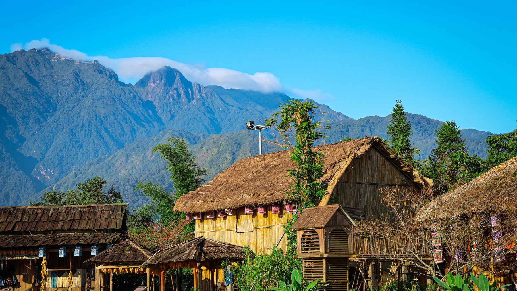
Photo by Haneul Trac on Pexels
Where to Stay
Accommodation near the reserve is basic. In Gia Nghia town, budget guesthouses ("nha nghi") run 200,000–400,000 VND per night. They're clean enough, with air conditioning and hot water. A step up would be the handful of mid-range hotels in town at 500,000–800,000 VND. There's no resort-level accommodation in the immediate area.
If you want comfort, base yourself in Da Lat and make Nam Nung a long day trip or overnight excursion. Da Lat has everything from 150,000 VND hostels to proper hotels.
Practical Tips Locals Would Tell You
- Bring cash. There are ATMs in Gia Nghia but nothing near the reserve. Card payments don't exist out here.
- Hire a local guide. The ranger station can arrange one. Trails are unmarked and the forest is dense enough to get disoriented.
- Carry leech socks if visiting in the shoulder months (April, October). Leeches are a fact of highland forest life.
- Fuel up in Gia Nghia. The next reliable petrol station might be 40+ km away depending on your route.
- Pack layers. Mornings at elevation are cool; midday can be warm and humid under the canopy.
Common Mistakes to Avoid
Don't plan Nam Nung as a quick stop between Da Lat and somewhere else — the roads are slower than they look on a map, and rushing means you'll see nothing but asphalt. Don't skip the guide; this isn't a national park with marked paths and visitor centers. And don't expect phone signal deep in the reserve — download offline maps before you leave town.
Last updated · May 29, 2026 · independently researched, never sponsored.