A Mountain Province at a Crossroads
Yen Bai province, located in Northwest Vietnam (베트남 / 越南 / ベトナム), has long been a meeting point of rivers, mountains, and cultures. Bordered by Lao Cai, Lai Chau, Son La, Phu Tho, Tuyen Quang, and Ha Giang provinces, the region covers approximately 6,900 square kilometers with a population of around 847,000 people. In June 2025, Yen Bai administratively merged with Lao Cai province, though the distinctive geography and communities that define the area remain unchanged.
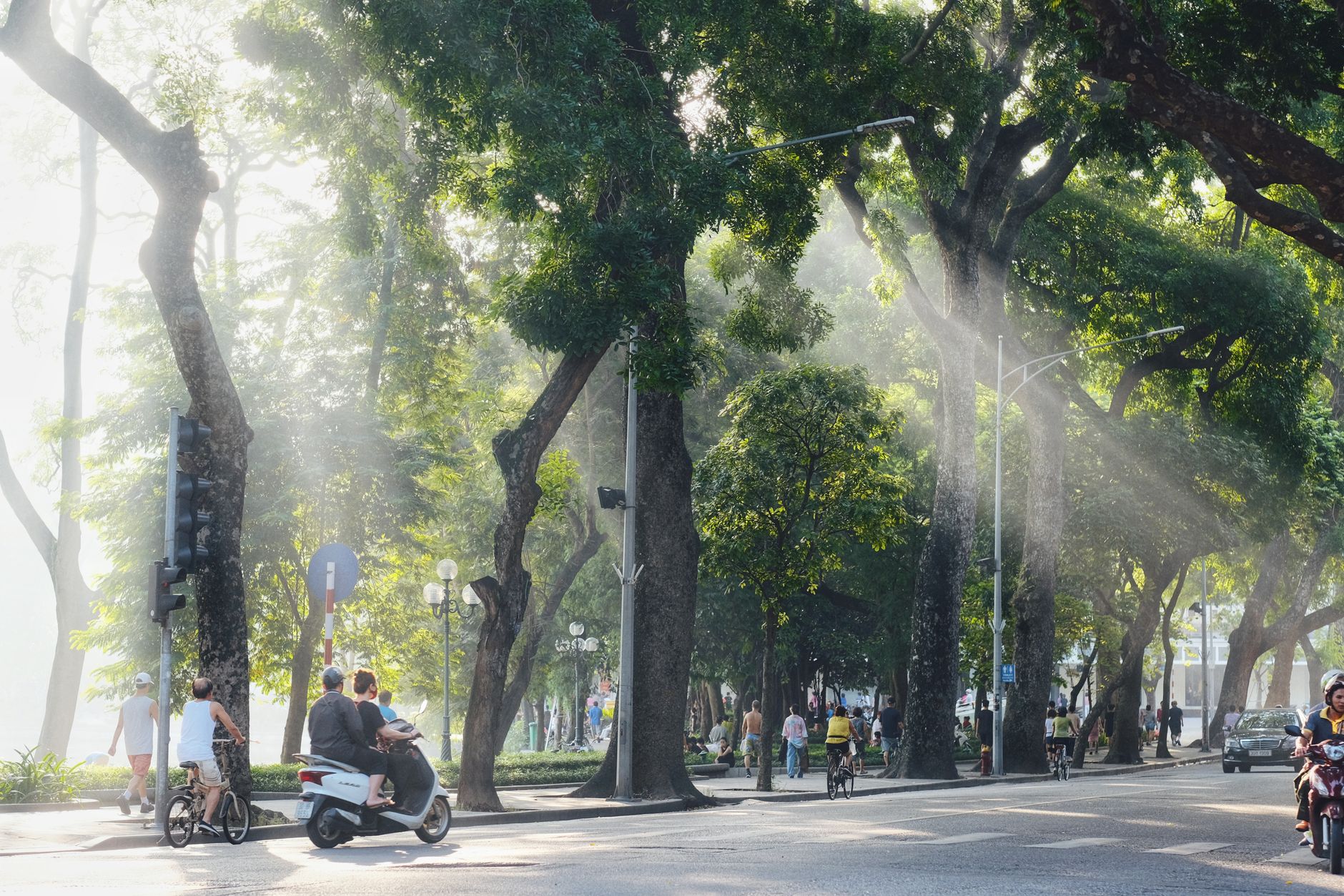
Yen Bai city itself sits along the Red River at roughly 50 meters elevation — low enough to feel sticky in summer, high enough that December nights drop to 12-14°C. Most travelers pass through the city quickly on their way to Mu Cang Chai or Thac Ba Lake, but the compact downtown around Nguyen Thai Hoc Street has a decent morning market and a handful of local "com binh dan" (everyday rice) joints where a plate of rice with grilled pork and pickled vegetables runs 30,000-40,000 VND.
Thac Ba Lake: An Unexpected Oasis
Thac Ba Lake is the province's defining natural feature — an artificial reservoir created for hydroelectric power that has become a landscape unto itself. Spanning 23,400 hectares with 1,331 islands and hills jutting from the water, the lake holds 3 to 3.9 billion cubic meters at capacity. The clear water mirrors surrounding forests, and the islands harbor several caves worth exploring: Hum, Cau Cuoi, and Bach Xa. A temple dedicated to Thac Ba stands on the lake's shore.
The lake transformed the climate of western districts, moderating what were once hot, dry zones into more temperate conditions. For visitors, it offers boat tours, island hikes, and a rare chance to see karst geology in freshwater rather than seawater context.
Practically speaking, boat hire on Thac Ba Lake costs roughly 800,000-1,200,000 VND for a half-day trip (4-5 hours), depending on the size of the boat and how far out you go. Most boats depart from the small pier near Vu Linh commune. Homestays along the lakeshore — many run by Dao families — charge 200,000-350,000 VND per night including dinner and breakfast. The best months for the lake are October through March, when the water level is high and the air is cool. During summer rains (June-August), the water turns muddier and some cave access is restricted.
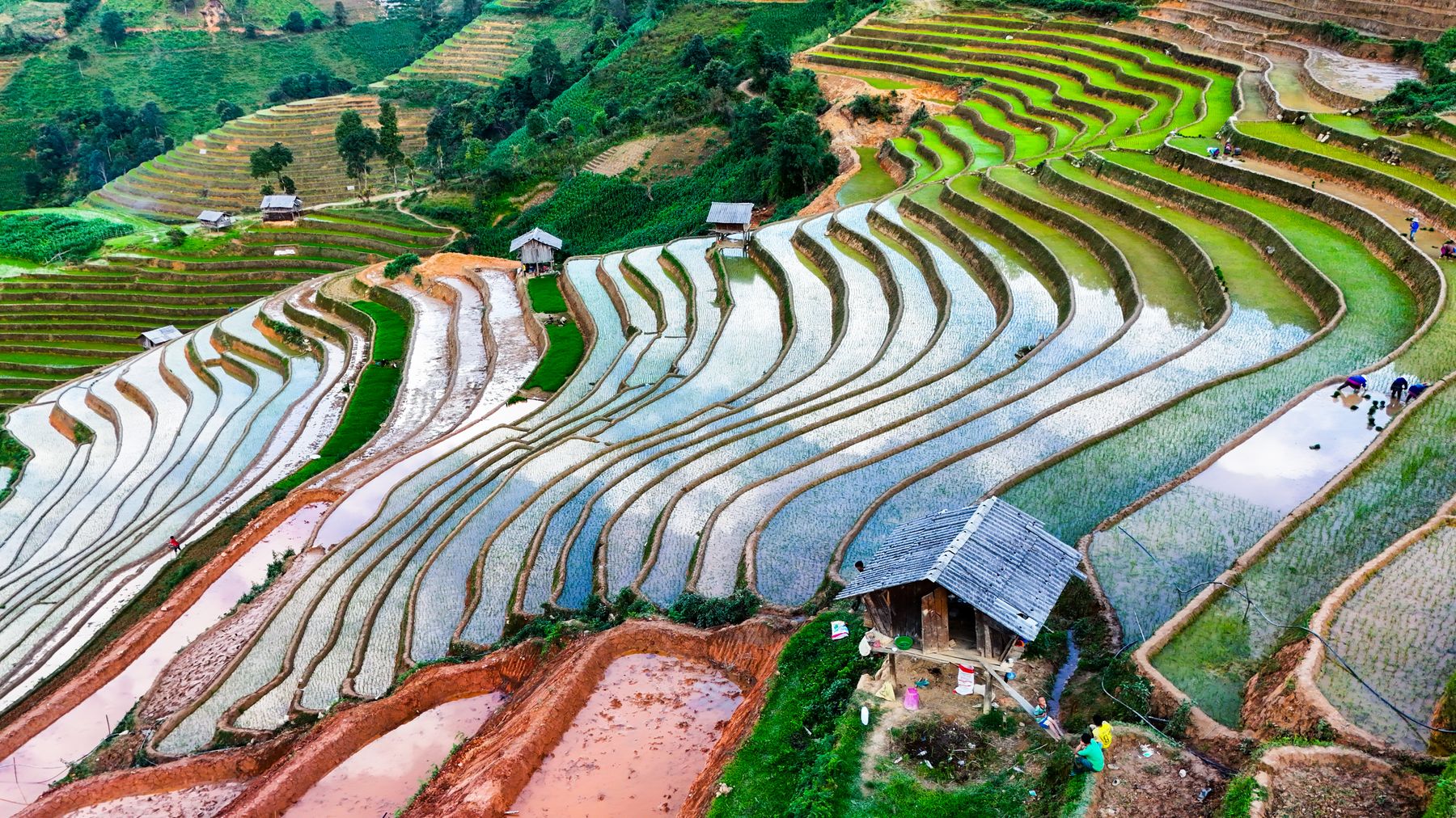
Photo by GIANG VU on Pexels
Terrain and Water Systems
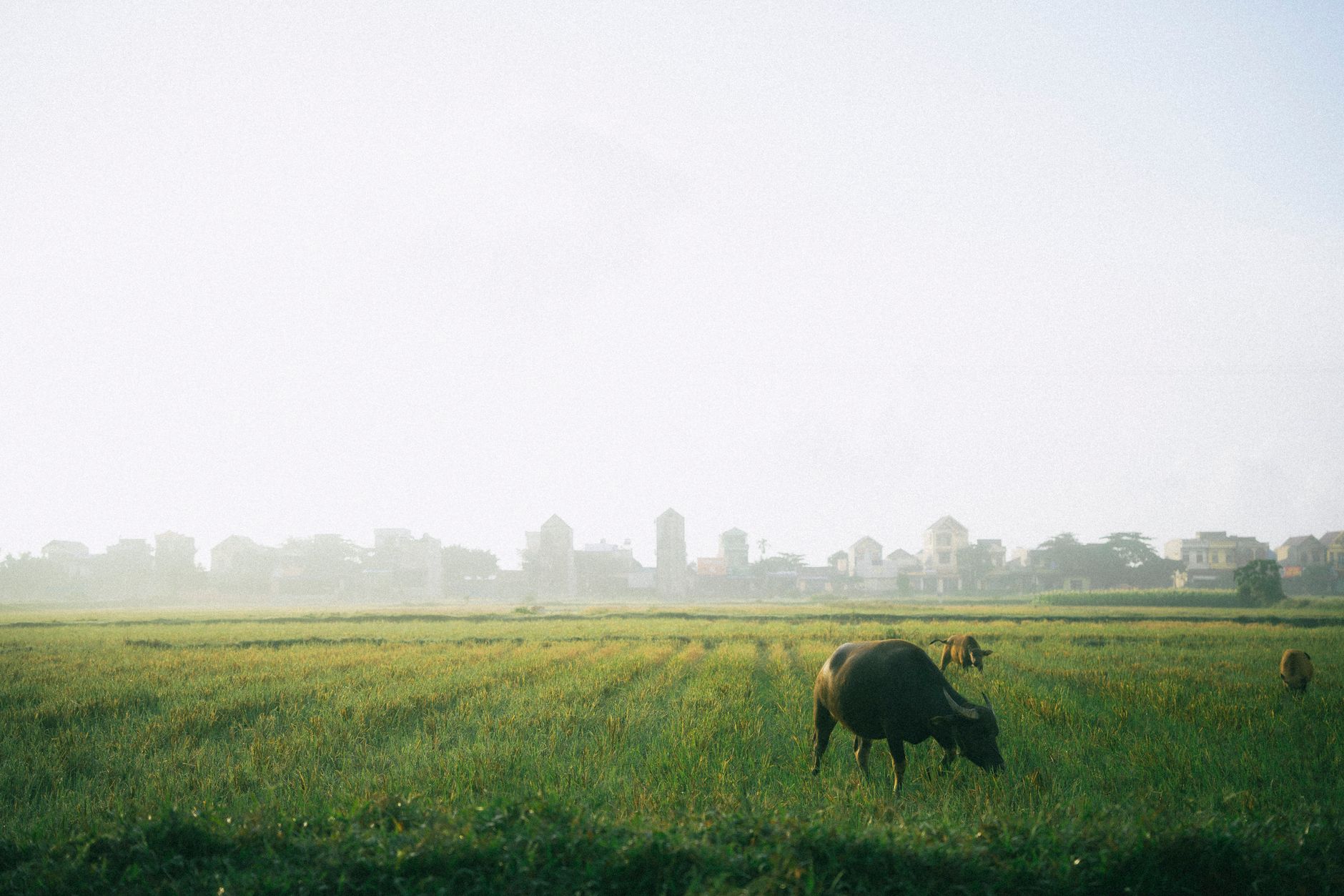
The Red River and Chay River — both originating in Yunnan, China — shape the province's geography and settlement patterns. The Red River valley floor, particularly the Muong Lo plain, contains the best farmland and is known locally as the province's rice bowl. The terrain rises steeply from east to west and south to north, averaging about 600 meters above sea level.
Beyond the two main rivers, Yen Bai has roughly 200 smaller canals, streams, and wetlands. The Hoang Lien Son mountain range cuts through the interior. Khau Pha Pass, on National Highway 32 in Mu Cang Chai District, marks a scenic transition point between low and high terrain. The pass tops out at around 1,200 meters and stretches roughly 30 km with sharp switchbacks — if you are riding a motorbike, count on at least an hour for this section alone. Fog can roll in fast, especially from November through February, so an early morning start (before 7:00 AM) gives you the clearest views.
The province sits at the boundary of three main biomes: rainforest, subtropical, and temperate mountain zones, with a tropical monsoon climate. The Mu Cang Chai Species and Habitat Conservation Area (established 2004, 20,293 hectares) protects endangered species and forest habitat. Entry is informal — there is no ticketed gate — but hiring a local guide from La Pan Tan or Che Cu Nha village (around 300,000-500,000 VND per day) is the practical way to navigate the trails.
Ethnic Communities
Yen Bai is home to the Kinh majority, who have farmed the river valleys for centuries, alongside four main branches of the Dao (Yao) ethnic group:
- Dao Do (Red Yao), also called Dao Dai Ban or Dao Sung
- Dao Quan Chet (Tight-trouser Yao), also known as Dao Nga Hoang
- Dao Quan Trang (White-trouser Yao)
- Dao Lan Tuyen (Indigo Yao)
Each Dao group maintains distinct clothing, agricultural practices, and oral traditions. Villages in higher elevations often feature traditional stilt houses and markets where ethnic dress is still worn daily.
The Hmong and Thai communities are also well-represented, particularly in Mu Cang Chai (predominantly Hmong) and Nghia Lo town area (predominantly Thai). Weekly markets — notably the Mu Cang Chai Friday market and the Nghia Lo Sunday market — are the easiest places to see community life up close. Vendors sell hand-woven textiles, medicinal herbs, and livestock alongside everyday goods like rice, cooking oil, and phone chargers. These are working markets, not tourist performances, so expect no entry fee and very little English. If you want to buy textiles, prices for a hand-embroidered Hmong cloth panel start around 150,000-300,000 VND; a full traditional skirt can run over 1,000,000 VND depending on complexity.
For travelers coming from Sapa, the ethnic diversity here feels similar but less mediated by tourism infrastructure. Homestay hosts are more likely to speak only Vietnamese or their ethnic language, so a few Vietnamese phrases go a long way. "Xin chao" (hello) and "cam on" (thank you) are the minimum.

Photo by HONG SON on Pexels
Historical Context
Archaeological finds — including an 80,000-year-old skeleton from Hum Cave in Luc Yen District (1964) and bronze jars dating back 2,000 years — show human settlement stretching into deep prehistory. Stone tools uncovered in Mu Cang Chai District confirm early occupation.
The Yen Bai region became a military and administrative center during the French colonial period (1859-1954). The Yen Bai mutiny of 1930 remains a noted event in Vietnamese history. Following World War II and the Japanese occupation (1941-1945), the region was contested between French and Vietnamese forces before independence in 1954.
The Dong Cuong Festival continues as an important annual cultural gathering in the province. Held at Dong Cuong Temple in Van Yen District, the festival typically falls in the first lunar month (usually February or early March) and draws pilgrims and visitors from across the northwest. If you happen to be in the region during Tet (뗏 (베트남 설날) / 越南春节 / テト) (Lunar New Year), the festival atmosphere extends for several days and includes traditional music, processions, and communal feasting.
Getting There and Getting Around
Yen Bai city is approximately 140 km northwest of Hanoi. The most common route is Highway 32 (QL32), which takes about 3.5-4 hours by car or bus depending on traffic leaving Hanoi. Buses depart from My Dinh Bus Station in Hanoi and cost 120,000-180,000 VND one way; look for carriers running to Yen Bai city or Nghia Lo.
There is also a railway line connecting Hanoi to Yen Bai city (and onward to Lao Cai). The train is slow — roughly 5-6 hours — but scenic once you pass Viet Tri. Hard-seat tickets cost around 80,000-120,000 VND. The train station in Yen Bai city is central, about 1 km from the main market.
Once in the province, a motorbike is the best way to move between sites. Rentals in Yen Bai city or Nghia Lo cost 150,000-200,000 VND per day for a semi-automatic (Honda Wave or similar). From Yen Bai city to Mu Cang Chai town is about 130 km on QL32 — a full day's ride if you stop at Khau Pha Pass and the terraces along the way. From Mu Cang Chai, you can loop north toward Lao Cai (about 110 km) or continue west to connect with routes toward Da Nang via the Ho Chi Minh Road, though that is a multi-day proposition.
Local "xe om" (motorbike taxi) drivers can be found at any market or bus stop. Agree on a price before riding — short trips within town run 15,000-30,000 VND. Ride-hailing apps have limited coverage outside Yen Bai city.
What to Eat in Yen Bai
Yen Bai is not a major culinary destination in the way that Hue or Saigon are, but the local food reflects the mountains and the ethnic mix. A few things worth seeking out:
-
"Thang co" — a Hmong-origin stew of horse meat, offal, and herbs cooked in a large communal pot. You will find it at weekly markets in Mu Cang Chai. A bowl costs 20,000-30,000 VND. The taste is strong and gamey; approach it with an open mind. It pairs with "ruou ngo" (corn wine), which is poured freely at market stalls.
-
Grilled stream fish — small freshwater fish from mountain streams, grilled over charcoal with salt and lime. Homestays around Thac Ba Lake and in the Mu Cang Chai valley serve this as a standard dinner item.
-
"Xoi ngu sac" — five-color sticky rice, dyed with natural plant extracts (purple from "la cam", yellow from turmeric, red from "gac" fruit, green from pandan). This is a Thai ethnic specialty common around Nghia Lo. A portion costs 10,000-15,000 VND at market stalls.
-
"Com lam" — bamboo-tube rice, cooked by stuffing sticky rice into a fresh bamboo section and roasting it over coals. Sold along roadsides in highland areas for 15,000-25,000 VND per tube.
For familiar Vietnamese staples, every town has "pho" stalls open from early morning (around 5:30-6:00 AM). A bowl of "pho" in Yen Bai city costs 30,000-40,000 VND. "Banh mi" carts appear near bus stations and markets, priced at 15,000-20,000 VND. Vietnamese coffee — "ca phe" — is available everywhere, but do not expect Hanoi-level egg coffee or Saigon-style iced milk coffee. Most cafes serve standard drip "ca phe sua da" (iced coffee with condensed milk) for 15,000-25,000 VND.
Quick Reference: Yen Bai at a Glance
- Location: Northwest Vietnam, 140 km from Hanoi
- Area: ~6,900 sq km
- Population: ~847,000
- Elevation: 50 m (Yen Bai city) to 1,200+ m (Khau Pha Pass area)
- Best months for terraces: Late September to mid-October (harvest gold); May-June (flooded paddies)
- Best months for Thac Ba Lake: October to March
- Getting there: Bus from Hanoi My Dinh (120,000-180,000 VND, 3.5-4 hrs) or train (80,000-120,000 VND, 5-6 hrs)
- Motorbike rental: 150,000-200,000 VND/day
- Homestay cost: 200,000-350,000 VND/night (dinner + breakfast often included)
- Languages: Vietnamese, Hmong, Thai, Dao — very limited English
- ATMs: Available in Yen Bai city and Nghia Lo; none in Mu Cang Chai town (carry cash)
- Mobile signal: Decent on Viettel in towns; patchy between villages
Common Mistakes Foreigners Make
Arriving without cash. ATMs exist in Yen Bai city and Nghia Lo, but Mu Cang Chai has none. Homestays, market vendors, and boat operators deal in cash only. Withdraw enough VND before heading into the highlands — 2,000,000-3,000,000 VND per person per day is a comfortable buffer.
Trying to "do" Mu Cang Chai in a day trip from Hanoi. The drive alone is 6-7 hours each way. You will spend the entire day in a car and see almost nothing. Two nights minimum — one in Mu Cang Chai town or a homestay in La Pan Tan, and one in Nghia Lo or Tu Le on the way back.
Coming at the wrong time for terraces. The golden rice terrace photos you see online are shot in a narrow window: late September to mid-October. Outside this period, the fields are either bare brown stubble (November-April) or green but less dramatic (June-August). The flooded-paddy look in May-June has its own beauty — mirror-like water reflecting the sky — but it is a different scene entirely.
Skipping Nghia Lo. Most travelers fixate on Mu Cang Chai and ignore Nghia Lo, a Thai-majority town in the Muong Lo valley about 80 km west of Yen Bai city. It has hot springs, a lively market, and good homestays. It also makes a natural overnight stop that breaks the long ride.
Underestimating Khau Pha Pass on a motorbike. The pass is not technically difficult if you have ridden in Vietnam before, but it is steep, narrow in places, and frequently foggy. Trucks and buses use the same road. Ride slow, use your horn on blind corners, and do not attempt it after dark.
Why Visit Now
Yen Bai appeals to travelers interested in mountain trekking, ethnic minority culture, and reservoir exploration. Mu Cang Chai's terraced rice fields are particularly striking in autumn and early winter. Thac Ba Lake offers a quieter alternative to the crowded limestone karst of Ha Long Bay. The region's ethnic communities remain accessible and largely off the main tourist circuit, making it suitable for visitors seeking deeper cultural immersion over standard itinerary stops.
Reach Yen Bai from Hanoi (approximately 140 km northwest) by road, or combine it with nearby Lao Cai, Lai Chau, or Son La in a multi-day mountain loop. A practical circuit: Hanoi to Yen Bai city (half day), Yen Bai to Nghia Lo (half day), Nghia Lo to Mu Cang Chai via Khau Pha Pass (full day), Mu Cang Chai north to Lao Cai and Sapa (full day), then train back to Hanoi overnight. Five days, four nights — enough to cover the highlights without rushing. Pair it with a stop in Ninh Binh on the way out of Hanoi, or extend north into Ha Giang if you have more time.
Bottom Line
Yen Bai does not try to sell itself the way more established destinations do, and that is precisely the point. The terraces, the lake, the ethnic markets — they exist on their own terms, not curated for visitors. Come prepared with cash, patience, and a willingness to eat whatever your homestay host puts on the table, and you will find one of northern Vietnam's most rewarding corners.
Last updated · May 29, 2026 · independently researched, never sponsored.