What It Is and Why It Matters
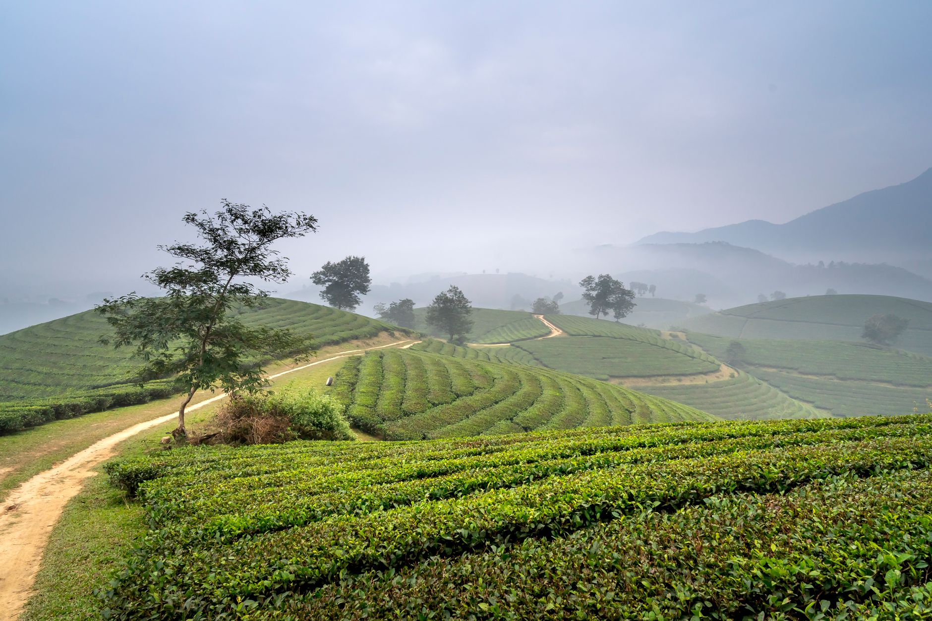
Dak Nong Geopark earned UNESCO Global Geopark status in 2020, making it one of only a handful of such sites in Southeast Asia. Spread across roughly 4,700 square kilometers of the central highlands (중부 고원 / 中部高原 / 中部高原) — now part of the merged Lam Dong province — the geopark sits on a basalt plateau shaped by volcanic activity that dates back millions of years. The landscape is defined by lava tube caves, crater lakes, layered basalt columns, and waterfalls that drop off the plateau's edges into deep jungle valleys.
This isn't a single park with a ticket booth. It's a sprawling territory that includes multiple sites, ethnic minority villages (primarily M'Nong and Ede communities), coffee plantations, and patches of old-growth forest. The town of Gia Nghia serves as the practical base for exploring.
Why Travelers Go
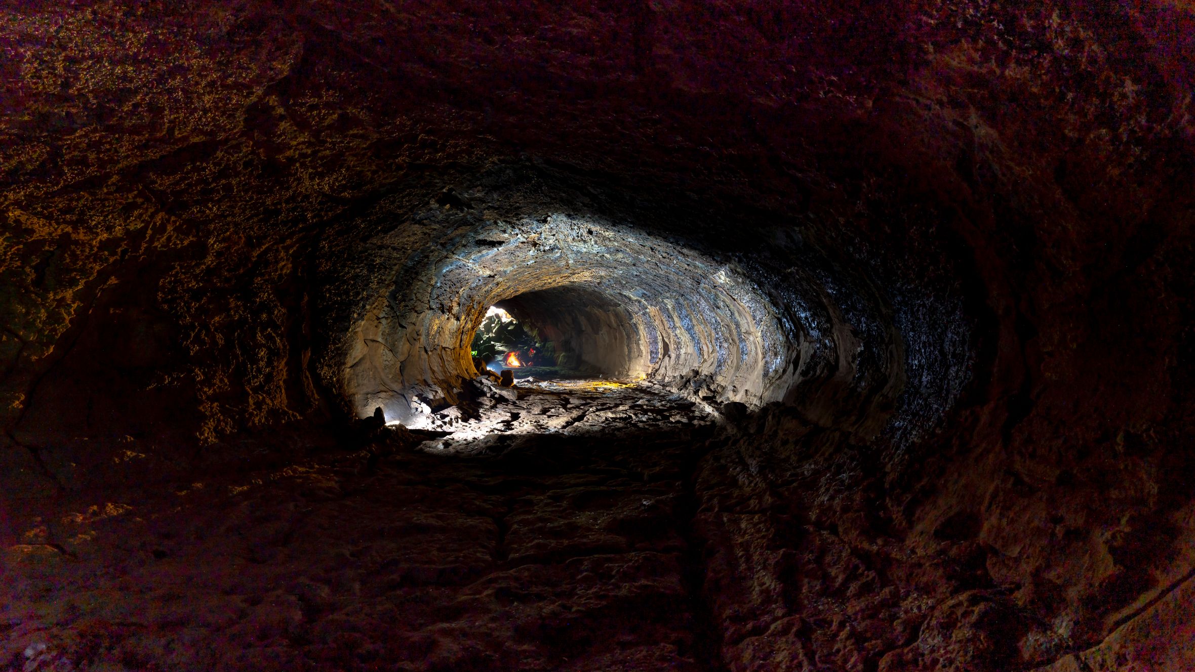
Most visitors come for the caves. The Chu B'Luk volcanic cave system is the longest lava tube network discovered in Southeast Asia — over 25 km mapped so far, with sections open to visitors. Walking through a tube formed by flowing basalt thousands of years ago hits differently than your average limestone cave.
Beyond the geology, the geopark offers a window into highland life that hasn't been reshaped by mass tourism the way Sapa or Da Lat have. The M'Nong communities here still practice "gong culture," a tradition recognized by UNESCO, and the weekly markets in smaller communes sell produce and forest goods you won't find in lowland Vietnam (베트남 / 越南 / ベトナム). If you've already done the well-trodden central highlands loop, Dak Nong is genuinely different ground.
Best Time to Visit
November through March is ideal. The dry season means red-dirt roads are passable, waterfalls are still flowing from the tail end of the rains, and daytime temperatures sit around 22–28°C — comfortable for hiking and cave exploration.
Avoid June through September if you can. Heavy rains turn unpaved roads into mud, and some cave sections close for safety. April and May work as shoulder months: hotter (touching 32°C some afternoons) but generally dry.
How to Get There
The nearest major hub is Da Lat, about 130 km south. From Da Lat, you have two options:
- Bus: Daily buses run from Da Lat's Lien Tinh bus station to Gia Nghia. The ride takes around 3.5–4 hours and costs 120,000–150,000 VND. Buses leave in the morning, usually between 6:00 and 8:00 AM.
- Motorbike: The QL28 route from Da Lat to Gia Nghia is one of the better highland roads — mostly paved, with long stretches through coffee plantations and pepper farms. Budget 3 hours without stops. Fuel up in Da Lat; stations thin out past Di Linh.
From Saigon, overnight sleeper buses to Gia Nghia run from Mien Dong bus station. The trip is about 8 hours and costs 200,000–280,000 VND depending on the operator.
There's no commercial airport in the geopark area. The closest airport is Lien Khuong in Da Lat.
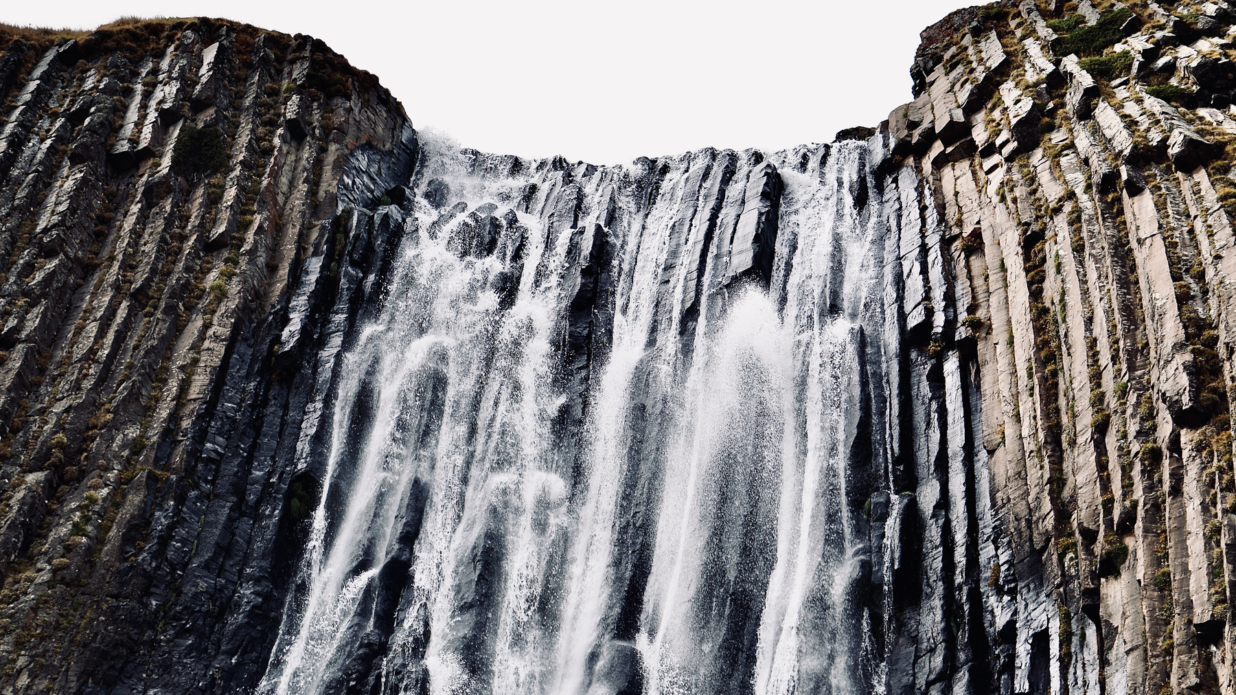
Photo by Anna Romanova on Pexels
What to Do
Explore the Chu B'Luk Lava Caves
The main draw. Several tube sections near Krong No are open to visitors with a local guide (required — don't try to freelance this). The C7 cave is the most accessible, with a relatively easy walk-through that takes about 45 minutes. Longer, more adventurous routes through C3 and C1 require crawling in places and take 2–3 hours. Bring a headlamp, long pants, and shoes with grip. Entry fees run around 50,000 VND plus guide fees of 200,000–400,000 VND per group depending on the route.
Dray Sap and Gia Long Waterfalls
These two waterfalls sit about 30 km south of Gia Nghia and are connected by a forest trail (roughly 3 km one way). Dray Sap drops wide and loud over basalt ledges; Gia Long is narrower but taller. The walk between them passes through secondary forest with good birding. Entry is 30,000 VND per person at each waterfall. Go early — by mid-afternoon, tour groups from Buon Ma Thuot arrive.
Ta Dung Lake
A reservoir formed by damming the Dong Nai River headwaters, Ta Dung sits at around 500 meters elevation and is dotted with small forested islands. Locals run boat trips (300,000–500,000 VND for a small group, 1–2 hours). The water is calm, the surrounding hills are covered in pine and broadleaf forest, and it's genuinely quiet on weekdays. The area around the lake has a few homestays if you want to overnight.
Visit a M'Nong Village
Several communities near Gia Nghia welcome visitors, particularly around Bon Bu Nor and Bon Bu N'Doh. Gong performances can sometimes be arranged through your guesthouse or the geopark visitor center in Gia Nghia. These aren't staged tourist shows — expect something informal, possibly with rice wine involved.
Drive the Plateau Loop
If you have a motorbike, the loop from Gia Nghia north through Dak Mil and east toward Krong No covers coffee country, pepper farms, and volcanic terrain. About 120 km round trip. The road quality is decent. Stop at roadside stalls for "ca phe" — this is robusta heartland, and the coffee is strong, cheap (10,000–15,000 VND a glass), and brewed thick with a phin filter.
Where to Eat
Gia Nghia isn't a food destination, but highland cooking has its own appeal. Look for "com tam" with grilled pork at the rice shops along Tran Hung Dao street — simple, reliable, 35,000–45,000 VND. For something more local, seek out "bo mot nang" (sun-dried beef) served with green banana and fermented fish dipping sauce at com binh dan places near the market. It's chewy, smoky, and pairs well with cold beer.
Vietnamese coffee here is worth paying attention to. You're surrounded by the farms that grow it. Any small cafe in town will serve a solid glass of dark, bitter robusta over ice for under 20,000 VND.
Where to Stay
Gia Nghia has a handful of mini-hotels (nha nghi) in the 200,000–400,000 VND range — clean enough, air-conditioned, hot water. Thanh Binh and Hoang Gia are two reliable options near the town center.
For something with more character, the homestays around Ta Dung Lake run 300,000–600,000 VND per night and usually include dinner. Book ahead on weekends; availability is limited.
There are no international-brand hotels in the geopark area.

Photo by Quang Nguyen Vinh on Pexels
Practical Tips
- Bring cash. Card payments are rare outside Da Lat. ATMs exist in Gia Nghia but can run out of cash on weekends.
- Hire a local guide for the caves. The geopark visitor center on Tran Hung Dao in Gia Nghia can arrange English-speaking guides with a day's notice, though English levels vary.
- Motorbike rental is easier to arrange in Da Lat than in Gia Nghia. If you're riding up, check brakes and tires before leaving — some of the roads have steep descents.
- Phone signal is generally fine in towns but drops in the caves and deeper forest areas.
Mistakes to Avoid
Don't try to see everything in one day. The sites are spread out over a large area, and distances on highland roads take longer than the map suggests. Two full days is a reasonable minimum, three is better.
Don't skip the visitor center. It's not fancy, but the staff can tell you which cave sections and roads are currently accessible — conditions change seasonally.
Don't expect Sapa-level tourist infrastructure. This is a working agricultural region that happens to have extraordinary geology. That's part of what makes it worth the trip.
Practical Notes
Dak Nong Geopark rewards travelers who are comfortable with a bit of roughness — unpaved last-mile roads, limited English, and not much hand-holding. If that sounds like a drawback, Da Lat is two hours south with all the comforts. If it sounds like exactly the point, you'll like it here.
Last updated · May 29, 2026 · independently researched, never sponsored.