Quang Nam is a coastal province in Central Vietnam (베트남 / 越南 / ベトナム), roughly 820 kilometers south of Hanoi via National Highway 1A. It borders Hue to the north, Da Nang to the northeast, Kon Tum inland to the west, and Quang Ngai to the south. The province is split into two main cities: Tam Ky (the capital) and Hoi An, the ancient trading town that draws most visitors.
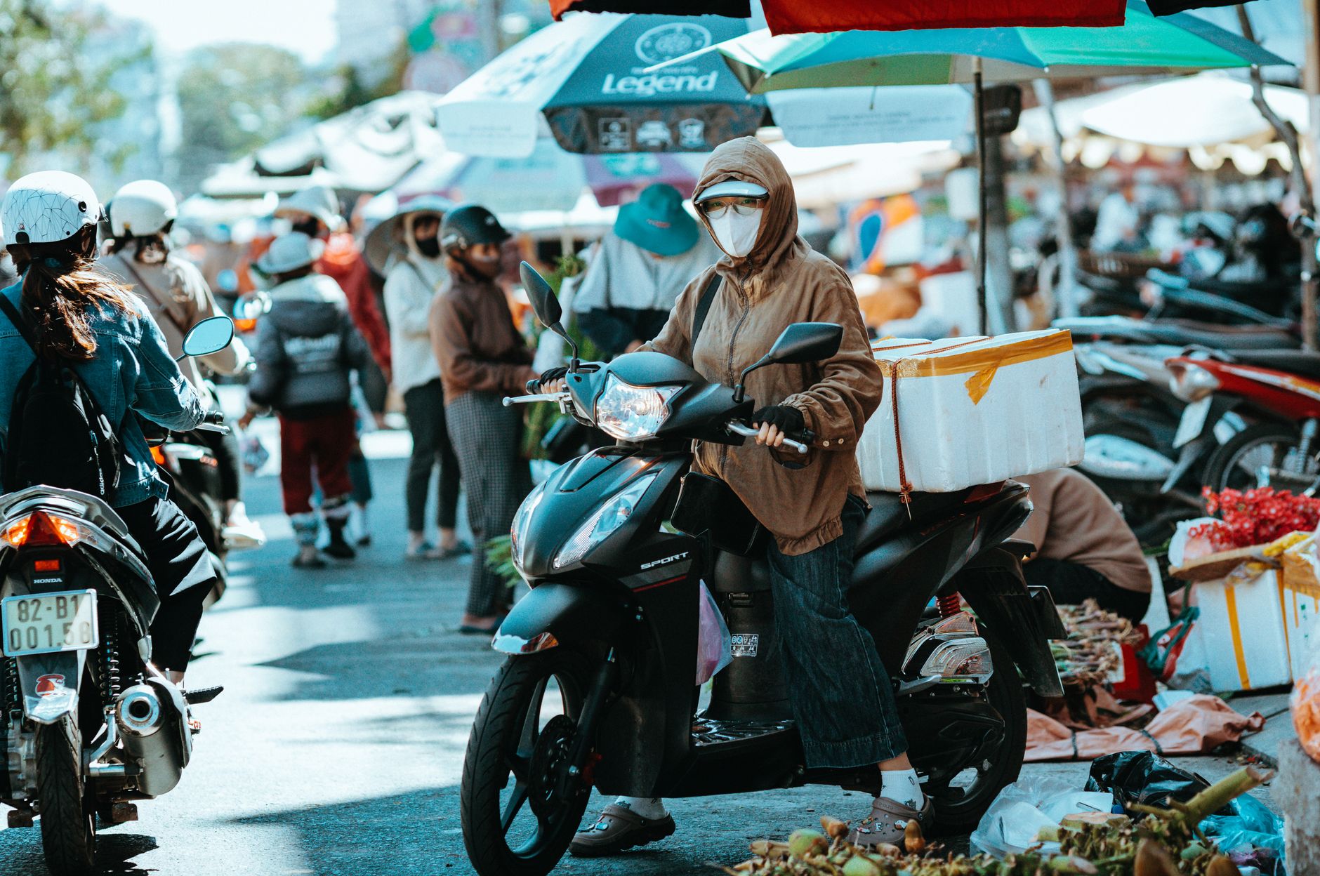
Most travelers fly into Da Nang International Airport and taxi or grab a Grab car south to Hoi An — about 30 km, costing around 250,000–350,000 VND by metered taxi. From there, the rest of Quang Nam opens up by motorbike, local bus, or hired car. But the province is far more than its most famous town, and skipping the inland districts means missing landscapes and food that never make it onto the tourist circuit.
A Kingdom Within a Kingdom
For nearly a thousand years, this stretch of coast was the heart of the Champa kingdom — a maritime power that controlled the trade routes from the Central Highlands (중부 고원 / 中部高原 / 中部高原). When Vietnamese forces expanded southward in the 1400s, Champa's political center shifted further south. But Hoi An remained a crucial port, funneling high-grade silk, fabrics, pepper, porcelain, and elephant tusks through its harbor to Chinese and Japanese merchants.
The Dutch came next, followed by the French. Alexandre de Rhodes, who romanized Vietnamese script in the 1600s, worked in this region. A military alliance between French and Vietnamese royalty was signed here during the Tay Son period, marking the beginning of what would become colonial French Indochina.
Traces of this layered history are everywhere. The Japanese Covered Bridge in Hoi An dates to the late 1500s. Chinese assembly halls — Fujian, Cantonese, Hainan, Chaozhou — line Tran Phu Street, each one built by a different merchant community. And at My Son, about 40 km southwest of Hoi An, the Champa temple towers predate Angkor Wat by centuries. Walking through these sites in sequence gives you a physical timeline of who controlled this coastline and when.
Geography and Landscape
Quang Nam covers 10,574 square kilometers and rises in tiers from the coast inland. The eastern plain hugs the South China Sea; the central midlands sit between; the western mountains account for 72 percent of the province and include Ngoc Linh, the highest peak in the Truong Son range at 2,598 meters.
The climate is tropical monsoon. Temperatures average above 25°C year-round. Rainfall concentrates between October and December (over 70 percent of annual totals). The Vu Gia-Thu Bon river system feeds the coastal plains — the same waterways that once powered the Champa kingdom's agricultural surplus and, later, supported French colonial rice exports.
For travelers, this geography matters practically. The coast from Hoi An south through Tam Ky is flat, warm, and bikeable. The midlands around Tien Phuoc and Nong Son are hilly tea-and-pepper country — cooler, quieter, and empty of tourists. The western highlands near the Laos border are remote enough that you need a local guide and a decent motorbike. If you're coming from Da Lat or Sapa expecting similar highland infrastructure, adjust your expectations down — western Quang Nam is raw.
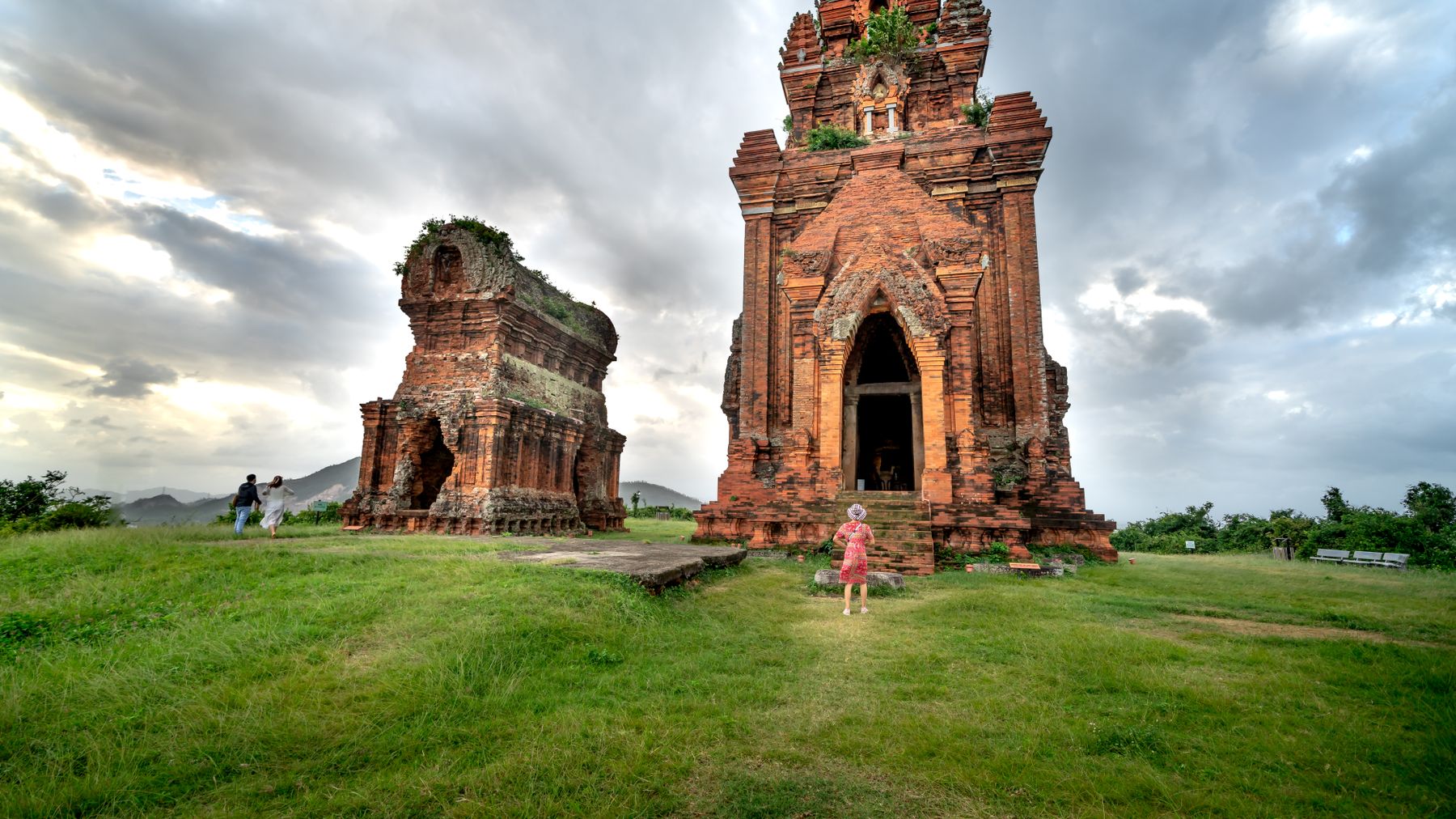
Photo by Quang Nguyen Vinh on Pexels
UNESCO and Modern Tourism
Quang Nam holds more UNESCO World Cultural Heritage designations than any other Vietnamese province: Hoi An Ancient Town and My Son Sanctuary. Both draw serious tourism. Hoi An's narrow lanes preserve Chinese and Japanese merchant-house architecture from the 17th–18th centuries; My Son's brick-and-stone temples show what Champa architectural ambition looked like before warfare and weather eroded them into ruins.
Hoi An charges a 120,000 VND ticket for access to the Old Town heritage sites — this covers entry to five attractions of your choice from a menu of assembly halls, old houses, museums, and the Japanese Bridge. You can walk the Old Town streets without a ticket, but you'll be stopped at the door of any heritage building. The ticket is valid for 24 hours and sold at booths on Bach Dang, Hoang Dieu, and Hai Ba Trung streets.
My Son Sanctuary sits about 40 km southwest of Hoi An. Entry is 150,000 VND. Most visitors arrive by tour bus (around 200,000–350,000 VND per person for a half-day group tour from Hoi An), but you can ride a motorbike there in about an hour through rice fields and small towns. Go early — gates open at 6:00 — to beat the tour buses that arrive around 9:00. A traditional Cham dance performance runs most mornings at the site, usually around 9:30 and 10:30.
The Cham Islands, off the coast, feature a 517-meter peak and are accessible by boat from Hoi An. Speedboats leave from Cua Dai pier (about 4 km from Hoi An center) daily, taking 20–25 minutes, with tickets running around 300,000–400,000 VND round trip. The islands are best visited between March and September when seas are calm. Snorkeling gear rents for about 50,000–100,000 VND on the island.

Photo by Quang Nguyen Vinh on Pexels
What to Eat in Quang Nam
Quang Nam's food is distinct from both Hue cuisine to the north and Saigon street food to the south. The flavors lean savory and herbaceous, with less sugar than southern cooking and less chili heat than Hue.
"Cao lau" is the dish most associated with Hoi An — thick, chewy rice noodles topped with sliced pork, herbs, crouton-like fried dough, and a small amount of broth. The noodles are traditionally made with water from a specific well (Ba Le Well on Phan Chu Trinh Street) and lye from Cham Island ash, which gives them their distinctive chew. A bowl costs 30,000–50,000 VND at most local spots. Try it at Cao Lau Thanh on Thai Phien Street or the stalls inside the Central Market.
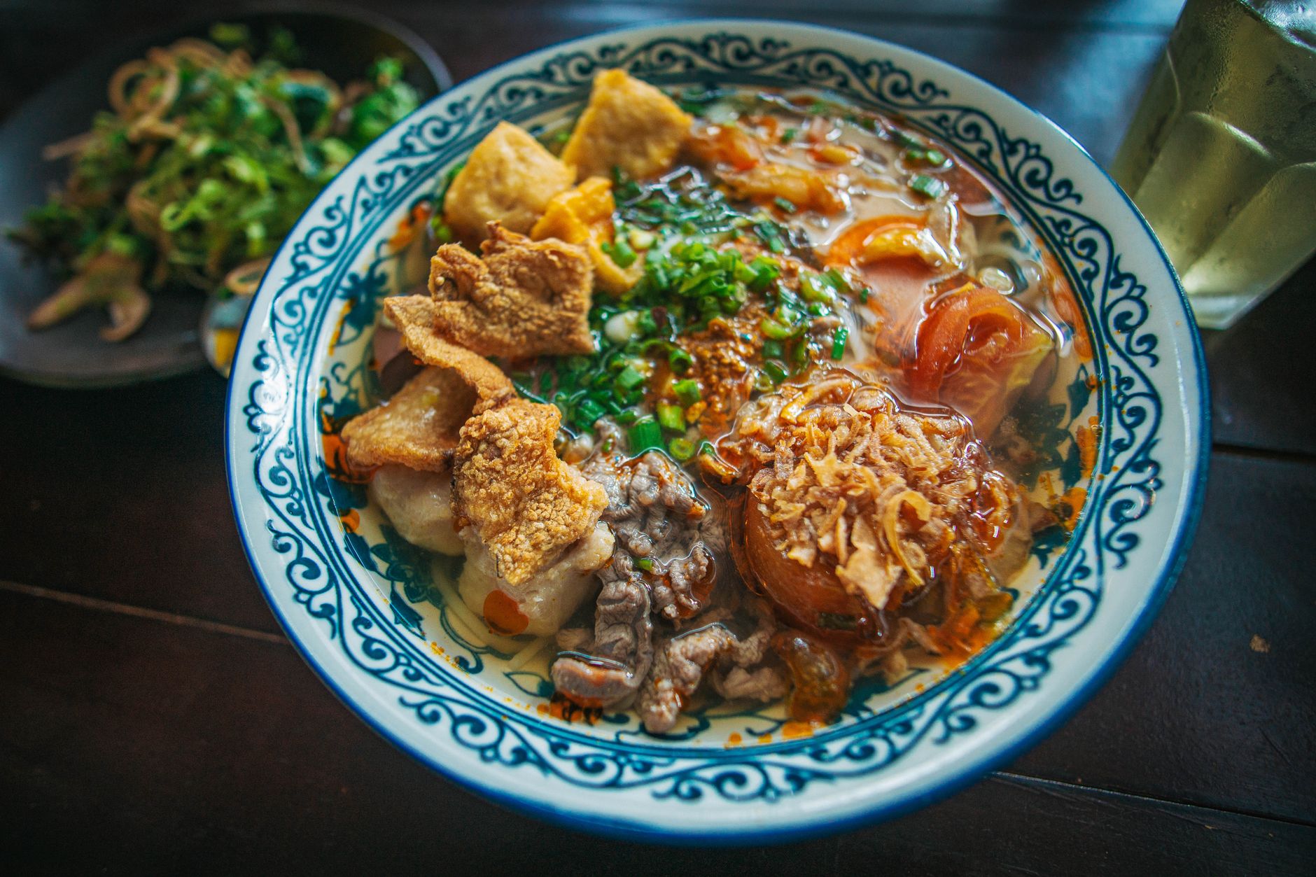
"Mi quang" is the province's other signature noodle — wide, yellow turmeric-tinted rice noodles served with a small amount of rich broth, shrimp, pork, quail egg, peanuts, sesame rice crackers, and a fistful of herbs. It's drier than "pho" and more textured. A solid bowl runs 25,000–40,000 VND. Mi Quang Ong Hai on Le Dinh Duong Street in Da Nang is famous, but the versions served at small roadside shops between Hoi An and Tam Ky — where the dish originates — tend to be more pared-back and honest.
"Banh mi" in Hoi An is a destination in itself. Banh Mi Phuong on Phan Chau Trinh gained international fame after Anthony Bourdain featured it, but the line is long and the experience has become a bit performative. Madam Khanh ("The Banh Mi Queen") on Tran Cao Van Street is equally good with a shorter wait. Expect to pay 20,000–30,000 VND per sandwich.
Other dishes worth tracking down: "com ga" (chicken rice with turmeric, shredded chicken, and a side of shredded papaya — Ba Buoi on Thai Phien Street is the classic address), "banh xeo" (crispy turmeric crepes, smaller and crispier in Central Vietnam than the Saigon version, around 10,000–15,000 VND per piece), and "che bap" (sweet corn dessert, sold from carts in Hoi An's evening market for about 10,000 VND).
Administrative History
In 1997, Quang Nam was separated from the larger Quang Nam-Da Nang administrative unit when Da Nang became its own city. Before that, the province had been divided in 1962 (with the southern half becoming Quang Tinh province) and reunited in 1976 after national unification. The name "Quang Nam" itself — "quang" meaning to expand, "nam" meaning south — was established by King Le Thanh Tong in 1471 as a declaration of Vietnamese expansion into Champa territory.
Common Mistakes and What Surprises Foreigners
Thinking Hoi An equals Quang Nam. Hoi An Ancient Town is about 4 square kilometers. Quang Nam province is over 10,500 square kilometers. Most visitors never leave the Old Town grid, missing the coastline south toward Tam Ky, the tea villages in the midlands, and the Phouc Son highland district.
Visiting My Son at midday. The site has almost no shade. Temperatures regularly hit 38°C in the ruins between 11:00 and 14:00 from April to August. Arrive when gates open at 6:00 or go after 14:30.
Ordering "cao lau" outside Quang Nam and expecting the same thing. Restaurants in Ho Chi Minh City and Hanoi serve versions, but the noodle texture depends on specific water and ash — the Hoi An originals taste noticeably different.
Assuming October–December is fine for beaches. That's peak monsoon season. The coast gets hammered with rain, Hoi An's Old Town floods periodically (sometimes knee-deep on certain streets), and the Cham Islands become inaccessible by boat. For beach time, aim for March to August.
Skipping the Tra Que vegetable village. It's only 3 km north of Hoi An center. Farmers here have been growing herbs and vegetables using the same methods for centuries — the herbs in your "cao lau" and "mi quang" likely came from this village. Cooking classes here run around 500,000–700,000 VND and are more genuine than the ones marketed heavily in the Old Town.
Not carrying cash. Card acceptance in Hoi An's tourist core is decent, but step outside the Old Town — into the Central Market, roadside "mi quang" shops, or anywhere in Tam Ky — and it's cash-only. ATMs are plentiful along Tran Hung Dao and Hai Ba Trung streets in Hoi An.
Quick Reference
- Getting there: Fly into Da Nang (DAD), then 30 km south to Hoi An by taxi (~300,000 VND) or Grab. Tam Ky is 55 km south of Hoi An via Highway 1A.
- Best months: February through August (dry season, calm seas, Cham Islands accessible).
- Worst months: October through December (heavy rain, flooding risk in Hoi An, rough seas).
- Hoi An Old Town ticket: 120,000 VND, valid 24 hours, covers 5 heritage sites.
- My Son entry: 150,000 VND. Gates open 6:00. Go early.
- Cham Islands boat: 300,000–400,000 VND round trip from Cua Dai pier, March–September only.
- Key dishes: "cao lau" (30,000–50,000 VND), "mi quang" (25,000–40,000 VND), "banh mi" (20,000–30,000 VND), "com ga" (30,000–45,000 VND).
- Currency: Vietnamese Dong (VND). Carry cash outside the Old Town.
- Language tip: "Cho toi mot to cao lau" = "Give me one bowl of cao lau." Smile. Point at what others are eating. It works.
- Motorbike rental: 100,000–150,000 VND per day in Hoi An. Automatic scooters are standard.
- Sim card: Buy at the airport in Da Nang. Viettel or Mobifone, about 100,000 VND for a tourist SIM with data.
Why It Matters for Visitors
Quang Nam is the geographic and historical bridge between Hanoi and Ho Chi Minh City. It's where the trade networks of Asia once converged, where empires collided, and where two UNESCO sites sit within striking distance of each other. The terrain — flat coast giving way to serious mountains — makes it a natural base for mixing beach time, ancient-town exploration, and highland trekking. The provincial capital, Tam Ky, rarely appears in guidebooks; Hoi An steals all the attention. But the province's 2,200-year arc from Sa Huynh culture to Champa kingdom to French colonial outpost to modern beach destination is Vietnam's broader story compressed into one stretch of coast.
Bottom Line
Quang Nam rewards the traveler who looks past Hoi An's lantern-lit streets — though those streets are worth your time too. Give the province at least three full days: one for the Old Town and its food, one for My Son at dawn, and one for the coast or the Cham Islands. If you have a week, push south toward Tam Ky or west into the highlands, where the tourist infrastructure thins out and the landscape gets serious. This is Central Vietnam at its most layered — literally built on the foundations of a kingdom most visitors have never heard of.
Last updated · May 29, 2026 · independently researched, never sponsored.