Tuyen Quang Province: Mountains, Rivers, and Ethnic Heritage
Tuyen Quang sits in the northeastern highlands, about 165 kilometers from Hanoi. It's the kind of place travelers overlook—which is exactly why you should go. Mountains dominate the landscape. Rivers shape the culture and economy. Ethnic minorities (Tay, Nung, Dao, and others) have lived here for centuries and still do.
The province spans 5,867 square kilometers with a population around 785,000. Its capital is Tuyen Quang township, nestled in the Lo River valley. Elevations range from 200 meters in the south to over 1,400 meters in the north. The highest point is Cham Chu peak at 1,589 meters—a serious hike but doable if you're fit.
Geography and Peaks
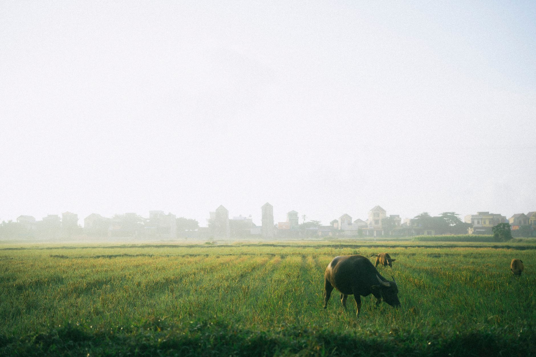
The province's shape is defined by water and altitude. The southern zones are gentler—river basins and foothills under 300 meters, suited to rice and cultivation. The north is steep, forested, and wild. About 7.2% is natural forest, a mix of rainforest and monsoon forest.
Cham Chu mountain is the prize. Most travelers don't know it exists. The climb takes a full day, but the views down the valley are worth the effort. The Tam Dao range also extends into the province from the south.
Tuyen Quang borders four Vietnamese provinces—Cao Bang (northeast), Thai Nguyen (east), Phu Tho (south), and Lao Cai (west)—and shares a border with Yunnan Province, China, to the north.
Rivers: The Lifeline
Three major rivers define Tuyen Quang: the Lo, Gam, and Pho Day. All three are navigable in parts, and all three were (and still are) highways for transporting goods before roads came.
The Lo River is the big one. It flows 145 kilometers through the province, starting in Yunnan and draining a basin of 2,090 square kilometers. It's clean, cold, and a pleasure to float on or fish in. Water flow varies wildly—from a minimum of 128 cubic meters per second in the dry season to a max of 11,700 during monsoon floods.
The Gam River runs 170 kilometers through Tuyen Quang after flowing through Cao Bang and Ha Giang. It joins the Lo at Tu Hiep.
The Pho (쌀국수 / 越南河粉 / フォー) Day is smaller, rising in the Tam Dao Mountains and flowing 84 kilometers before leaving the province.
In total, Tuyen Quang has an estimated 2,000 ponds and a combined surface water volume of roughly 10 billion cubic meters. Underground water is abundant—about 3.5 million cubic meters per day. The province also has three mineral water springs: two hot, one cold.

Photo by Quang Nguyen Vinh on Pexels
Climate: Wet and Cool
Expect a tropical monsoon climate with a strong seasonal rhythm. The dry season (October to April) is cooler and clearer. The wet season (May to September) is hot and soaking. Average annual rainfall is 1,500 millimeters, concentrated in about 150 rainy days. The monsoon accounts for 94% of that rain.
Thunderstorms are common April through August. In the north, mist lingers 60 to 80 days during early winter. Hoarfrost (rare but beautiful) touches the ground once every two years, usually in January or November.
Annual average temperature is 22.4°C—cool for Vietnam's lowlands, warm for the highlands.
People and Culture
The province is home to around 900 villages in upland areas, most inhabited by ethnic minorities: Tay, Nung, Dao, and smaller groups. They've adapted to steep terrain, shifting cultivation (swidden farming), and rice terracing. Traditional crafts and festivals remain part of daily life.
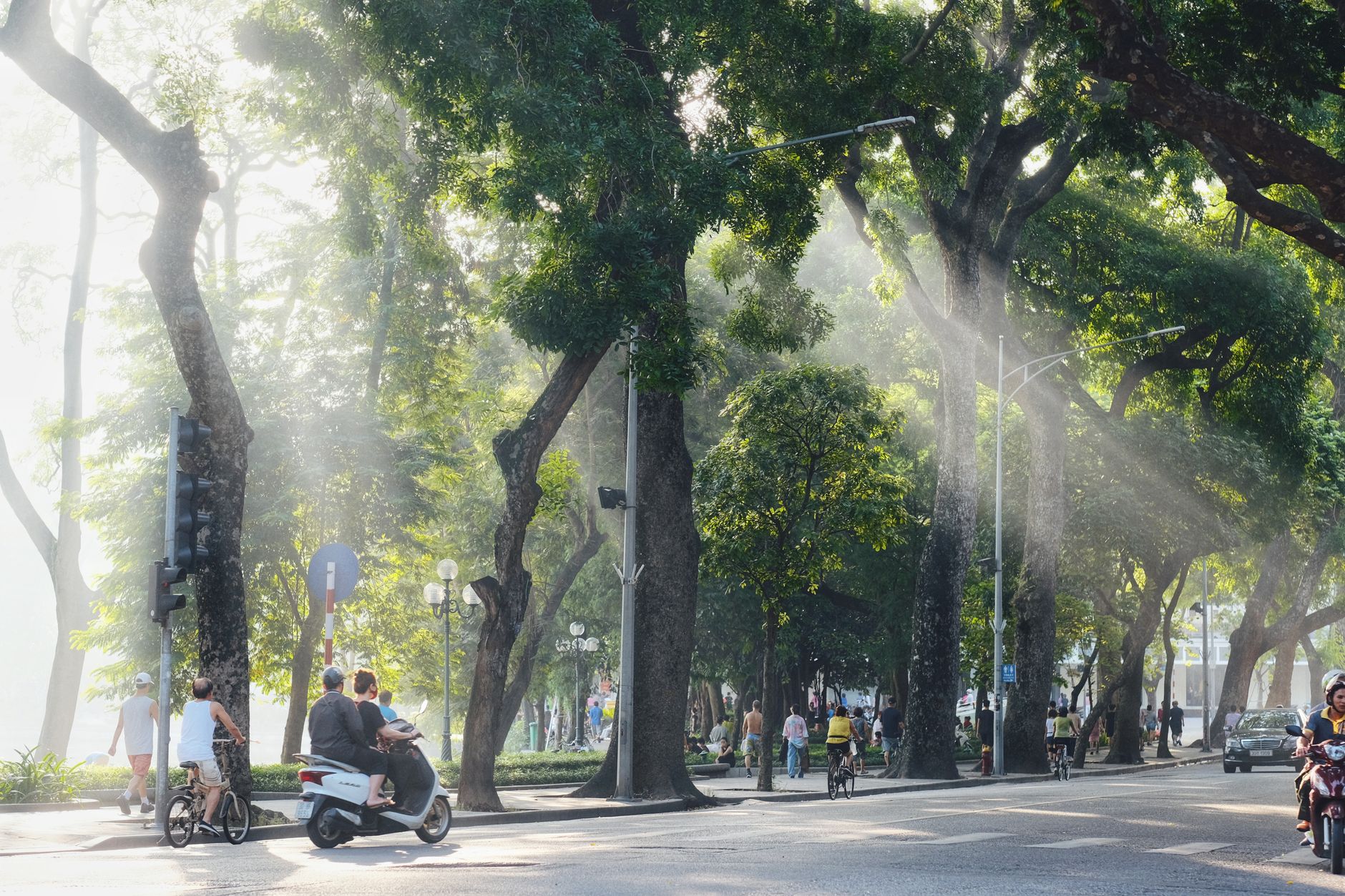
Tourism infrastructure is sparse—this is not a polished destination. But that's the appeal. You'll find authentic homestays, local guides who know the mountains, and women selling fresh herbs at the market. Communication is easier in Tuyen Quang town; in villages, bring a phrasebook.

Photo by Quang Nguyen Vinh on Pexels
Getting There and Around
Tuyen Quang township sits 165 kilometers north of Hanoi (하노이 / 河内 / ハノイ) via National Highway No. 2. The drive takes 3 to 4 hours by car. Buses run several times daily from Hanoi's central stations (Giap Bat, Nuoc Ngam)—tickets cost 60,000 to 80,000 VND.
Within the province, motorbike rental is standard (100,000 to 150,000 VND per day). Roads are improving but can be rough in upland districts. A local guide is worth the investment if you're hiking Cham Chu or exploring minority villages.
Water transport via the Lo River is possible for organized tours, though this is emerging infrastructure, not mainstream yet.
What to Do
Hiking is the main draw. Cham Chu peak, multi-day treks into Ha Giang or Cao Bang, and day walks through tea and cassava fields. The Lo River offers fishing, kayaking, and riverside camping if you arrange it in advance.
For food, Tuyen Quang's street markets sell fresh produce, herbal medicines, and local specialties like com tam (broken-rice dishes) prepared with vegetables and herbs from the uplands. Coffee from higher elevations is growing in quality. Eat at small stalls near the central market; avoid chain restaurants.
Visit during March–April (spring, warm, flowers blooming) or September–October (cool, clear skies after monsoon). Avoid May through August (oppressively hot and wet) and December through February (misty and cold).
Tuyen Quang is not flashy. There are no five-star resorts, no Instagram waterfalls with crowds. What you get is silence, steep mountains, rivers, and the sense that you've traveled somewhere that hasn't been packaged for tourists yet. If that appeals, go.
Frequently Asked Questions
How far is Tuyen Quang from Hanoi and how do I get there?
Tuyen Quang sits about 165 kilometers from Hanoi in the northeastern highlands. The drive takes you into the Lo River valley, where the provincial capital is located. Road access is the primary option for most travelers. The journey passes through foothills before climbing into terrain that ranges from 200 meters elevation in the south to over 1,400 meters in the north.
What ethnic groups and cultural experiences can I expect in Tuyen Quang?
Tuyen Quang is home to Tay, Nung, Dao, and other ethnic minority groups spread across roughly 900 upland villages. These communities have maintained traditional crafts, festivals, and farming practices including rice terracing and swidden cultivation. Tourism infrastructure is sparse, which means interactions tend to be authentic. Homestays are available. This is not a polished destination, and that is precisely the draw for travelers seeking something outside the standard circuit.
When is the best time to visit Tuyen Quang to avoid heavy rain?
The dry season runs October through April, bringing cooler temperatures and clearer skies — the more reliable window for hiking and village visits. The wet season (May to September) delivers intense monsoon rain, with 94% of the annual 1,500 millimeters falling then across roughly 150 rainy days. Thunderstorms are common April through August. January and November occasionally bring hoarfrost at higher elevations, occurring roughly once every two years.
Last updated · May 29, 2026 · independently researched, never sponsored.