Quang Ngai province occupies a slim wedge of Vietnam (베트남 / 越南 / ベトナム)'s South Central Coast, squeezed between the sea and the western mountains. It's less touristy than Quang Nam or Binh Dinh to the north and south, which makes it quieter—and more genuine as a glimpse of central Vietnamese life outside the postcard towns.
The province sits 130 km south of Da Nang, 820 km north of Ho Chi Minh City, and 908 km south of Hanoi, all reachable via National Route 1. The provincial capital, Quang Ngai City, is concentrated with about 40% of the province's population; the rest scatter across coastal lowlands and five sparsely peopled western districts where Hre and other highland ethnic groups live.
Geography: Coast and Highlands
Quang Ngai's landscape divides cleanly. The coastal and central plains hug the 129-km shoreline and the Tra Khuc River delta. The western third rises into mountains capped at 1,630 meters near the Quang Nam border. The coastline straightens in the south; the north develops distinct capes. Population density mirrors this split: the coast and Quang Ngai City exceed 400 people per km²; the five western districts drop below 100, with three dipping under 50. The province is the least urbanized in the South Central Coast—only 14.4% of residents live in towns.
For context, drive 20 minutes west from Quang Ngai City and the landscape shifts from flat rice paddies and shrimp ponds to rolling foothills threaded with streams. Keep going another hour toward Son Ha or Ba To districts and you're in genuine highland territory—sparse villages, dense canopy, and roads that thin to a single lane in places. It's a compressed altitude gradient that few provinces on this coast can match.
Historical Layers
The area has been inhabited for millennia. The "Sa Huynh" culture left archaeological remains in Duc Pho District; the Cham kingdom ruled here before 1471, when Dai Viet forces defeated Champa in the Champa-Dai Viet War and absorbed the region. By the 19th century, the Long Wall of Quang Ngai had been built to secure the frontier between Vietnamese lowlands and Hre uplands—a practical boundary that also enabled trade. Parts of the wall's foundations can still be traced in Son Ha and Minh Long districts, though you'll need a local guide and decent boots.
The "Thien An Mountain Pagoda," constructed in 1695, sits on a mountainside roughly 3 km southwest of Quang Ngai City center as a working monastery and cultural landmark. The compound includes a lake, pine groves, and an elevated view of the Tra Khuc River valley—locals come here on weekends and holidays, so weekday mornings are the quieter window. Entry is free; modest dress is expected. In the lead-up to 1945's August Revolution, Quang Ngai was one of the first central provinces to organize self-defense units; the Ba To Guerrilla Unit mobilized peasants across the region.
After reunification, the province was designated as a hub for industrial development. The Dung Quat Refinery—Vietnam's first oil refinery—began production in February 2009 and remains the economic engine.
History-minded travelers passing between Hue and Hoi An sometimes extend south to Quang Ngai specifically for these layers—Sa Huynh-era sites, Cham remnants, and 19th-century frontier architecture don't get the same crowds as the Imperial Citadel or the Temple of Literature up north.
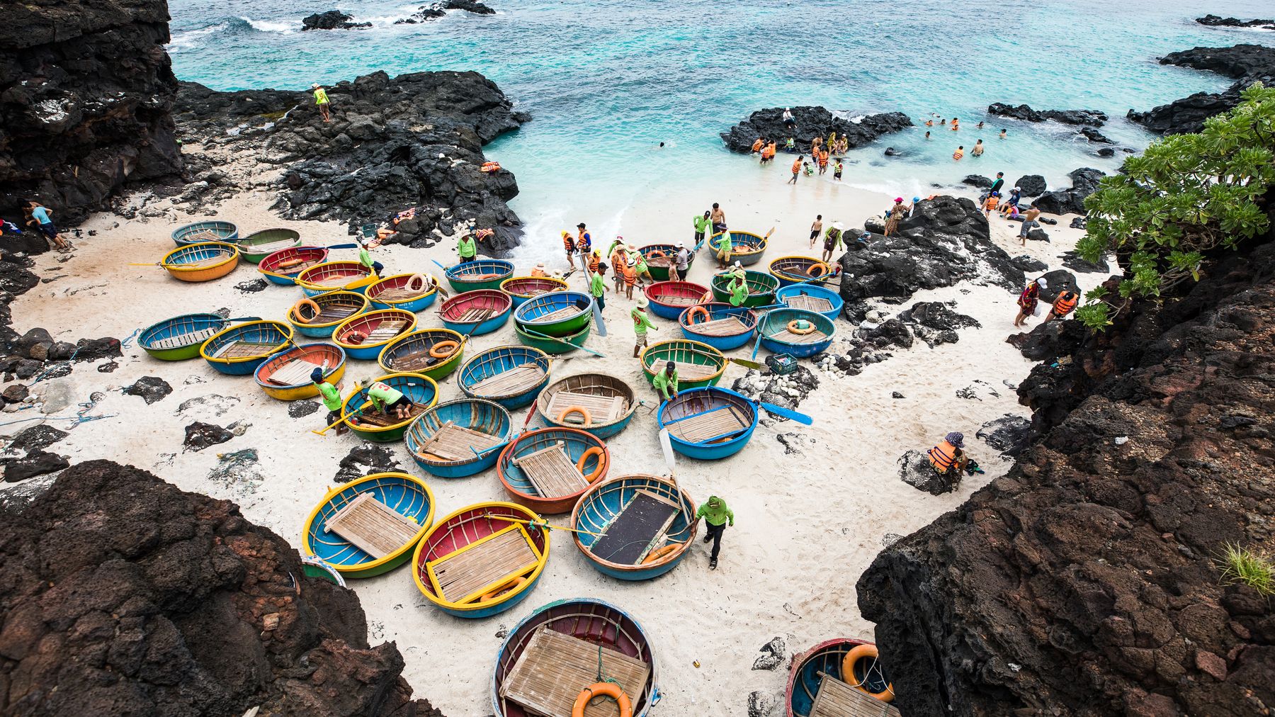
Photo by Son Tung Tran on Pexels
People and Culture
The ethnic composition is largely "Kinh" (ethnic Vietnamese) in the coastal lowlands, over 99%. The southwest is Hre territory; the Xo Dang live in mountain districts like Son Ha; Chams cluster along the southern coast; the Co majority the inland Tra Bong area. This ethnic mosaic is part of why Quang Ngai feels less homogeneous than many coastal provinces.
If you spend time in the highland districts, you'll notice distinct textile patterns and house construction styles that differ village to village. Weekly markets in Ba To (Saturday mornings) draw Hre sellers bringing forest honey, dried medicinal herbs, and hand-woven cloth. Prices are low—a jar of wild honey runs about 150,000-200,000 VND—and the atmosphere is purely local.

Photo by Fu Shan Un on Pexels
Economy: From Agriculture to Industry
Rice is the agricultural staple—381,200 tonnes harvested in 2007—with sugar-cane, peanuts, and coconuts as secondary crops. Cattle herds number around 288,000, mostly in the northwest and southwest.
Fishing is substantial. Ly Son island offshore is a major fishing center, accounting for almost a quarter of the province's 126,000 tonnes of fish caught in 2012. Ly Son is worth a visit if you want to see a working fishing community without the tourist overlay.
Industry has exploded since 2009. The Dung Quat Economic Zone operates with a separate visa regime for foreign workers and has attracted significant Japanese investment. Industrial output grew 144.7% in 2009 alone. Beer, textiles, bricks, fertilizer, and furniture are produced here. Vinatex, the state textile conglomerate, has expanded into the province. By 2009, industry accounted for 46.3% of GDP—higher than Da Nang.
This industrial growth matters for travelers: it explains why Quang Ngai City feels busier and more developed than you might expect for a "less developed" province. Roads are decent. Facilities exist. It's not a backpacker backwater.
Ly Son Island: Getting There and What to Expect
Ly Son sits about 25 km offshore from Sa Ky port, which is itself roughly 20 km northeast of Quang Ngai City. Speedboats depart Sa Ky daily, usually between 7:00 and 8:00 in the morning, with return trips around 14:00-15:00. The crossing takes about 30 minutes by speedboat. Tickets run 160,000-200,000 VND one way; buy them the day before during peak season (April through August) because boats sell out.
The island is small—about 10 km² for the main island (Ly Son Lon) and a sliver of a secondary island (Ly Son Nho, or Be Island) reachable by a short boat ride. You can motorbike around Ly Son Lon in under an hour. Rental bikes are available near the port for about 100,000-150,000 VND per day.
Ly Son is famous for two things: garlic and fish. The island's garlic, grown in volcanic soil and harvested around March, has a sweetness and pungency that Vietnamese cooks specifically seek out. You'll see garlic fields everywhere from December through early spring—flat sandy plots layered with white coral sand on top of red volcanic earth. Outside garlic season, fishing dominates.
For food on the island, look for "goi toi" (garlic salad—raw garlic shoots mixed with seafood), grilled cuttlefish, and "canh rong bien" (seaweed soup). A seafood meal at a local spot near the port runs 100,000-200,000 VND per person. Don't expect polish—most places are family-run, plastic-chair-and-table setups. That's the point.
Ly Son also has volcanic rock formations on its eastern coast and the Thoi Loi peak (about 170 meters) with a crater lake at the top—a 15-minute climb from the parking area. The views take in the full shoreline and, on clear days, the mainland.
What to Eat in Quang Ngai
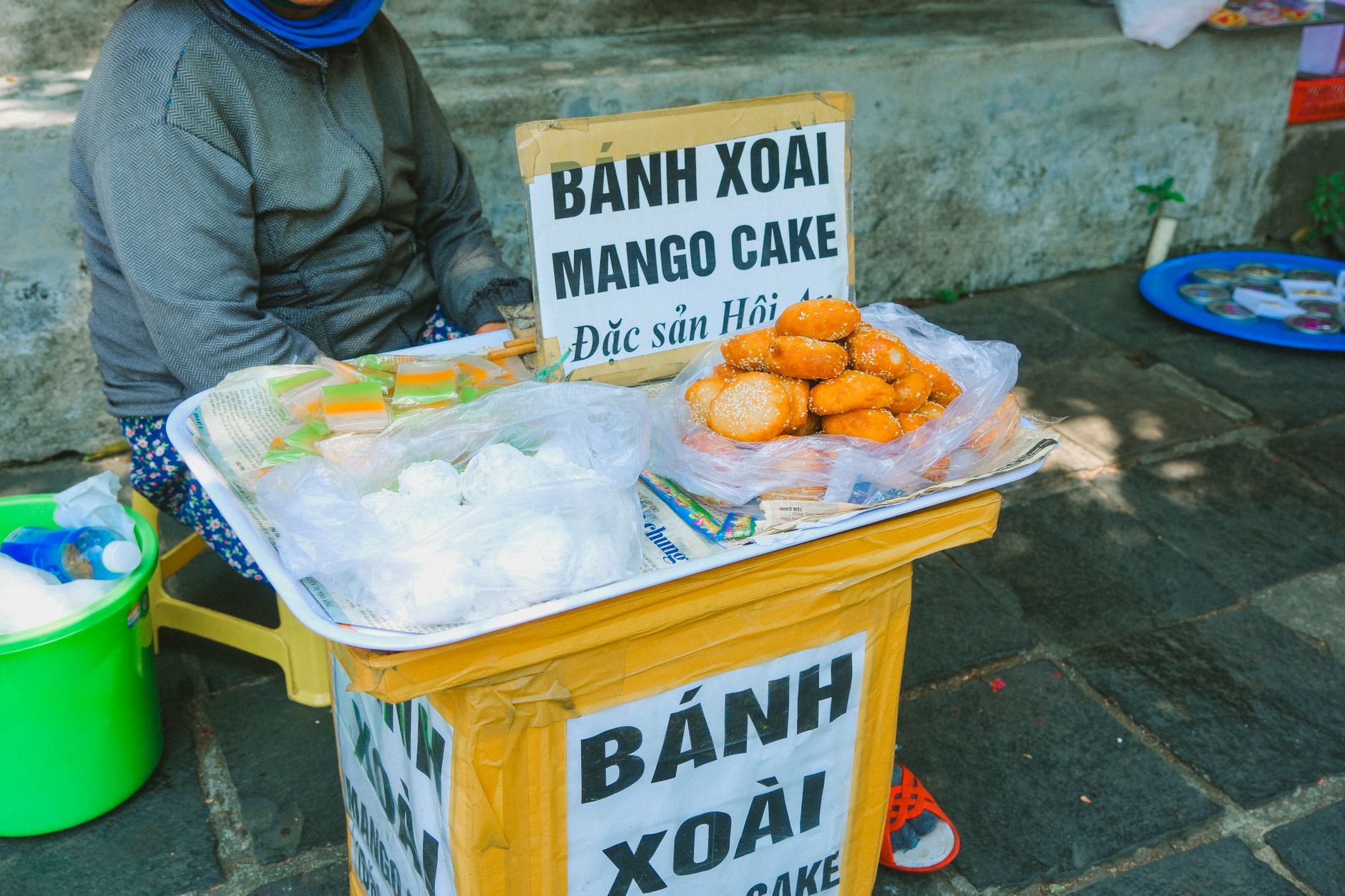
Quang Ngai isn't a food tourism destination the way Hoi An or Saigon are, but the province has a handful of regional dishes worth tracking down.
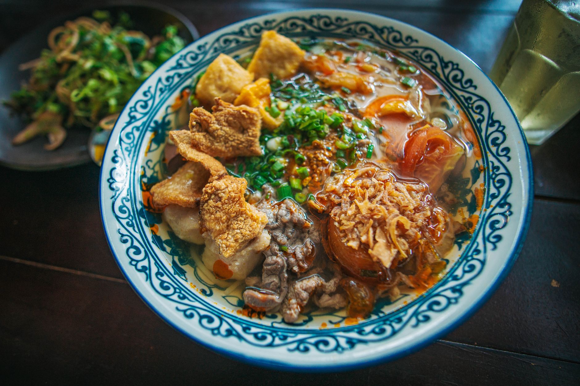
"Don" (rice fern cake): The signature Quang Ngai dish. Thin, translucent rice cakes made from a fern-root starch, served cold with shrimp, herbs, pork, and a sweet-savory fish sauce dip. You'll find it at dedicated stalls in Quang Ngai City, particularly along Phan Dinh Phung and Hung Vuong streets. A bowl costs 20,000-35,000 VND. The texture is slippery and slightly chewy—nothing like standard "banh cuon" or rice paper rolls. If you eat one dish in Quang Ngai, this is the one.
"Ram" (crispy spring rolls): The Quang Ngai version of "cha gio" uses a rice-paper wrapper and is deep-fried until shattering-crisp. Often paired with don or eaten solo with pickled vegetables. 15,000-25,000 VND for a plate.
"Ca bop nuong" (grilled pufferfish): A coastal specialty, especially around Sa Huynh and Duc Pho (쌀국수 / 越南河粉 / フォー). The fish is cleaned, marinated, and charcoal-grilled. Locals pair it with rice paper, herbs, green banana, and "mam" (fermented fish paste). A serving runs about 80,000-120,000 VND depending on size and restaurant. Note: pufferfish preparation requires knowledge of which species are safe—eat this at established local restaurants, not random stalls.
Seafood generally: Quang Ngai's coastline means fresh "ca," "tom," and "muc" (fish, shrimp, squid) are available daily at market stalls and simple restaurants. My Khe beach (not the Da Nang one—Quang Ngai has its own My Khe, about 15 km east of the city) has a strip of seafood shacks where you pick your catch from tanks. Expect 150,000-300,000 VND per person for a full spread.
For morning coffee, Quang Ngai City has a growing cafe scene along Quang Trung street. "Ca phe sua da" (iced milk coffee) is the default order; say "khong duong" if you want it without extra sugar. A glass runs 15,000-25,000 VND. The local style tends toward strong robusta—darker and more bitter than what you'd get in Da Lat, where arabica is more common.
Getting Around the Province
Quang Ngai City has a small domestic airport (Quang Ngai Airport, code VCL—also called Chu Lai Airport, located about 35 km north in Nui Thanh district, technically in Quang Nam province but serving Quang Ngai). VietJet and Vietnam Airlines operate flights to Hanoi and Ho Chi Minh City. From the airport, a taxi to Quang Ngai City center costs about 350,000-450,000 VND.
The train station sits in the city center on Quang Trung street. The Reunification Express stops here, connecting north to Da Nang (about 3 hours, 70,000-150,000 VND for a hard seat) and south to Quy Nhon or Saigon (12-14 hours, 300,000-600,000 VND depending on class).
Within the province, motorbike is the most practical transport. Rentals in Quang Ngai City run 120,000-180,000 VND per day. Roads along the coast are flat and manageable; heading into the western highlands requires more confidence—steep grades, occasional unpaved stretches, and limited fuel stops past Son Ha town. Top up your tank before leaving the lowlands.
Common Mistakes Foreigners Make
Confusing Quang Ngai's My Khe with Da Nang's My Khe. Both are real beaches, but they're 130 km apart. If your hotel booking says My Khe, double-check which province you're in.
Skipping Ly Son because of weather. The island crossing gets rough from October through February—boats cancel frequently. Plan your visit between March and September. If seas are marginal, locals will still go; that doesn't mean you should.
Expecting English menus. Quang Ngai City has almost no English-language signage outside a few hotels. Download a translation app. The phrase "cho toi cai nay" (give me this one) plus pointing works at most food stalls.
Underestimating distances to highland districts. Ba To is only 70 km from Quang Ngai City on the map, but the road takes nearly two hours each way. Son Tay district is further and slower. Budget a full day for any highland side trip.
Arriving without cash. ATMs exist in Quang Ngai City but are sparse outside it. Ly Son has one or two ATMs that sometimes run dry on weekends. Bring enough VND for your island stay.
Quick Reference
- Province capital: Quang Ngai City
- Distance from Da Nang: 130 km south (2.5 hours by car)
- Distance from Ho Chi Minh City: 820 km north
- Coastline: 129 km
- Airport: Chu Lai (VCL), 35 km north — flights to Hanoi, HCMC
- Train station: Quang Trung street, Quang Ngai City (Reunification Express)
- Ly Son boat: Sa Ky port, daily 7:00-8:00 AM, 160,000-200,000 VND one way, 30 min
- Signature dish: "Don" (rice fern cake), 20,000-35,000 VND
- Best months: March-August (dry, calm seas for Ly Son)
- Language: Very limited English — bring a translation app
- Currency tip: Carry cash; ATMs scarce outside the city
Why Visit
Quang Ngai offers an unvarnished view of central Vietnam—working fishing villages, mountain ethnic minority settlements, industrial-era coastal towns, and genuine local hospitality. If you're driving National Route 1 between Da Nang and the Mekong Delta, Quang Ngai City and Ly Son island are logical stops. The Thien An pagoda and the Long Wall sites appeal to history-minded travelers. The province is least touristy in its region, which is exactly the appeal.
For food travelers, it pairs well with a broader central coast route: pho and bun cha in Hanoi, mi quang and cao lau in Quang Nam, don and ram in Quang Ngai, bun bo Hue up in Hue, and com tam when you finally reach Saigon. Each province has its own table. Quang Ngai's is quieter and less photogenic, but it's honest.
Bottom Line
Quang Ngai won't make anyone's top-five list for a first trip to Vietnam. It doesn't try to. The province works best as a deliberate detour for travelers who've already done Hoi An and Da Nang and want to see what central coastal Vietnam looks like without the tourist infrastructure. Come for Ly Son, eat don, drive into the highlands if you're up for it, and move on knowing you saw a part of this coast that most visitors skip entirely.
Last updated · May 29, 2026 · independently researched, never sponsored.