Bu Gia Map National Park is one of those places in southern Vietnam (베트남 / 越南 / ベトナム) that doesn't appear on most itineraries, which is precisely why it's worth the drive. Sitting at the northeastern edge of the southern highlands near the Cambodian border, the park protects over 26,000 hectares of semi-evergreen and evergreen tropical forest — one of the last significant patches of lowland forest left in the south.
What it is and how it got here
Bu Gia Map was designated a nature reserve in 1986 and upgraded to national park status in 2002. The forest here connects to Cambodia's Mondulkiri province across the border, forming a cross-boundary wildlife corridor that's critical for species like black-shanked douc langurs, yellow-cheeked crested gibbons, and pygmy slow lorises. Researchers have documented over 1,000 plant species and around 500 animal species within the park boundaries.
The park sits on a basalt plateau at elevations between 200 and 700 meters, which keeps it marginally cooler than the lowlands around Saigon. The terrain is hilly, cut by streams that feed into the Dak Huyt and Dak Sar rivers. It's not dramatic karst scenery like Phong Nha — this is dense, tangled, working forest that rewards patience more than photo ops.
Why travelers go
Three reasons, mostly. First, the gibbons. Bu Gia Map is one of the few accessible places in Vietnam where you can hear — and sometimes see — yellow-cheeked crested gibbons calling at dawn. The males are black, the females golden, and their duets carry across the canopy starting around 5:30 AM. Second, the solitude. Visitor numbers here are a fraction of what you'd find at Cat Tien or Bach Ma. On a weekday you might be the only non-researcher in the park. Third, the S'tieng and M'nong ethnic minority communities living around the park's buffer zone offer a window into highland cultures that haven't been packaged for tourism.
Best time to visit
Dry season runs from November through April, and that's when you want to go. Trails are passable, leeches are less aggressive, and stream crossings stay manageable. December to February is the sweet spot — cooler mornings, lower humidity, better odds of wildlife sightings because animals concentrate near remaining water sources.
Avoid June through September. The park gets hammered with rain, trails turn to mud chutes, and some routes close entirely. The forest is beautiful when it's wet, but you'll spend more time watching your footing than watching wildlife.
How to get there
The park headquarters is near Dak Nhau commune. From Saigon (사이공 / 西贡 / サイゴン), you're looking at roughly 200 km north — about 4.5 to 5 hours by car or motorbike via National Highway 13 through Binh Duong and up through Dong Xoai.
If you're on a motorbike, fill up in Dong Xoai or Phuoc Long town. Fuel stops get sparse after that. The final 30 km from Phuoc Long to the park entrance is paved but narrow, winding through rubber and cashew plantations.
No direct public bus runs to the park. You can catch a bus from Saigon's Mien Dong bus station to Phuoc Long (around 120,000–150,000 VND, 4 hours), then hire a local "xe om" (motorbike taxi) for the last stretch — expect to pay 80,000–120,000 VND depending on your negotiation. Better yet, arrange a pickup through the park management board in advance.

Photo by Tường Chopper on Pexels
What to do
Trek the gibbon trail
The park offers guided treks ranging from 3 km nature walks to full-day 12 km routes through primary forest. The gibbon-focused trek starts before dawn — you hike to a known territory and wait. Guides are park rangers, not tourism professionals, so don't expect polished commentary, but they know where the animals are. Trek fees run around 200,000–300,000 VND per person, plus a guide fee of roughly 500,000 VND per group.
Visit Dak Mai waterfall
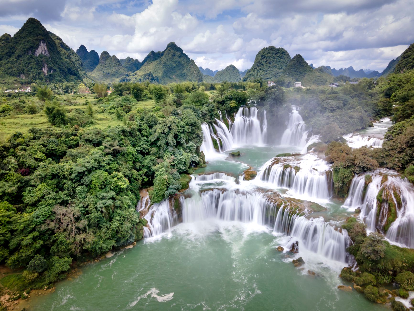
A 5 km trail leads to Dak Mai, a wide cascade that pools into a swimming hole during dry season. The trail passes through bamboo forest and crosses a couple of streams. Bring water shoes — the rocks are slippery year-round.
Night wildlife spotting
The park occasionally permits night walks with rangers. Slow lorises, civets, and flying squirrels are the main targets. This needs to be arranged ahead of time with the park office and isn't always available — call before you plan around it.
Explore buffer zone villages
S'tieng communities near the park still practice traditional weaving and rice wine fermentation. This isn't a curated cultural village experience — you're visiting real communities, so go with a local contact or park guide who can introduce you properly. Bring small gifts (fruit, snacks) rather than cash.
Birdwatching at dawn
Beyond gibbons, the park holds serious birding potential: great hornbills, green peafowl (endangered and rarely seen elsewhere in the south), and various woodpecker and barbet species. Bring binoculars — the canopy is dense and most sightings are high.
Where to eat nearby
Don't expect restaurant rows. In Phuoc Long town, about 30 km south, you'll find local rice shops serving "com tam" with grilled pork and broken rice for 35,000–50,000 VND. Look for places packed with locals at lunch — that's your quality signal.
Near the park, try "ga nuong" (grilled chicken) if a local family is selling it. The free-range chickens around here are smaller and tougher than city birds, but the flavor is genuine. Pair it with steamed rice and whatever greens are available. Budget 60,000–80,000 VND for a full meal.
Where to stay
The park has basic guesthouses near headquarters — concrete rooms with fans, shared bathrooms. Expect 200,000–350,000 VND per night. They're clean enough but bring your own towel and toilet paper.
Phuoc Long town has a handful of mini-hotels ("nha nghi") in the 250,000–400,000 VND range with air conditioning and hot water. Nothing fancy, but functional. For something more comfortable, you'd need to base yourself further south in Dong Xoai, where rooms at mid-range hotels start around 500,000 VND.
Camping inside the park is sometimes possible with advance permission. Ask the management board directly.

Photo by Lena Helfinger on Pexels
Practical tips locals would tell you
- Bring cash. There are no ATMs near the park and card payment doesn't exist out here. Stock up in Phuoc Long or Dong Xoai.
- Leech socks matter. Even in dry season, stream crossings mean leeches. Tuck pants into socks, consider leech-proof gaiters, and carry salt or a lighter.
- Call the park office before you go. Phone: check the Binh Phuoc provincial tourism site for the current number. Guides need to be booked, and access conditions change with weather. Showing up unannounced can mean a wasted trip.
- Pack a rain layer regardless of season. Afternoon showers happen year-round at this elevation.
- Mosquito repellent with DEET. This is a malaria-risk zone. Seriously. Use repellent, sleep under a net, and consider prophylaxis if you're staying multiple nights.
Common mistakes to avoid
Planning a day trip from Saigon. The 5-hour drive each way makes it miserable as a round trip — stay at least one night, ideally two, to catch the dawn gibbon chorus. Arriving without a guide and expecting to self-explore; the park requires guided entry for most trails. Underestimating the heat and humidity even in "cool" season — carry at least 2 liters of water per person for any trek over 5 km.
Practical notes
Bu Gia Map rewards the kind of traveler who's comfortable with basic infrastructure and genuine quiet. It's not a polished national park experience — it's forest, wildlife, and not much else. That's the whole point. If you're heading further into the southern highlands, Da Lat is about 250 km northeast and makes a natural next stop.
Last updated · May 26, 2026 · independently researched, never sponsored.