What it is
Kon Chu Rang is a 15,900-hectare nature reserve sitting at the junction of Gia Lai and Binh Dinh provinces in the Central Highlands (중부 고원 / 中部高原 / 中部高原). Established in 2004, it protects one of the last stretches of relatively intact montane forest on the eastern side of the Truong Son range. Elevations run from around 500m up to the 1,500m peak of Kon Chu Rang itself — the name comes from the Bahnar language, roughly meaning "tall mountain with cold wind," which is accurate enough once you're up there at dawn.
The reserve is managed primarily from the Gia Lai side (K'Bang district), though its eastern slopes drain into Binh Dinh's An Lao district. It's home to gibbons, langurs, Asian black bears, and over 200 bird species, though you'll need patience and luck — this isn't a zoo.
Why travelers go
Honestly, most don't. Kon Chu Rang sees maybe a few hundred visitors a year, almost all Vietnamese hikers and birdwatchers. That's precisely the appeal. If you've done Sapa, Da Lat, and the usual Central Highlands coffee-town circuit and want forest without the crowds, this is it.
The draw is multi-day trekking through primary forest — massive dipterocarp trees, moss-covered boulders, river crossings, and a handful of waterfalls that don't have Instagram handles yet. The 50m Hang En waterfall (not to be confused with the Phong Nha cave) is the marquee sight, plunging into a pool surrounded by old-growth canopy.
Birdwatchers come for endemic species and the chance to hear gibbon calls at sunrise without competing with tour buses.
Best time to visit
Dry season runs from November through April. January to March is ideal — cool enough for comfortable trekking (15-22°C at higher elevations), minimal rain, and clear mornings for wildlife spotting. Avoid June through September entirely; trails become slippery mud channels, leeches multiply dramatically, and river crossings can be genuinely dangerous after heavy rain.
April and May are borderline — warming up, occasional afternoon showers, but still manageable if you start early.
How to get there
The main access point is K'Bang town in Gia Lai province, about 55km northeast of Pleiku city.
From Pleiku: Take QL19 east toward Binh Dinh, then turn north on DT669 toward K'Bang. The drive is about 1.5 hours by motorbike or car. Pleiku has a domestic airport (Pleiku Airport) with daily flights from Hanoi and Saigon — tickets typically run 800,000-1,500,000 VND one way.
From Quy Nhon (Binh Dinh side): Technically possible via An Lao district, but the roads are rough and access from this side requires more planning. Most travelers approach from Gia Lai.
From the reserve management station: The main office is in K'Bang town. You need to register here before entering — show up without prior arrangement and you'll likely be turned away. More on that below.

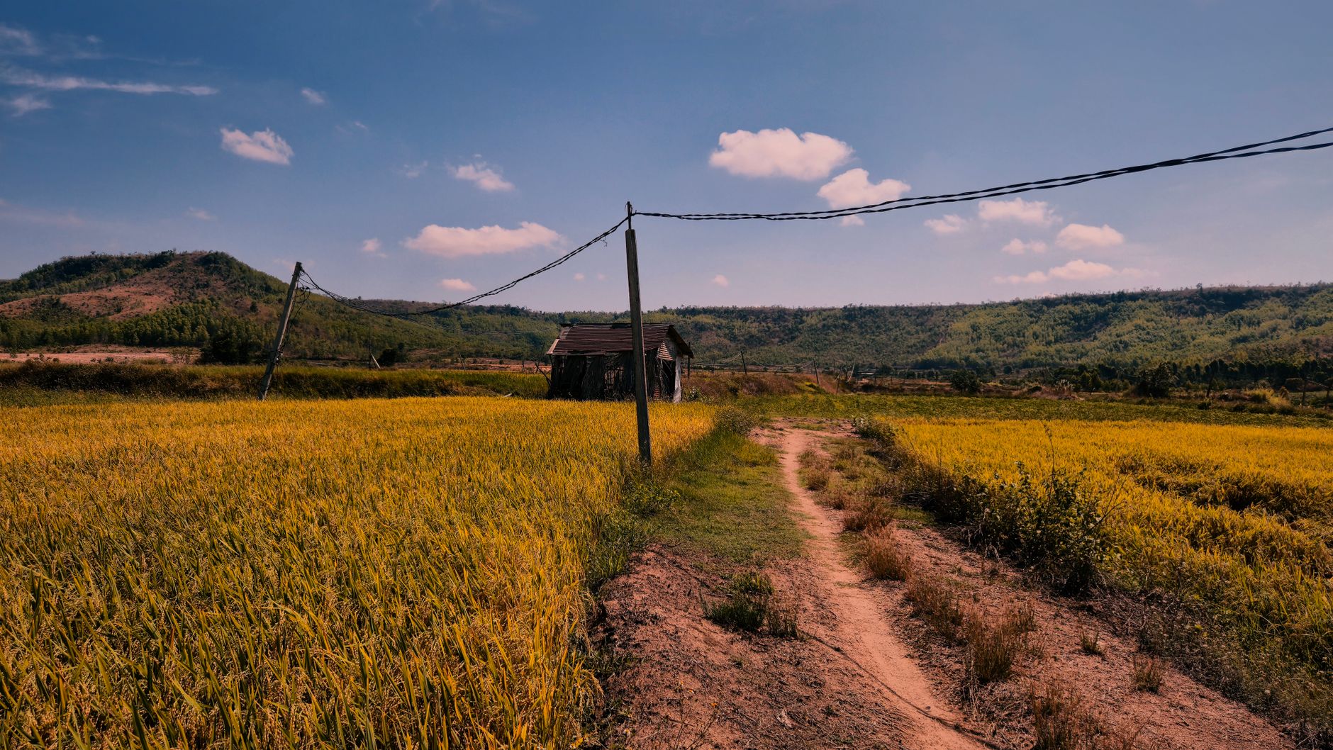
Photo by Quang Nguyen Vinh on Pexels
What to do
Trekking
The primary activity. Routes range from day hikes (8-12km) to multi-day treks (2-3 days) deeper into the reserve. The Hang En waterfall trek is the most popular — roughly 14km round trip with moderate difficulty, involving stream crossings and some scrambling. A guide is mandatory for all trails inside the reserve.
Wildlife observation
Dawn and dusk are prime hours. Gibbons call between 5:30-7:00 AM in the dry season. Bring binoculars — the canopy is dense and sightings happen at distance. Don't expect Nat Geo encounters; appreciate the soundscape.
Visiting Bahnar villages
Several Bahnar ethnic minority villages sit along the buffer zone. The "rong" houses (communal stilt houses with high thatched roofs) are distinctive architecture worth seeing. Be respectful — these are people's homes, not exhibits. Ask before photographing.
Where to eat
There are no restaurants inside the reserve. Pack your food for treks. In K'Bang town, options are limited to local "com binh dan" (everyday rice shops) along the main road. Expect 30,000-50,000 VND per meal — rice with grilled pork, morning glory, and soup. Nothing fancy, but filling.
If you're spending a night in Pleiku before or after, the city has better options. Try "[com tam](/posts/com-tam-saigon (사이공 / 西贡 / サイゴン)-broken-rice)" (broken rice) spots near the market or a bowl of "pho" at one of the early-morning stalls on Hung Vuong street. Gia Lai is also known for its "bun" noodle soups with distinctive Central Highlands seasonings.
Where to stay
Inside the reserve, accommodation means the ranger station guesthouse or camping. The guesthouse is basic — think concrete room, thin mattress, communal bathroom — but it's clean enough and runs about 150,000-200,000 VND per night. Camping is permitted at designated spots along trekking routes (your guide will know these).
In K'Bang town, there are a few "nha nghi" (guesthouses) in the 200,000-350,000 VND range. Don't expect hot water or English-speaking staff.
For more comfort, stay in Pleiku and day-trip or arrange an early departure. Pleiku has proper hotels in the 400,000-800,000 VND range with air conditioning and hot showers — the HAGL Hotel and Pleiku Hotel are reliable mid-range picks.

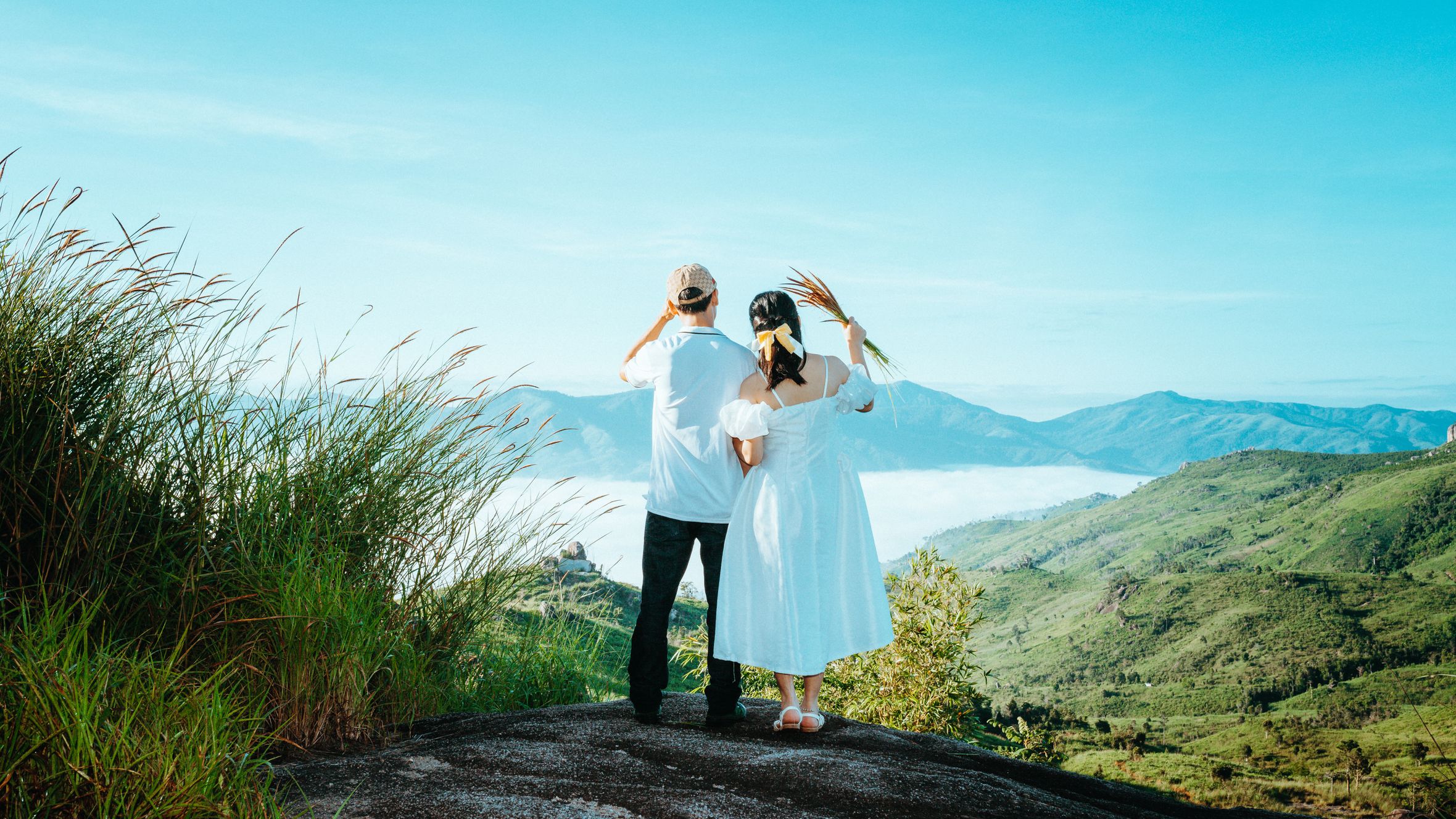
Photo by HONG SON on Pexels
Practical tips
- Permits and guides are mandatory. Contact the Kon Chu Rang reserve management board in K'Bang at least 3-5 days before your visit. A local tour operator in Pleiku can arrange this — try asking at your hotel or searching for Gia Lai trekking groups on Facebook. Guide fees run around 500,000-800,000 VND per day.
- Bring your own gear. Trekking shoes with good grip, rain jacket even in dry season, water purification, basic first aid, and insect repellent. Leeches are present year-round at lower elevations.
- Cash only. No ATMs inside the reserve, and K'Bang's ATMs can be unreliable. Withdraw what you need in Pleiku.
- Phone signal is patchy to nonexistent once you're on the trails. Download offline maps (Maps.me works well here) and tell someone your itinerary.
- Language barrier is real. Very little English spoken in K'Bang or by reserve staff. Basic Vietnamese phrases help enormously, or bring a translation app downloaded for offline use.
Common mistakes
Showing up without arrangements. This isn't a national park with a ticket booth. You need advance coordination with the management board. Travelers who arrive unannounced waste a day sorting logistics.
Underestimating the terrain. Trails here aren't manicured boardwalks. River crossings, steep grades, and unmarked junctions are normal. This isn't a beginner hike — basic fitness and some trekking experience are expected.
Skipping Pleiku entirely. The city gets dismissed as a transit point, but it's worth a half-day. The tea and coffee plantations on the outskirts, the Bien Ho lake (a volcanic crater lake), and the local food scene give useful context for the Highlands before you disappear into the forest.
Practical notes
Kon Chu Rang rewards travelers who plan ahead and accept some discomfort. It's not polished, not convenient, and not easy to reach — which is exactly why the forest is still standing. Budget two full days minimum for a meaningful visit, or three if you want to trek to the deeper waterfalls. Pair it with Pleiku's crater lakes and coffee country for a four or five-day Central Highlands loop that most visitors never see.
Last updated · Apr 29, 2026 · independently researched, never sponsored.