Dak Lak province sits in Vietnam's Central Highlands (중부 고원 / 中部高原 / 中部高原), a landscape of plateaus, freshwater lakes, and coffee plantations anchored by the ethnic minority communities that call it home. The province borders Gia Lai to the north, Khanh Hoa to the east, Lam Dong to the south, and Mondulkiri province in Cambodia to the west. Home to the Rade, Jarai, and Mnong peoples, it's one of Vietnam's most ethnically diverse regions.
What the Name Means
The name "Dak Lak" comes from the Mnong language, a Mon-Khmer tongue spoken by indigenous groups here. "Dak" translates to "water" or "lake," while "Lak" refers to the province's largest freshwater lake — so the name literally means "Lak Lake." The official Vietnamese spelling preserves the long "a" sounds of the original Mnong pronunciation. French colonial texts used "Darlac," and you'll still see variant spellings like "Daklak" on older signs and guesthouses. Locals in Buon Ma Thuot typically just say "Dak Lak" with a flat tone on both syllables — no need to overthink pronunciation.
The Long History
The region was part of the Kingdom of Champa until the 15th century, when Vietnamese expansion pushed south and absorbed it. By 1540, Vietnamese authorities had appointed nobles to settle ethnic Vietnamese in the area and establish military outposts. During the French colonial period, plantations flourished — coffee, rubber, and other cash crops became the economic backbone — though French rule also sparked resistance from the local tribes.
Administrative boundaries shifted repeatedly. Dak Lak was carved out as its own province in 1904, merged back into Kon Tum in 1913, re-established in 1923, and reshaped multiple times through the mid-20th century. In 1976, after national reunification, Dak Lak and Quang Duc merged into a single province. In 2003, the province was split again, creating the separate Dak Nong province to the south.
Today the province feels settled into its identity: coffee country with deep indigenous roots. War-era history is visible at sites like the Buon Ma Thuot Victory Monument on Le Duan Street, which marks the March 1975 campaign, but the city itself is forward-looking and commercial.

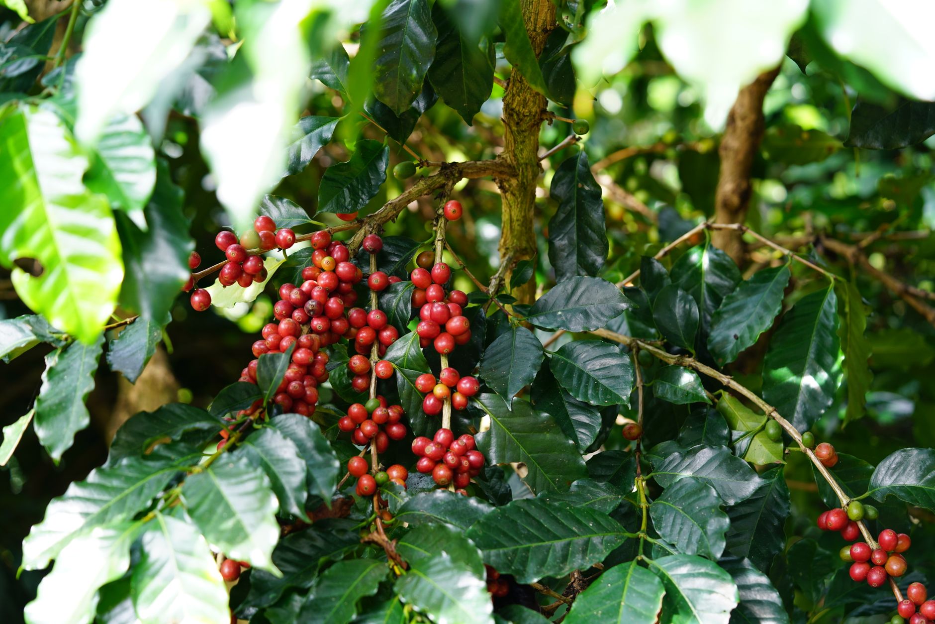
Photo by Nhi Huynh on Pexels
Geography and Attractions
The province occupies the Dak Lak Plateau, sitting about 600 meters above sea level. About 60 kilometers south of Buon Ma Thuot (the provincial capital) lies Lak Lake, the largest freshwater lake in the region. Overlooking the water stands the former summer retreat of Emperor Bao Dai, now converted into a hotel — a striking blend of colonial architecture and mountain views. Rooms at Bao Dai's Villa run roughly 400,000–800,000 VND per night depending on season, and you can walk the grounds even without booking a stay.
Jun Village sits on the lakeshore, home to the Jun people. The village offers homestay programs where families host travelers in traditional longhouses. Expect to pay around 150,000–250,000 VND per person per night including a home-cooked dinner of grilled fish, rice, and jungle greens.
Elephant rides through the village and across the lake are a popular draw for visitors, though consider the welfare of the animals and the ethics of the operation before booking. A growing number of ethical alternatives now exist — Yok Don National Park, about 40 km northwest of Buon Ma Thuot, runs a well-regarded elephant observation program where you walk alongside semi-wild elephants in the forest rather than riding them. Half-day treks cost around 1,200,000 VND per person.
Other natural sites worth the drive:
- Dray Nur and Dray Sap Waterfalls — twin falls about 25 km south of Buon Ma Thuot, connected by a suspension bridge. Entry is 30,000 VND each. Best visited in the wet season (June–October) when the volume is impressive.
- Chu Yang Sin National Park — home to the province's highest peak at 2,442 meters. Multi-day treks require a local guide and permit; arrange through the park office in Krong Bong district.
- Ea Kao Lake — a quiet reservoir 12 km east of the city center, popular with locals for weekend picnics. No entry fee.
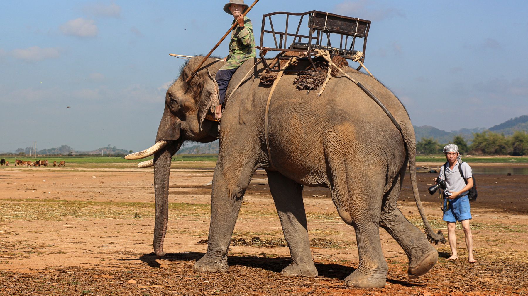
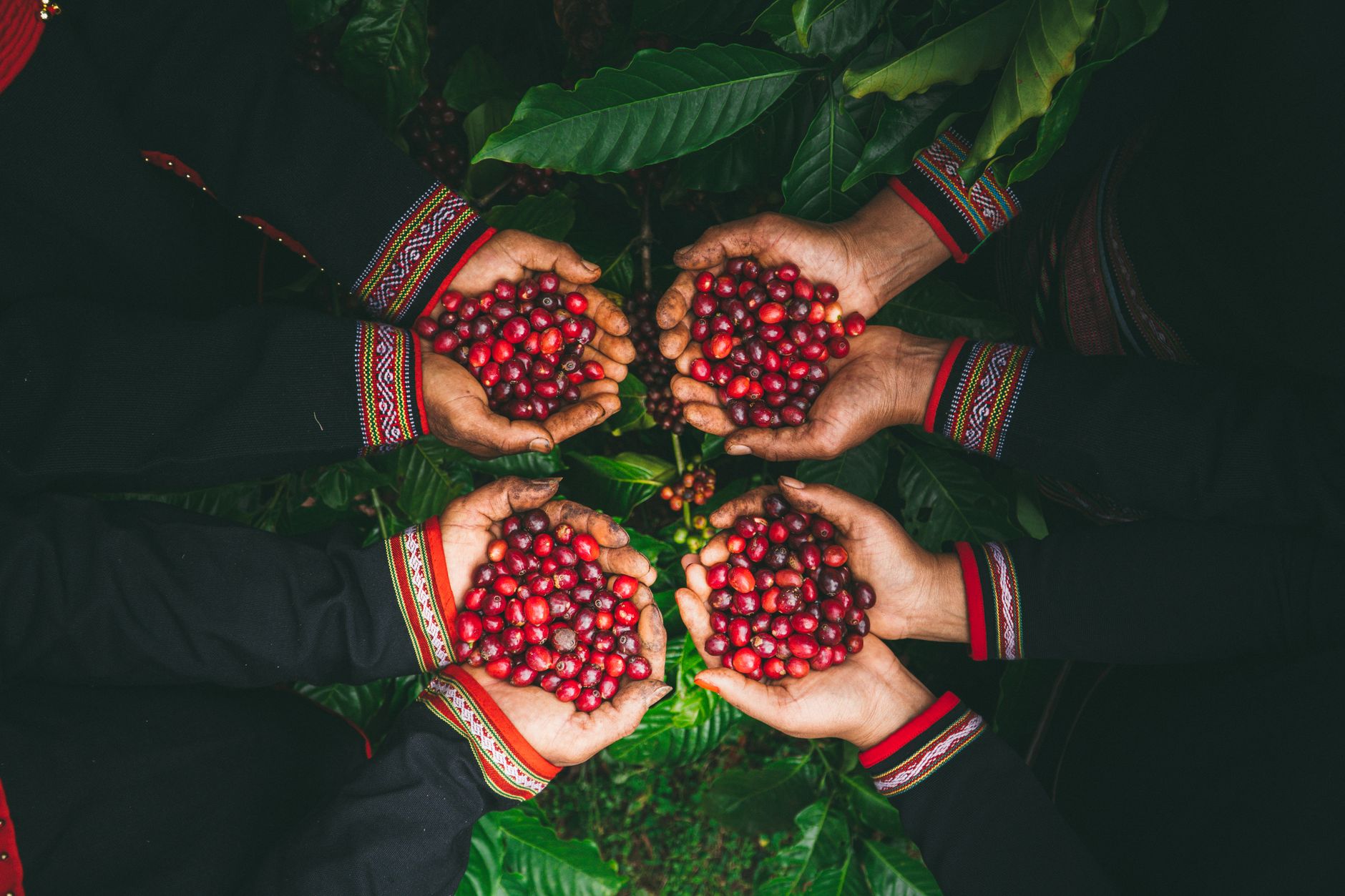
Photo by Vy Van Bui on Pexels
Coffee, Rubber, and the Economy
Dak Lak is Vietnam (베트남 / 越南 / ベトナム)'s coffee heartland. The plateau's elevation and soil chemistry produce some of the country's most prized robusta beans. The province accounts for roughly 30% of Vietnam's total coffee output, and Vietnam itself is the world's second-largest coffee exporter after Brazil — so when you sip a robusta-based blend anywhere on Earth, there's a decent chance it grew within 50 km of Buon Ma Thuot.
Beyond coffee, rubber plantations and fruit orchards (avocado, durian, pepper) dominate the rural landscape. The province has also invested in hydroelectric power generation to diversify its economic base — dams along the Srepok and Krong Ana rivers supply power across the Central Highlands.
For travelers, the coffee connection is the main draw. The annual Buon Ma Thuot Coffee Festival (held every two years, usually in March) features cupping competitions, farm tours, and a trade expo that draws buyers from across Southeast Asia.
Drinking Coffee in Dak Lak
You can't visit Dak Lak without sitting down for "ca phe" — and here it means something slightly different from what you'll find in Hanoi or Saigon. The local style leans heavily on robusta: dark-roasted, brewed through a metal "phin" filter, served with condensed milk or black over ice. Expect a thicker body and more bitter punch than arabica-based drinks.
Places to try in Buon Ma Thuot:
- Trung Nguyen Coffee Village (Nguyen Dinh Chieu Street) — the flagship showroom of Vietnam's biggest coffee brand. Sprawling garden complex, free entry. A cup of weasel coffee ("ca phe chon") here runs about 80,000–120,000 VND. Regular drip is 25,000–40,000 VND.
- Ede Coffee (Le Hong Phong Street) — a smaller roaster run by an Ede family, serving single-origin beans from their own farm in Krong Pak district. Black coffee 20,000 VND.
- An Coffee (Phan Chu Trinh Street) — a local chain popular with university students. Condensed-milk coffee ("ca phe sua da") is 18,000 VND.
If you want to visit a working plantation, several farms along Provincial Road 8 between Buon Ma Thuot and Lak Lake accept drop-in visitors during harvest season (November–January). No booking required — just pull up on a motorbike and ask. Most farmers are happy to show you the drying beds and offer a cup.
Food in Dak Lak
The Central Highlands kitchen borrows from both Vietnamese lowland cooking and indigenous traditions. You'll find standard dishes like pho and banh mi everywhere, but the local specialties are what justify eating here:
- "Com lam" — sticky rice cooked inside bamboo tubes over charcoal. Sold at roadside stalls along Highway 27 for 10,000–15,000 VND per tube. Best eaten with grilled pork or dried buffalo meat.
- Grilled chicken with "la e" — jungle leaves wrapped around free-range chicken and charcoal-grilled. Available at most "quan nhau" (drinking spots) in the city for 150,000–200,000 VND per whole bird.
- Wild boar dried jerky — chewy, salty, sold by weight at Buon Ma Thuot's central market (Cho Buon Ma Thuot on Tran Hung Dao Street). Around 300,000 VND per kilogram.
- "Ruou can" — communal rice wine sipped through long bamboo straws from a shared clay jar. Common at village homestays and ethnic minority festivals. Not sold commercially in most restaurants — you'll need to visit a village or attend a gong ceremony.
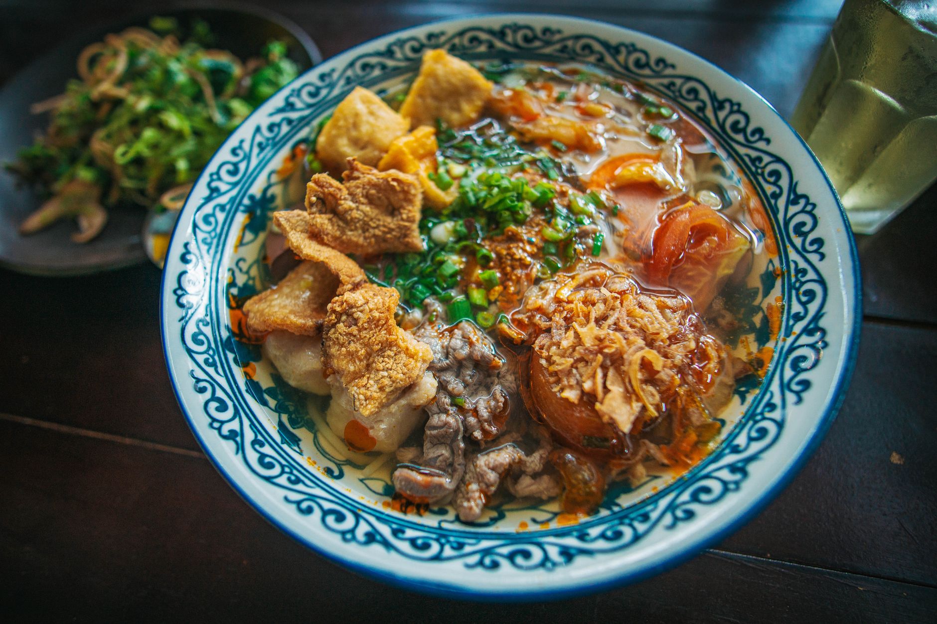
For everyday meals, the stretch of Y Jut Street near Dak Lak University has cheap "com binh dan" (rice-plate shops) serving lunch for 25,000–35,000 VND. Bun cha doesn't appear much here — instead look for "bun do" (red noodles with pork and peanuts), a regional variant you won't find outside the Highlands.
Getting There
Two airports serve the region: Buon Ma Thuot Airport (BMV) and Tuy Hoa Airport, both offering daily domestic flights to Hanoi and Ho Chi Minh City. Vietnam Airlines, VietJet Air, Pacific Airlines, and Bamboo Airways all operate routes in and out of the province, making it accessible for a long weekend or extended stay in the highlands.
Flight time from Ho Chi Minh City is about 50 minutes; from Hanoi, roughly 1 hour 40 minutes. One-way fares on budget carriers start around 600,000–900,000 VND if booked a few weeks ahead.
By road, Buon Ma Thuot connects to:
- Da Lat — 190 km south via Highway 27, about 4 hours by bus (ticket around 150,000 VND on Phuong Trang or Thanh Buoi lines)
- Nha Trang — 200 km east via Highway 26, roughly 4.5 hours
- Pleiku (Gia Lai) — 200 km north via Highway 14, about 4 hours
Sleeper buses from Saigon depart nightly from Ben xe Mien Dong and take about 8 hours (250,000–350,000 VND). From Da Nang, the journey is around 10 hours via Kontum.
Once in the province, a rented motorbike (manual 120,000–150,000 VND/day, automatic 150,000–200,000 VND/day) is the most practical way to explore. Roads between Buon Ma Thuot, Lak Lake, and Yok Don are paved and in decent condition.
What Surprises Foreigners
- The cool weather. At 600 meters elevation, mornings and evenings in Dak Lak are genuinely cool — 18–22 degrees Celsius from November through February. Pack a light jacket. This catches people off guard after the heat of coastal cities.
- Limited English. Tourism infrastructure is thin compared to Hoi An or Da Nang. Few restaurant menus have English translations. Learn basic Vietnamese ordering phrases: "cho toi mot ca phe den" (give me one black coffee), "tinh tien" (the bill please).
- Gong culture. The Rade and Jarai peoples use bronze gong ensembles for ceremonies, harvests, and funerals. UNESCO recognized Central Highlands gong culture as intangible heritage in 2005. If you're invited to a gong ceremony at a village, it's a real cultural event — not a tourist show.
- Red dirt roads. Side roads off the main highways are laterite — packed red earth that turns slippery in rain. A motorbike with decent tires handles them fine in dry season; in the wet months, stick to paved routes or rent a car.
- No party scene. Buon Ma Thuot shuts down early. Most restaurants close by 21:00, and nightlife is limited to a handful of karaoke bars and "bia hoi" spots. This is not Saigon.
Quick Reference
- Provincial capital: Buon Ma Thuot (population ~400,000)
- Elevation: ~450–600 meters above sea level (city center ~536 m)
- Best months to visit: November–March (dry season, cool mornings, coffee harvest)
- Rainy season: May–October (heavy afternoon downpours, waterfalls at peak flow)
- Airport code: BMV (Buon Ma Thuot)
- Distance from HCMC: ~350 km (8 hrs by bus, 50 min by air)
- Distance from Da Lat: ~190 km (4 hrs by bus)
- ATMs: Available on Nguyen Tat Thanh and Phan Chu Trinh streets; Vietcombank and BIDV accept international cards
- SIM cards: Viettel and Mobifone shops on Le Duan Street; 4G coverage is solid in the city but patchy in remote areas near Yok Don
- Key ethnic groups: Ede (Rade), Jarai, Mnong, Kinh (Vietnamese majority)
- Local specialties: robusta coffee, "com lam," dried buffalo meat, avocado, durian
Bottom Line
Dak Lak rewards travelers who want substance over spectacle. There are no beach clubs or rooftop bars — just red-dirt roads cutting through coffee plantations, longhouse villages where rice wine flows from clay jars, and some of the cheapest, strongest coffee you'll drink anywhere in Vietnam. Two or three nights based in Buon Ma Thuot, with day trips to Lak Lake and Yok Don, gives you a genuine feel for a part of the country most visitors skip entirely.
Last updated · May 29, 2026 · independently researched, never sponsored.