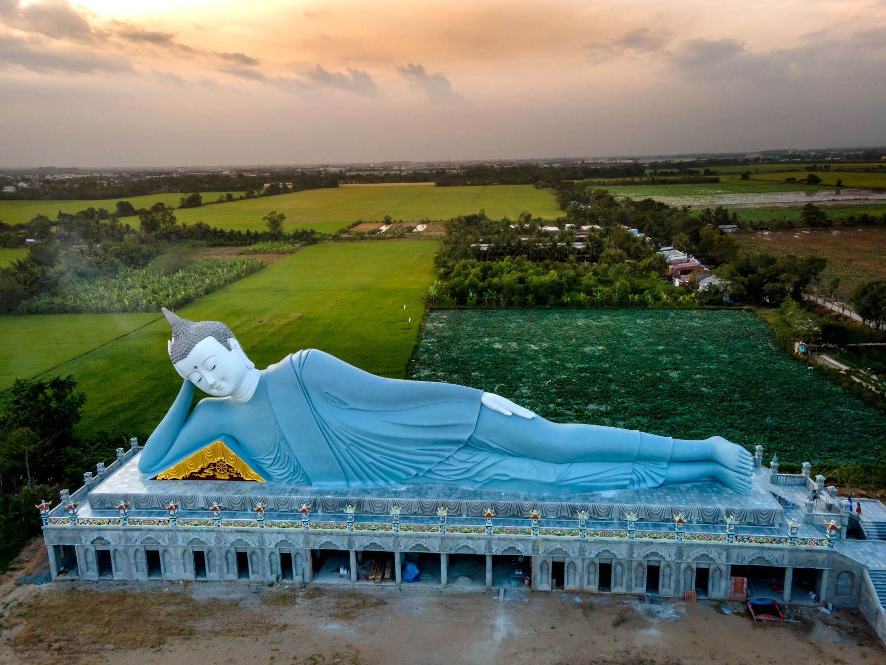
The Ha Giang Loop is the single best thing you can do on a motorbike in Vietnam (베트남 / 越南 / ベトナム), and probably in all of Southeast Asia. Four days, roughly 350 km of mountain road through limestone karst towers, terraced rice fields cut into near-vertical slopes, and ethnic-minority villages where Hmong, Tay, and Lo Lo communities live largely the way they have for centuries. This guide covers the route day by day, what bike to rent, what it actually costs, and the stuff nobody tells you until you're already white-knuckling a hairpin on QL4C.
At a Glance: Ha Giang Loop Quick Reference
- Total distance: ~350 km (classic loop), ~400 km with northern detours
- Recommended days: 4 days / 3 nights (3 is rushed, 5 is luxurious)
- Start/end: Ha Giang City
- Road surface: 90% paved, 10% patchy or gravel (especially Meo Vac–Du Gia stretch)
- Fuel cost: Roughly 350,000–450,000 VND total (~$14–18 USD) for a semi-auto
- Homestay cost: 100,000–250,000 VND/night ($4–10 USD), dinner+breakfast often included
- Bike rental: 150,000–350,000 VND/day depending on model
- Best months: September–November (rice terraces golden), March–May (clear skies, blooming)
- Worst months: July–August (heavy rain, landslides), December–January (fog, near-zero visibility some mornings)
How to Get to Ha Giang City
Ha Giang City is the staging point. Nobody starts the loop from anywhere else — the town has all the rental shops, hostels, and the permit office.
From Hanoi by Bus
The most common route. Sleeper buses run from My Dinh Bus Station (northwest Hanoi) and a few from Gia Lam. The trip takes 6–7 hours depending on traffic and the driver's ambitions.
- Hung Thanh and Hai Van are the two most-used bus companies. Tickets cost 200,000–280,000 VND one way.
- Book through your hostel in Hanoi (하노이 / 河内 / ハノイ) or walk up to My Dinh — departures run from about 7 AM through late evening (the 9 PM sleeper is popular so you arrive at dawn).
- The road is good tarmac the whole way. You'll pass through Tuyen Quang province. Expect one bathroom/snack stop.
- Some hostels in Ha Giang City offer free pickup from the bus station — confirm before you arrive.
From Sapa
No direct bus. You'll need to route back through Hanoi or take a combination of local buses through Lao Cai and Bac Ha, which takes 10+ hours and isn't worth it unless you enjoy logistical suffering. Most riders do Sapa and Ha Giang as separate northern loops out of Hanoi.
Choosing Your Bike: Honda Win, Wave, XR, or Easy Rider?
This decision shapes your entire trip. Ha Giang City has dozens of rental shops clustered along Nguyen Trai street and near the backpacker hostels (QT Hostel, Jasmine, Bong Hostel area).
Honda Wave / Blade (Semi-Automatic, 110–125cc)
- Cost: 150,000–200,000 VND/day
- Pros: Cheap fuel consumption (about 1.8L/100 km), easy to ride, parts available everywhere, any roadside mechanic can fix it in 20 minutes
- Cons: Less comfortable on long descents, small wheels feel skittish on gravel patches
- Best for: Riders with some experience on semi-autos, budget travelers, anyone who's ridden a scooter in Saigon or Da Nang and wants a step up
Honda XR150 (Manual, 150cc)
- Cost: 250,000–350,000 VND/day
- Pros: Proper suspension, higher ground clearance, confidence on gravel and dirt, more stable at speed
- Cons: Heavier, requires manual clutch skill, higher fuel cost (~2.5L/100 km), pricier if you drop it (damage deposits run 1–3 million VND)
- Best for: Experienced riders, anyone planning the Du Gia back-road detour, riders over 75 kg
The Old Honda Win (Manual, 100–125cc)
The backpacker classic. Cheap, unreliable, and romantic in a broken-down kind of way. Frankly, fewer shops rent these now — the XR has mostly replaced them. If someone offers you a Win for 100,000 VND/day, inspect the brakes, chain tension, and tire tread. You'll likely need at least one roadside repair. Budget 50,000–100,000 VND for that.
Easy Rider (Hiring a Driver)
If you can't ride or don't want to, every hostel and rental shop arranges "easy riders" — a local driver on a semi-auto with you on the back. Cost: 600,000–900,000 VND/day including the driver's food and fuel. You lose some freedom but gain a guide who knows every viewpoint and lunch stop. Not a lesser experience — just a different one.
Permit note: Technically, you need a Vietnamese motorbike license or an International Driving Permit with a motorbike endorsement to ride legally. Police checkpoints on the loop are rare but not unheard of. The fine is typically 800,000–1,200,000 VND. Most travelers ride without proper documents. That's a fact, not a recommendation — your risk to assess.

Photo by Quý Nguyễn on Pexels
Day 1: Ha Giang City to Yen Minh (90–100 km)
Morning Prep
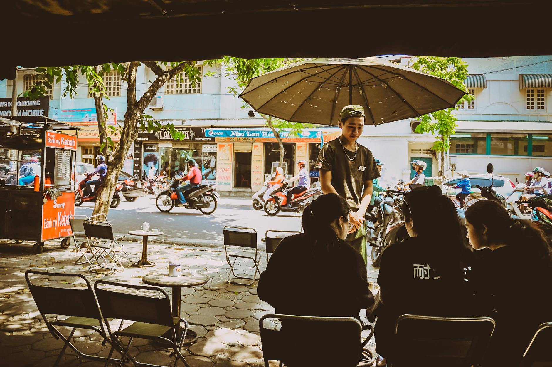
Fuel up at the Petrolimex station on the north end of town (roughly 25,000 VND/liter for RON 95). Pack light — a dry bag strapped to the rear rack is ideal. Grab a "banh mi" and iced coffee from the vendors near the central market before you ride.
The first 25 km north on QL4C is gentle — flat valley road, rice paddies, not much traffic. Enjoy it. This is the last flat stretch you'll see for three days.
Quan Ba Heaven Gate
Around km 46, you'll climb sharply to Quan Ba Heaven Gate (Cong Troi Quan Ba), a viewpoint at roughly 1,500 m elevation. The road switchbacks tightly — stay in second gear on the climb, hug the inside line, and honk before blind corners. Every truck driver does the same; it's not aggression, it's protocol.
From the parking area, walk up the stairs to the overlook. Below you: the "Twin Mountains" (Nui Doi), a pair of symmetrical green hills rising from the valley floor. Worth 15 minutes. There's a small shop selling instant coffee and snacks at the top — 15,000 VND for a coffee.
Tam Son Town (Lunch Stop)
About 10 km past Quan Ba, Tam Son is a good lunch stop. "Pho" with buffalo meat is the local thing here — a darker, gamier broth than what you get in Hanoi. Expect 35,000–45,000 VND a bowl. Several small restaurants line the main road.
Afternoon Push to Yen Minh
The road from Tam Son to Yen Minh climbs through pine forests and Hmong villages. It's well-paved but winding. You'll see women in full traditional dress walking along the road — slow down around villages, livestock wanders freely.
Arrive in Yen Minh by 3–4 PM. The town itself is functional, not charming — a district capital with concrete buildings and a decent market.
Where to Stay in Yen Minh
- Yen Minh homestays: Several Hmong-run homestays are signposted 2–5 km before town. A Mong (Hmong) family homestay typically costs 100,000–150,000 VND/person, dinner and breakfast included. The food is simple — rice, stir-fried greens, sometimes pork — and generous.
- In-town hotels: 200,000–300,000 VND for a private room with hot water. Clean enough. Try A Pao Hotel if the homestays are full.
Day 2: Yen Minh to Dong Van (50–60 km, but a Full Day)
Shorter distance, bigger scenery. This is where the geology goes vertical.
Sa Phin and the H'mong King's Palace
About 15 km past Yen Minh, detour left to Sa Phin village. The Vuong Family Mansion (commonly called the H'mong King's Palace) sits in a valley surrounded by rock walls. Built in 1919–1928 by the opium-trading Vuong clan, it's a stone-and-wood compound blending Chinese feng shui architecture with local Hmong building techniques. Entry: 20,000 VND. Give it 30–45 minutes.
Lung Cu Flag Tower
This is the northernmost point of Vietnam. From the junction past Sa Phin, it's about 25 km north on a narrow but paved road to Lung Cu. The flag tower sits on top of Dragon Mountain (Lung Cu), and you climb 389 steps to the top where a massive Vietnamese flag marks the border.
The view from the top is wide and stark — terraced hills, a river gorge, and the border fence below. On clear days visibility stretches for kilometers. Entry is free. Budget 1.5–2 hours for the detour including riding time.
Fuel warning: Top off before the Lung Cu detour. There's a small fuel shop in Lung Cu village (often just a hand pump), but selection and availability aren't guaranteed.
Dong Van Town
Back on the main loop, push south to Dong Van. This is the best overnight stop on the entire loop — a small town ringed by karst peaks with a well-restored Old Quarter of Hmong, Tay, and Chinese merchant houses. The Sunday market (every Sunday morning, starts around 6 AM) draws minority groups from surrounding villages and is one of the most photogenic markets in northern Vietnam.
Where to Stay and Eat in Dong Van
- Dong Van Old Quarter homestay / Lung Vai homestay: 150,000–200,000 VND, atmospheric rooms in old stone houses
- Hotels on the main road: 250,000–350,000 VND, modern rooms, hot showers that actually work
- Dinner: Try "thang co" — a Hmong-style organ stew made with horse or buffalo offal, herbs, and chili. It's an acquired taste but defines this region. A bowl runs 30,000–40,000 VND. If that's too adventurous, "com tam" (broken rice) and grilled pork places exist too.
- Drinks: "Bia hoi" (fresh draft beer) is available but the local corn wine ("ruou ngo") is the real Ha Giang drink. Accept it if a homestay host offers — refusing is impolite. Sip slowly; it's stronger than it tastes.
Day 3: Dong Van to Meo Vac via Ma Pi Leng Pass (25 km of Riding, Full Day of Stops)
The headline day. Only 25 km of road, but you'll spend 5–7 hours because you'll stop constantly.
Ma Pi Leng Pass
Leaving Dong Van heading south, the road climbs to Ma Pi Leng, a 20 km stretch of road carved into cliff faces above the Nho Que River gorge. The pass tops out around 1,500 m and the gorge drops roughly 800 m below you.
This is the most dramatic road in Vietnam. The original route was hand-carved by thousands of workers from 1959 to 1965 — plaques along the road commemorate the effort. The rock is sheer limestone, the drop is real, and the road narrows to barely two lanes in places.
Photography Tips for Ma Pi Leng
- Best light: Morning, roughly 7–10 AM. The gorge faces east, so early sun lights the river below and the cliffs glow warm.
- Key viewpoints: There are three to four marked pullouts with low walls. The most photographed is about 8 km south of Dong Van where the river bends in a tight horseshoe.
- The Nho Que River viewpoint and sky path: A glass-floored "sky walk" was built partway down the cliff. Entry: 50,000 VND. Opinions vary — some riders love it, others think it's tacky. The view is the same from the road above, free.
- Drone note: Drones are technically restricted in border areas, and Ha Giang is a border province. Enforcement is inconsistent. If you fly, be discreet and don't launch near military posts or the Lung Cu flag tower.
Descending to Meo Vac
The road drops fast after the pass. Switchbacks are tight and some have loose gravel on the surface — engine brake in second gear, don't ride the front brake on corners. By early afternoon you'll roll into Meo Vac, a valley town that feels more remote than Dong Van.
Where to Stay in Meo Vac
- Meo Vac Lodge: One of the nicer spots, 300,000–500,000 VND, balcony rooms overlooking the valley
- Auberge de Meo Vac: Budget-friendly, 150,000–200,000 VND, good communal vibe with other riders
- Local homestays on the outskirts: 100,000–150,000 VND, dinner included
Meo Vac's Sunday market is comparable to Dong Van's — if your timing lines up, wake early for it.

Photo by Nguyen Khuong on Pexels
Day 4: Meo Vac Back to Ha Giang City (150 km, the Long Day)
The return leg. Two main options.
Option A: The Standard Return via Du Gia (Longer, Rougher, Better Scenery)
From Meo Vac, head south to Du Gia rather than retracing QL4C. This adds about 30 km and 1.5 hours but takes you through completely different terrain — lush valleys, fewer tourists, bamboo forests, and river crossings.
- The Du Gia road has 10–15 km of unpaved or poorly maintained surface. After heavy rain, mud is real. A Wave handles it fine in dry weather; an XR is better if it's been raining.
- From Du Gia, you can loop through Bac Me district and rejoin QL34 south to Ha Giang City.
- Total riding time: 6–8 hours with stops.
Option B: Retrace QL4C via Yen Minh (Faster, All Paved)
Straightforward: Meo Vac → Dong Van → Yen Minh → Ha Giang City, back the way you came. About 150 km on paved road. You'll see things you missed heading north — the light hits differently in the other direction. Total riding time: 5–6 hours.
Most riders take Option A on the way back and Option B only if weather or fatigue forces it.
Arrival and Evening
Back in Ha Giang City by late afternoon. Return the bike (inspect together with the shop owner — photograph any pre-existing scratches before your trip and again at return). Celebrate with a "bia hoi" at one of the sidewalk spots along Nguyen Trai. The overnight bus back to Hanoi leaves at 8–9 PM; book it through your hostel.
What Does the Ha Giang Loop Actually Cost?
Budget breakdown for one person, 4 days / 3 nights:
- Bike rental (Wave, 4 days): 600,000–800,000 VND ($24–32)
- Fuel (4 days): 350,000–450,000 VND ($14–18)
- Accommodation (3 nights homestay): 300,000–600,000 VND ($12–24)
- Food (4 days): 400,000–600,000 VND ($16–24)
- Entry fees (Flag Tower, Palace, Sky Path): 70,000–100,000 VND ($3–4)
- Bus Hanoi–Ha Giang round trip: 400,000–560,000 VND ($16–23)
- Misc (water, snacks, bike repair): 100,000–200,000 VND ($4–8)
Total: approximately 2,200,000–3,300,000 VND ($90–135 USD)
That's hard to beat for four days of the best mountain riding in the country. By comparison, a single night in a mid-range hotel on Phu Quoc costs more than the entire loop.
When to Ride: Season-by-Season Breakdown
- September–November: The prime window. Rice terraces in Hoang Su Phi and around Yen Minh turn gold in late September through October. Clear skies, warm days (20–28°C), cool nights. October is peak tourist season on the loop — you won't be alone, but it's never crowded like Ha Long Bay.
- March–May: Second-best window. Buckwheat flowers bloom across the plateau in March, turning hillsides pale pink and white. Warmer than autumn, occasional afternoon rain but rarely all-day.
- June–August: Monsoon season. Rain is heavy, landslides close sections of QL4C regularly, fog can cut visibility to 20 meters. Experienced riders go in July for the intense green landscapes and empty roads. Not recommended for first-timers.
- December–February: Cold. Temperatures drop to 5–10°C at elevation, and frost is common above 1,200 m. Fog blankets the valleys many mornings. If you go in winter, pack layers — a proper jacket, not a hoodie — and expect some viewpoints to be socked in.
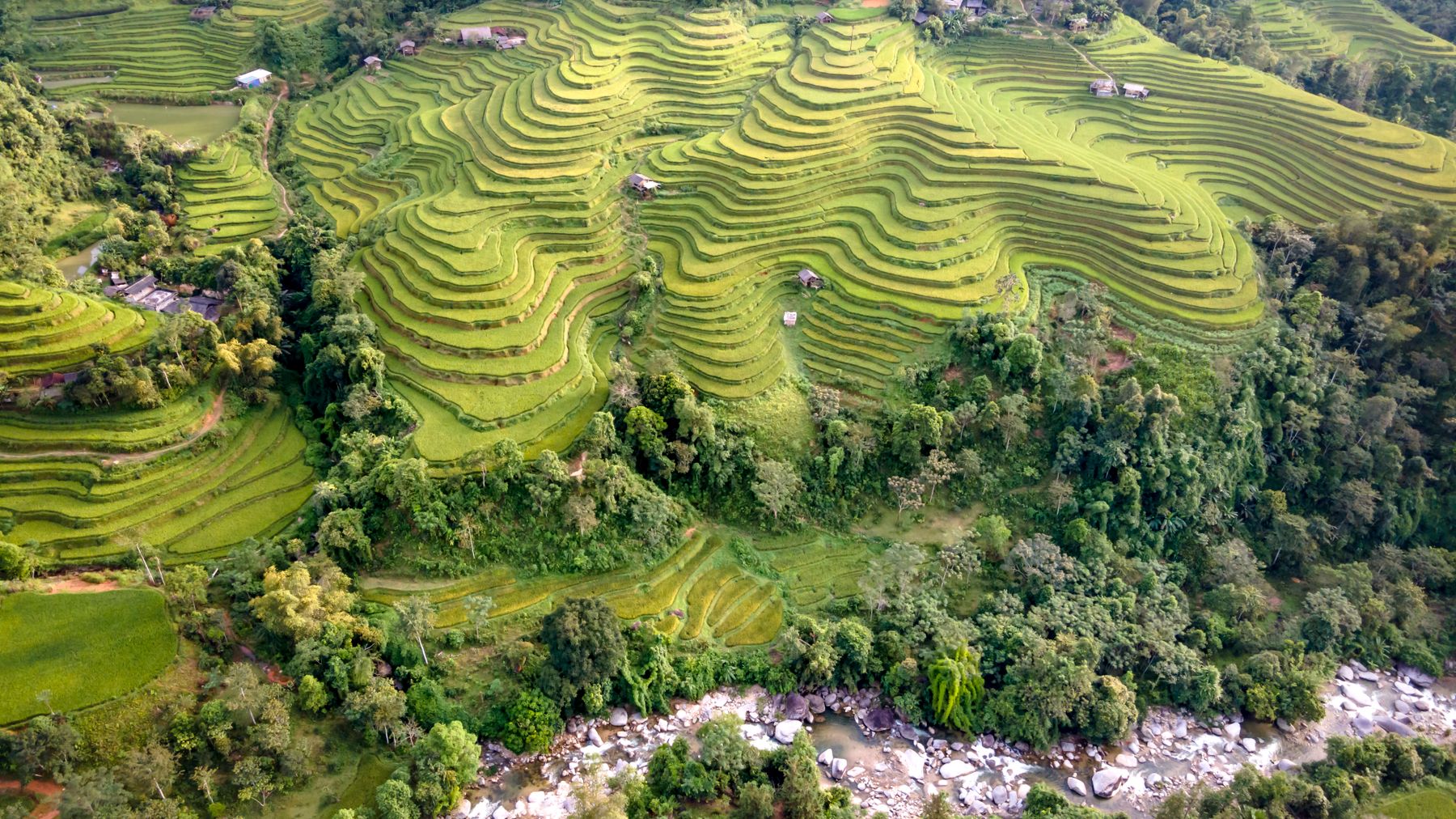
Photo by Quang Nguyen Vinh on Pexels
Safety, Etiquette, and What Nobody Mentions
Road Safety
The Ha Giang Loop is not a casual ride. The road is well-built but unforgiving — sheer drops with no guardrails in places, blind corners, occasional rockfall, and local truck traffic that takes the full lane. Ride within your ability. If a corner feels too fast, it is.
Carry a basic first-aid kit. Phone signal is patchy north of Yen Minh — download offline maps (Maps.me or Google Maps offline) before you leave Ha Giang City.
Cultural Etiquette
You're riding through communities, not a theme park.
- Ask before photographing people, especially children. A smile and a gesture toward your camera is enough — if they wave you off, respect it.
- Don't enter homes without being invited. If you stop at a village, stay on the road or in clearly public areas unless a resident gestures you in.
- If you accept corn wine or food at a homestay, finishing what's offered is polite. Leaving a full glass signals displeasure.
- Buy something at village markets — even a small bag of dried plums or local honey (20,000–40,000 VND). Tourism money matters in these communities.
Altitude and Weather Shifts
You'll climb from 300 m (Ha Giang City) to over 1,500 m in a few hours. Temperature swings of 10–15°C are normal in a single day. Morning fog can be thick enough to soak your clothes. Carry a rain jacket and a dry layer in your bag, every day, regardless of the forecast.
Connecting the Loop to a Wider Northern Vietnam Trip
Most riders pair Ha Giang with other northern destinations. A common itinerary:
- Hanoi (2–3 days): Eat "bun cha" on Hang Manh, drink "egg coffee" at Giang Cafe on Nguyen Huu Huan, visit the Temple of Literature and the One Pillar Pagoda, catch a "water puppetry" show at Thang Long Theatre.
- Ha Giang Loop (4–5 days): This guide.
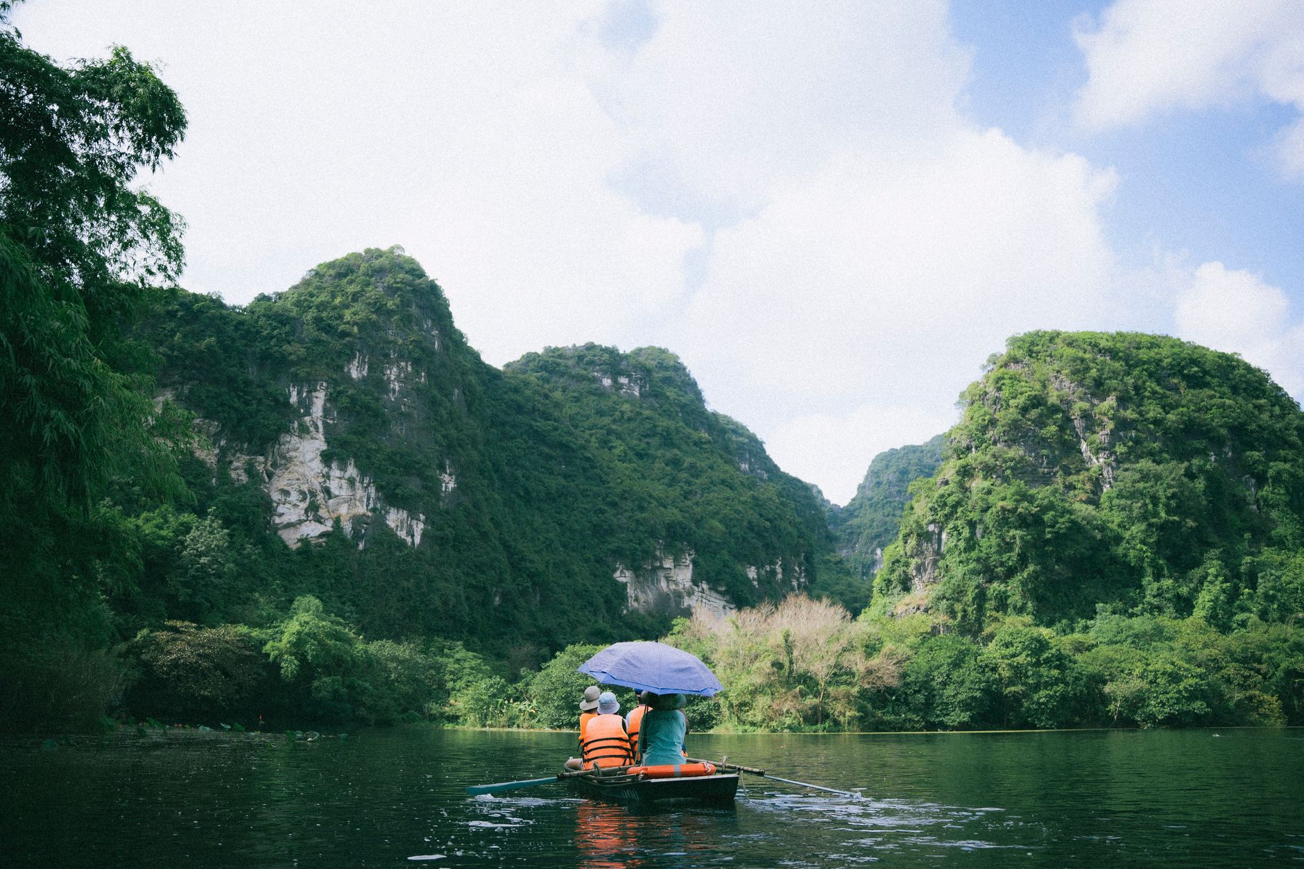
- Ninh Binh / Tam Coc (2 days): Rowboats through limestone karst — the "Ha Long Bay on land" comparison is overused but not wrong. Rent a bicycle and ride through the rice paddies to Bich Dong Pagoda.
- Sapa or Mai Chau (2–3 days): Trekking, homestays, terraced-rice views from a different angle. Mai Chau is lower, warmer, and less touristy than Sapa.
Some travelers also add Phong Nha for caving or Da Lat for the central highlands, though those require a flight or a very long bus ride south.
Bottom Line
The Ha Giang Loop earns its reputation not through hype but through the simple fact that no other road in Vietnam — maybe no other road in Southeast Asia — delivers this combination of landscape, culture, and riding challenge in four days. Budget $100–135, bring a decent rain jacket, ride within your limits, and respect the communities you pass through. The road does the rest.
Last updated · May 29, 2026 · independently researched, never sponsored.