What it is
Nui Pac Ta sits in the northern reaches of Tuyen Quang province, near the former border with Ha Giang. At roughly 1,500 meters, it's not the tallest peak in the northern highlands, but it's one of the least-visited — which is precisely the point. The mountain is part of the limestone karst spine that runs from Ha Giang south through the upper Tuyen Quang districts, surrounded by Dao and Tay ethnic minority villages that have been here for centuries.
Unlike the heavily trafficked routes around Sapa or the Ha Giang loop, Pac Ta sees maybe a handful of hikers per week during peak season. There's no ticket booth, no concrete staircase, no selfie platform at the summit. You'll find a forest trail, a few stream crossings, and panoramic views of layered ridgelines fading into Yunnan haze.
Why travelers go
Three reasons, mostly:
- Solitude. If you've done the Ha Giang (하장 / 河江 / ハーザン) motorbike loop and want something without the convoy of rental Hondas, this delivers.
- Village immersion. The trailhead passes through working Dao hamlets — not tourism villages. People are farming, not selling souvenirs.
- The view. On clear mornings, the summit gives you an unobstructed 360-degree sweep across the karst valleys. The light at dawn is genuinely worth the early start.
Best time to visit
October through December is ideal — dry skies, cool temperatures (12-18°C at altitude), and the rice terraces in the valleys below turn gold before harvest. January and February can be bitterly cold with fog that kills visibility. March through May is hit-or-miss: some clear days, but increasing humidity and occasional storms.
Avoid June through September entirely. The trails become slick mud channels, leeches are aggressive, and cloud cover means you'll summit into a wall of white nothing.
How to get there
From Hanoi, take an early bus to Tuyen Quang city (roughly 150 km, 3-3.5 hours via the expressway, tickets around 120,000-150,000 VND). From Tuyen Quang city, you'll need to continue north toward Lam Binh or Na Hang district — another 80-100 km on provincial roads. Local buses run this route but are slow and infrequent; a rented motorbike from Tuyen Quang city (150,000-200,000 VND/day) gives you flexibility.
The trailhead is near the commune of Thuong Lam. Ask locals for "duong len Pac Ta" — most people know the mountain even if they haven't climbed it. There's no formal parking area, but you can leave a bike at a nearby house (tip 20,000-50,000 VND).
If you're already on a Ha Giang trip, the mountain is accessible from the southern districts, cutting through Bac Me toward Na Hang.
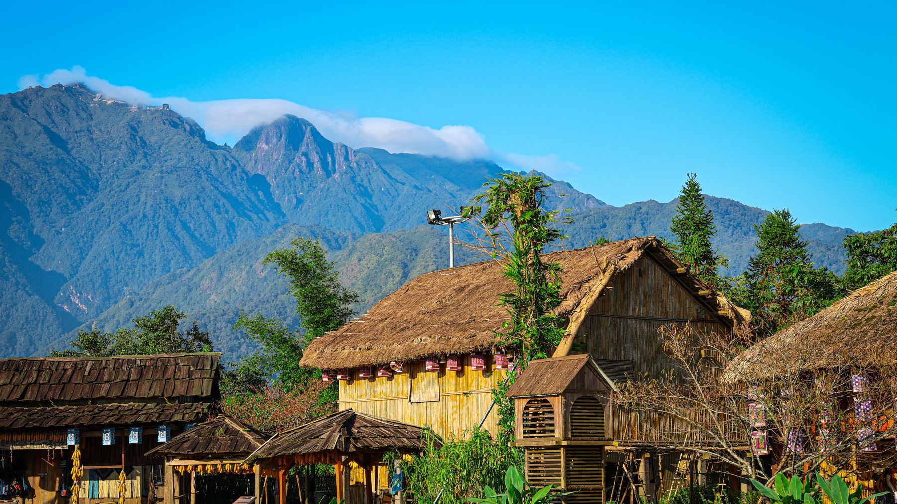
Photo by Haneul Trac on Pexels
What to do
The hike
The main trail to the summit takes 4-6 hours round trip depending on fitness and conditions. It's not technical — no ropes or scrambling required — but it's steep in sections and poorly marked. A local guide is strongly recommended, not just for navigation but because some trail forks lead to dead ends in bamboo thickets. Guides can be arranged through homestays in the area for 300,000-500,000 VND per day.
The first hour winds through bamboo forest and past a small waterfall (seasonal — dry by November). After that, the canopy opens into mixed hardwood forest with moss-covered boulders. The final push to the summit is exposed ridge walking with drop-offs on one side — not dangerous, but pay attention.
Village visits
The Dao villages near the trailhead are worth a morning even if you skip the hike. The Red Dao communities here still practice traditional indigo dyeing and herbal medicine baths. If you're polite and ask permission, some families will show you their loom setup. Don't photograph without asking.
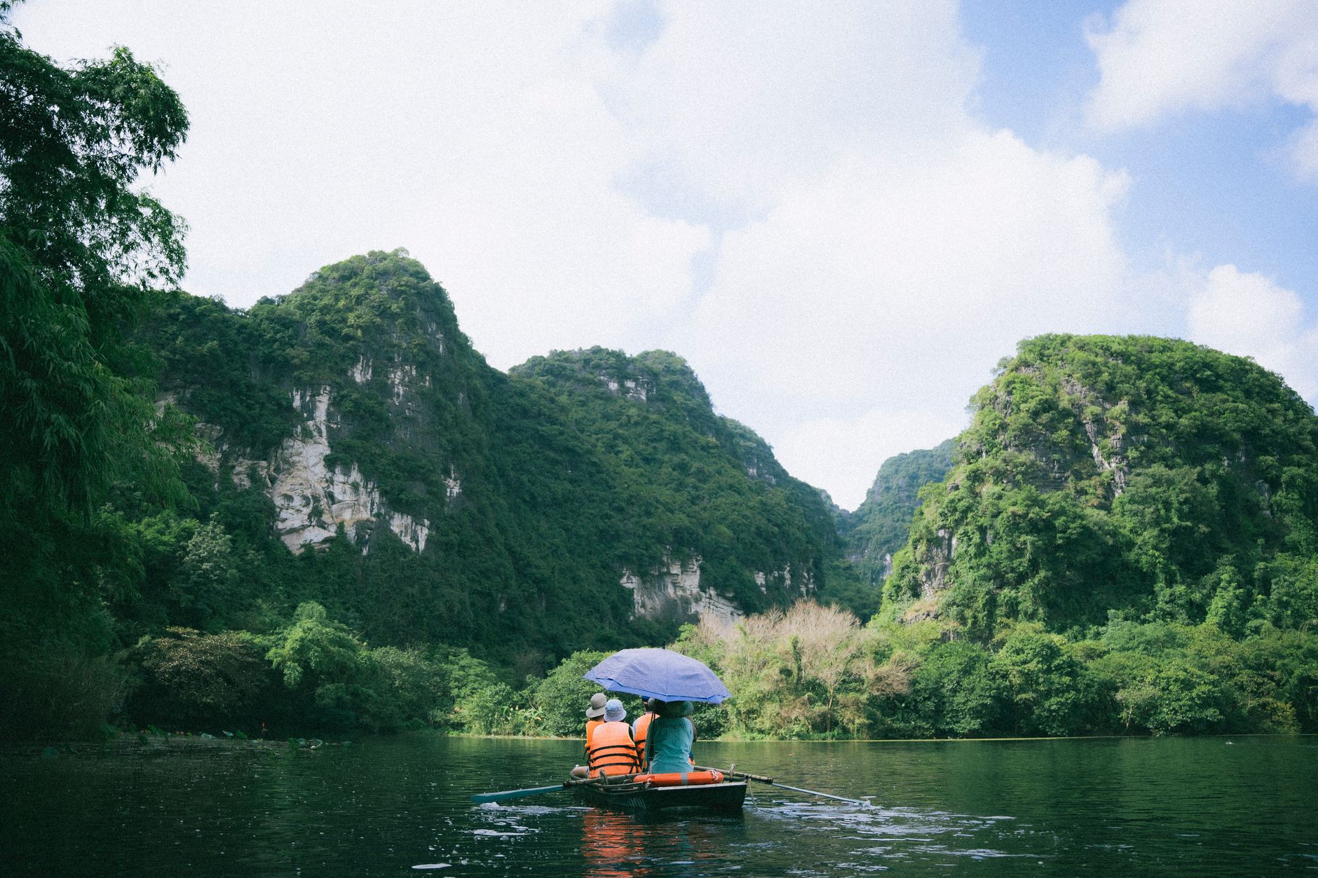
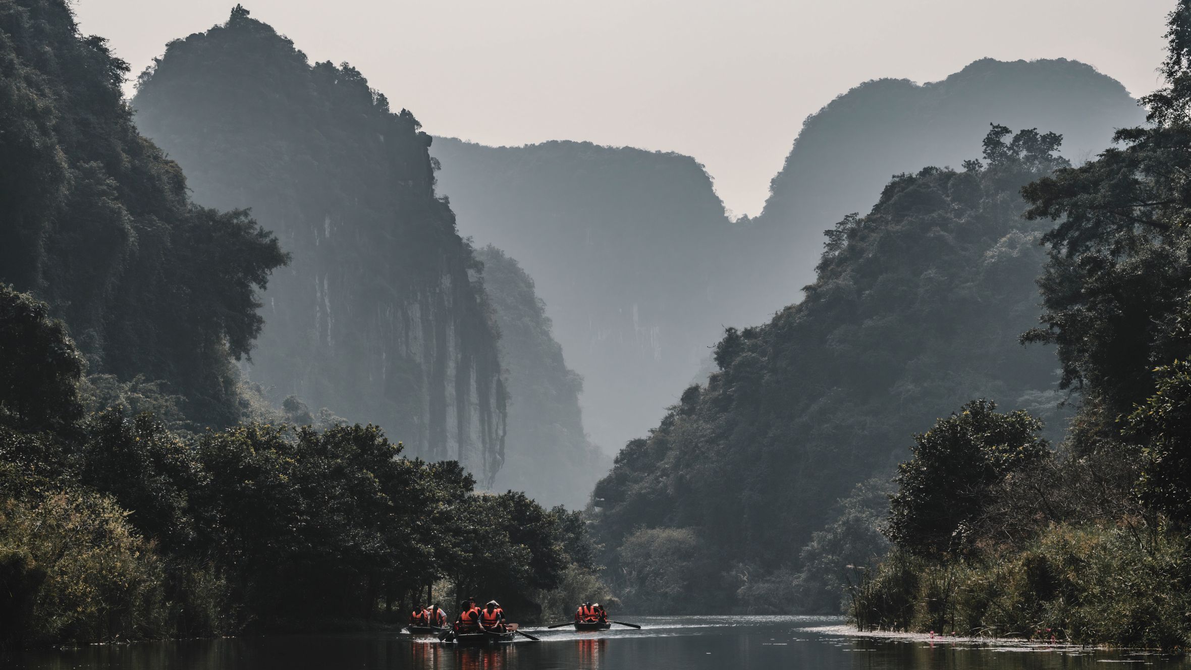
Na Hang Lake
If you have an extra day, Na Hang Lake (about 30 km south) is a flooded valley surrounded by karst towers — think a quieter, less commercialized version of Ha Long Bay but freshwater. Boat trips run 200,000-400,000 VND depending on duration.
Where to eat
There are no restaurants on the mountain. Pack lunch — sticky rice, bananas, and a thermos of vietnamese coffee will get you through.
In the nearby towns (Na Hang, Lam Binh), food options are basic but good. Look for "com binh dan" (everyday rice) shops serving stir-fried greens, pork, tofu, and soup for 35,000-50,000 VND per plate. The local specialty is "thang co" — a Hmong-origin offal hotpot that's an acquired taste but worth trying once. Stream fish grilled in banana leaves shows up at most local eateries and is reliably excellent.
For breakfast, "pho" and "banh cuon" are available in Na Hang town from around 6 AM.
Where to stay
No hotels exist near the trailhead. Your options:
- Homestays in Thuong Lam commune — basic but clean. Expect a mattress on the floor, mosquito net, shared bathroom, and home-cooked dinner included. Around 200,000-350,000 VND per person.
- Na Hang town — a few guesthouses ("nha nghi") with private rooms, hot water, and Wi-Fi. 250,000-400,000 VND per night.
- Lam Binh — similar to Na Hang, slightly fewer options.
Book nothing online — just show up. These places don't use Booking.com. If you want to confirm availability, have a Vietnamese speaker call ahead.

Photo by Quang Nguyen Vinh on Pexels
Practical tips
- Bring cash. No ATMs near the trailhead; the nearest is in Na Hang town.
- Phone signal is patchy above 800 meters. Download offline maps (Maps.me or Google Maps offline) before you leave Tuyen Quang city.
- Pack layers. Temperature swings of 10-15°C between valley and summit are normal.
- Leeches are present in wet season. Tuck pants into socks, apply tobacco water or DEET to ankles.
- Basic Vietnamese phrases go far here. English is effectively non-existent outside Hanoi (하노이 / 河内 / ハノイ).
Common mistakes
- Starting too late. Cloud rolls in by 10-11 AM most days. Leave by 5:30 AM for clear summit views.
- No guide. The trail isn't marked consistently. Getting lost costs hours, not minutes.
- Underestimating the road. Provincial roads north of Tuyen Quang city are winding and potholed. Don't plan to cover 100 km in an hour.
- Expecting Sapa-level infrastructure. This isn't a developed tourism area. That's the appeal — but it means no convenience stores, no English menus, no tour buses.
Final note
Nui Pac Ta rewards the kind of traveler who doesn't need a checklist. It's a mountain you climb because it's there, in a part of northern Vietnam that most visitors drive past on their way to Ha Giang's famous passes. Give it two days minimum — one for the approach, one for the hike — and you'll come back with something better than a postcard view: an actual memory of silence.
Last updated · May 29, 2026 · independently researched, never sponsored.