What Hoanh Son Quan actually is
Hoanh Son Quan is a stone gate sitting at roughly 300 meters elevation on the Hoanh Son pass (also called Deo Ngang), the point where the Truong Son mountain range meets the sea between Ha Tinh province and Quang Binh province. The gate was built during the Tran dynasty in the 13th century, then rebuilt and reinforced under the Nguyen dynasty in 1833 during Emperor Minh Mang's reign. For centuries, it marked the boundary between northern and southern Vietnam (베트남 / 越南 / ベトナム) — a geographic and cultural dividing line that shaped trade, migration, and language patterns along the central coast.
The structure itself is modest: a single arched gateway made of brick and stone, roughly 4 meters tall, with Chinese characters carved above the opening reading "Hoanh Son Quan" (literally "Gate of the Horizontal Mountain"). It's not a grand fortress. It's a checkpoint built into a mountainside, surrounded by forest, with the East Sea visible in the distance. What makes it worth the trip isn't scale — it's context.
Why travelers go
Most people driving or riding between Ha Tinh and Quang Binh pass right through without stopping. That's a missed opportunity. Hoanh Son Quan sits on one of the most historically important passes in Vietnam, referenced in poetry going back to the 19th century. The poet Ba Huyen Thanh Quan wrote her most famous poem, "Qua Deo Ngang," about crossing this exact pass at dusk — it's one of those poems every Vietnamese person learns in school.
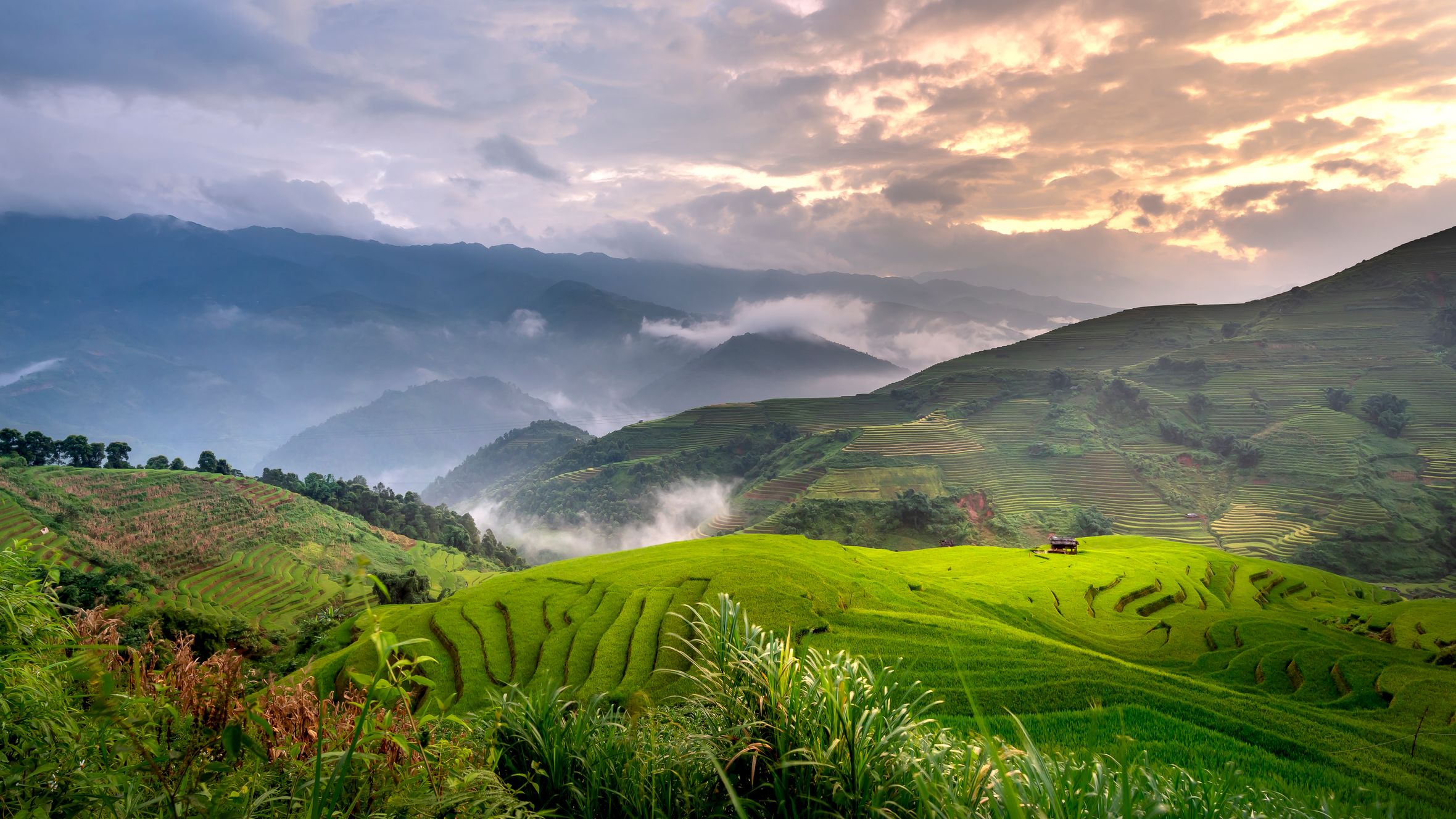
Beyond literature, the pass is where you can physically feel the shift between northern and central Vietnam. The vegetation changes. The accent changes. The food changes. Standing at the gate with jungle on both sides and the coastline below gives you a geographic understanding of Vietnam that a map can't replicate.
Best time to visit
March through May is ideal. The weather is warm but not yet punishing, skies are generally clear, and the surrounding forest is green from spring rains. June through August gets extremely hot — Ha Tinh regularly hits 38-40°C in summer, and the exposed pass amplifies it. September through November brings the rainy season, and the road up can get slippery. December through February is cool and sometimes foggy, which has its own appeal if you don't mind limited visibility.
Early morning arrivals (before 8am) beat the heat any time of year and give you the best light for photos looking east toward the sea.
How to get there
The nearest major hub is Dong Hoi (Quang Binh), about 90 km south — or Vinh (Nghe An), about 100 km north. From either city:
From Dong Hoi: Take a motorbike or car north on National Highway 1A. The pass is roughly 1.5 hours by motorbike, 1 hour by car. A Grab car from Dong Hoi runs around 500,000-600,000 VND one way. If you're heading to Phong Nha, Hoanh Son Quan makes a logical stop on the way north.
From Vinh: Head south on Highway 1A through Ha Tinh city. Total distance is about 100 km, roughly 2 hours by motorbike. A rented motorbike in Vinh costs 120,000-180,000 VND per day.
From Ha Tinh city: The pass is only about 50 km south, making it an easy half-day trip. Local "xe om" (motorbike taxi) drivers know the route — expect 200,000-250,000 VND round trip with waiting time.
The gate is just off Highway 1A at the top of the pass. There's a small parking area and a short trail (about 200 meters) leading up to the gate itself.

Photo by Nguyễn Văn Quý Ngọc on Pexels
What to do
Walk through the gate and up the ridge
The main trail runs through the gate and continues along the ridge for another 500 meters or so. The path is uneven and partially overgrown in places, but manageable in decent shoes. At the high point, you get a panoramic view of the coastline to the east and forested mountains to the west. Budget 30-45 minutes for the walk.
Read the inscriptions
The carved characters above the gate are original Nguyen-dynasty work. If you read Chinese characters or have a translation app handy, they're worth examining. A small information board near the parking area (in Vietnamese) gives historical context.
Visit the Ba Huyen Thanh Quan memorial
A short walk from the gate, there's a small shrine and statue dedicated to the poet. It's simple — a bust and a stone tablet with her poem — but it connects the physical place to the literary tradition.
Explore the coastal road below
If you have your own wheels, the stretch of Highway 1A descending from the pass toward Quang Binh hugs the coastline for several kilometers. There are pull-off points where you can stop and look back up at the pass from sea level. The contrast between mountain jungle above and fishing villages below is the kind of thing that reminds you how compressed Vietnam's geography really is.
Combine with Thien Cam beach
Thien Cam beach is about 15 km north of the pass on the Ha Tinh side. It's a local beach — not a resort strip — with calm water and a handful of seafood shacks. A good place to cool off after the hike.
Where to eat nearby
The pass itself has no restaurants, so eat before or after. Ha Tinh city has the best options:
"Cu doi" (freshwater mussel): Ha Tinh is known for its river mussels, cooked in a sour tamarind broth or stir-fried with lemongrass. Look for stalls along the Nga Doi river area — a bowl runs 30,000-50,000 VND.
"Banh canh" in Ha Tinh uses a thicker, chewier noodle than you'll find further south, served in a rich pork bone broth. The shops along Phan Dinh Phung street do solid versions for 25,000-35,000 VND.
If you're coming from the Quang Binh side, Dong Hoi has plenty of "banh xeo" spots and good fresh seafood along the river.
Where to stay
There's no accommodation at the pass. Your options:
- Ha Tinh city: Budget guesthouses from 200,000-350,000 VND/night. Mid-range hotels (Muong Thanh, Vinpearl) from 500,000-900,000 VND.
- Dong Hoi: More tourist infrastructure, with hostels from 150,000 VND/night and hotels from 400,000 VND up. Better choice if you're combining with a Phong Nha (퐁냐 / 峰牙 / フォンニャ) visit.
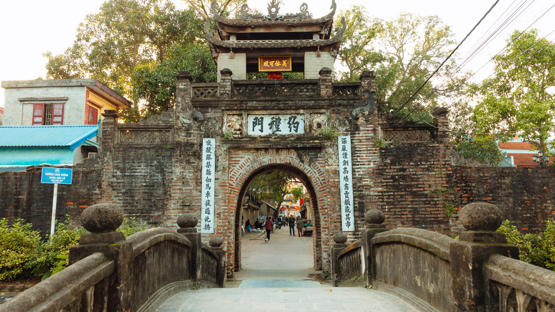
Photo by HONG SON on Pexels
Practical tips locals would tell you
- Bring water. There's nothing at the top except a small vendor who may or may not be there.
- Wear proper shoes, not sandals. The trail beyond the gate is rocky and uneven.
- If you're on a motorbike, the descent on the Quang Binh side has sharp switchbacks — take it slow, especially if the road is damp.
- The pass gets windy. If you're riding, a light jacket cuts the chill even in warm months.
- There's no entrance fee.
Common mistakes to avoid
- Driving through without stopping. The gate is easy to miss if you don't know to look for the small sign and parking area on the right side of Highway 1A (coming from the north).
- Coming at midday in summer. The exposed trail and lack of shade make this miserable in peak heat.
- Expecting a big site. This isn't Hue's Imperial Citadel or My Son. It's a single gate on a mountain pass. The value is in the history and the view, not in the architecture. Adjust expectations accordingly.
Practical notes
Hoanh Son Quan works best as a stop on a longer drive between Ha Tinh and Quang Binh, not necessarily as a standalone destination. If you're doing the north-to-south route through central Vietnam — Ninh Binh to Phong Nha, say — it slots in naturally and adds maybe an hour to your day. That hour is well spent.
Last updated · May 29, 2026 · independently researched, never sponsored.